
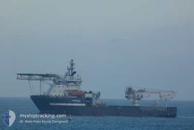
OLYMPIC TRITON
Offshore Supply Ship
Current Trip
| Time Travelled | 10 days |
|---|---|
| Remaining Time | --- |
| Distance Travelled | 207.09 nm |
| Remaining Distance | --- |
| AVG Speed | 8.4 Noeuds |
| MAX Speed | 10.5 Noeuds |
| AVG Wind | 14.8 knots |
| MAX Wind | 20.6 knots |
| MIN Temp | 11.5°C / 52.7°F |
| MAX Temp | 13.2°C / 55.76°F |
| Tirant d eau | 6.7 m |
| Position reçue | 1 m depuis |
Current Position
| Longitude | 2.01379° |
|---|---|
| Latitude | 57.01933° |
| Etat | Restricted manoeuverability |
| Vitesse | 0.1 Noeuds |
| Parcours | 295° |
| Zone | North Sea |
| Station | T-AIS |
| Position reçue | 1 m depuis |
Info
Information
The current position of OLYMPIC TRITON is in North Sea with coordinates 57.01933° / 2.01379° as reported on 2024-06-02 16:37 by AIS to our vessel tracker app. The vessel's current speed is 0.1 Noeuds and is heading at the port of SHEARWATER.
The vessel OLYMPIC TRITON (IMO: 9383754, MMSI: 259424000) is a Offshore Supply Ship that was built in 2007 ( 17 Age ). It's sailing under the flag of [NO] Norway.
In this page you can find informations about the vessels current position, last detected port calls, and current voyage information. If the vessels is not in coverage by AIS you will find the latest position.
The current position of OLYMPIC TRITON is detected by our AIS receivers and we are not responsible for the reliability of the data. The last position was recorded while the vessel was in Coverage by the Ais receivers of our vessel tracking app.
The current draught of OLYMPIC TRITON as reported by AIS is 6.7 meters
Weather
| Temperature | 11.9°C / 53.42°F |
|---|---|
| Wind Speed | 13 knots |
| Direction | 289° WNW |
| Pressure | 1022.6 hPa |
| Humidity | 81.8 % |
| Cloud Coverage | 67 % |
Featured Company
Last Port Calls
| Port | Arrival | Departure | Time In Port |
|---|---|---|---|
| 2024-05-23 05:58 | 2024-05-23 11:37 | 5 h | |
| 2024-05-11 18:54 | 2024-05-17 21:34 | 6 d | |
| 2024-05-03 08:30 | 2024-05-04 04:32 | 20 h | |
| 2024-04-24 06:28 | 2024-04-24 21:41 | 15 h | |
| 2024-04-07 21:04 | 2024-04-08 13:34 | 16 h | |
| 2024-04-07 12:29 | 2024-04-07 18:23 | 5 h | |
| 2024-04-04 21:35 | 2024-04-06 02:22 | 1 d |
Most Visited Ports (Last year)
| Port | Arrivals | |
|---|---|---|
| 7 | ||
| 6 | ||
| 4 | ||
| 3 | ||
| 2 | ||
| 2 |
Last Trips
| Origin | Departure | Destination | Arrival | Distance | |
|---|---|---|---|---|---|
| 2024-05-17 21:34 | 2024-05-23 05:58 | 324.87 nm | |||
| 2024-05-04 04:32 | 2024-05-11 18:54 | 558.41 nm | |||
| 2024-04-24 21:41 | 2024-05-03 08:30 | 326.02 nm | |||
| 2024-04-08 13:34 | 2024-04-24 06:28 | 369.85 nm | |||
| 2024-04-07 18:23 | 2024-04-07 21:04 | 26.98 nm | |||
| 2024-04-06 02:22 | 2024-04-07 12:29 | 345.37 nm | |||
| 2024-03-24 12:10 | 2024-04-04 21:35 | 435.86 nm |
Events
| Heure | Evenement | Détails | Position/ Destination | Info |
|---|---|---|---|---|
| 2024-06-02 00:10 | Arret |
57.01964 / 2.01619
SHEARWATER A
|
Vitesse: 0.3 kn Parcours: 77° |
|
| 2024-06-01 23:53 | Démarrage |
57.02894 / 1.97093
SHEARWATER A
|
Vitesse: 4.8 kn Parcours: 85° |
|
| 2024-06-01 11:26 | Changement de destination | SHEARWATER A JUDY FIELD |
57.03329 / 1.95675
SHEARWATER A
|
Vitesse: 0.1 kn Parcours: 5° |
| 2024-06-01 11:26 | Changement d'ETA | 2025/05/30 09:30 2024/05/24 01:30 |
57.03329 / 1.95675
SHEARWATER A
|
Vitesse: 0.1 kn Parcours: 5° |
| 2024-06-01 09:39 | Arret |
57.03328 / 1.95684
JUDY FIELD
|
Vitesse: 0.1 kn Parcours: 15° |
|
| 2024-06-01 08:41 | Dans la zone couverte |
57.03077 / 1.95535
North Sea
|
Vitesse: 0.8 kn Parcours: 8.1° |
|
| 2024-06-01 05:53 | Hors de la zone couverte |
57.03153 / 1.95654
North Sea
|
Vitesse: 0.4 kn Parcours: 25.3° |
|
| 2024-06-01 02:02 | Dans la zone couverte |
57.03100 / 1.95520
North Sea
|
Vitesse: 0.1 kn Parcours: 7.6° |
|
| 2024-05-31 21:05 | Hors de la zone couverte |
57.03094 / 1.95541
North Sea
|
Vitesse: 0.3 kn Parcours: 249.3° |
|
| 2024-05-31 20:52 | Dans la zone couverte |
57.03184 / 1.95652
North Sea
|
Vitesse: 0.5 kn Parcours: 180.5° |