
NORWEGIAN VIVA
Passenger
Current Trip
| Time Travelled | 5 h, 41 mins |
|---|---|
| Remaining Time | 3 h, 19 mins |
| Distance Travelled | 112.10 nm |
| Remaining Distance | 79.07 nm |
| AVG Speed | 20.1 Noeuds |
| MAX Speed | 24 Noeuds |
| AVG Wind | 9 knots |
| MAX Wind | 15 knots |
| MIN Temp | 17.3°C / 63.14°F |
| MAX Temp | 21.1°C / 69.98°F |
| Tirant d eau | 8.3 m |
| Position reçue | 1 m depuis |
Current Position
| Longitude | -4.88654° |
|---|---|
| Latitude | 36.14469° |
| Etat | Under way using engine |
| Vitesse | 18.4 Noeuds |
| Parcours | 69.6° |
| Zone | Alboran Sea |
| Station | T-AIS |
| Position reçue | 1 m depuis |
Info
Information
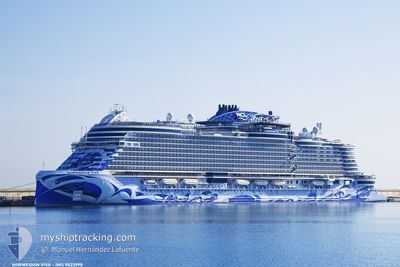
The current position of NORWEGIAN VIVA is in Alboran Sea with coordinates 36.14469° / -4.88654° as reported on 2024-06-16 23:41 by AIS to our vessel tracker app. The vessel's current speed is 18.4 Noeuds and is heading at the port of MOTRIL. The estimated time of arrival as calculated by MyShipTracking vessel tracking app is 2024-06-17 03:01 LT
The vessel NORWEGIAN VIVA (IMO: 9823998, MMSI: 311001127) is a Passenger It's sailing under the flag of [BS] Bahamas.
In this page you can find informations about the vessels current position, last detected port calls, and current voyage information. If the vessels is not in coverage by AIS you will find the latest position.
The current position of NORWEGIAN VIVA is detected by our AIS receivers and we are not responsible for the reliability of the data. The last position was recorded while the vessel was in Coverage by the Ais receivers of our vessel tracking app.
The current draught of NORWEGIAN VIVA as reported by AIS is 8.3 meters
Weather
| Temperature | 19.6°C / 67.28°F |
|---|---|
| Wind Speed | 11 knots |
| Direction | 252° WSW |
| Pressure | 1013.4 hPa |
| Humidity | 77.5 % |
| Cloud Coverage | --- |
Featured Company
Last Port Calls
| Port | Arrival | Departure | Time In Port |
|---|---|---|---|
| 2024-06-16 04:16 | 2024-06-16 18:01 | 13 h | |
| 2024-06-15 09:10 | 2024-06-15 17:23 | 8 h | |
| 2024-06-14 04:30 | 2024-06-14 15:28 | 10 h | |
| 2024-06-13 03:32 | 2024-06-13 10:47 | 7 h | |
| 2024-06-12 05:18 | 2024-06-12 19:00 | 13 h | |
| 2024-06-11 06:45 | 2024-06-11 18:53 | 12 h | |
| 2024-06-10 04:17 | 2024-06-10 13:08 | 8 h | |
| 2024-06-09 04:01 | 2024-06-09 15:17 | 11 h | |
| 2024-06-08 05:05 | 2024-06-08 19:17 | 14 h | |
| 2024-06-07 03:33 | 2024-06-07 16:11 | 12 h |
Last Trips
| Origin | Departure | Destination | Arrival | Distance | |
|---|---|---|---|---|---|
| 2024-06-15 19:23 | 2024-06-16 06:16 | 105.85 nm | |||
| 2024-06-14 16:28 | 2024-06-15 11:10 | 348.20 nm | |||
| 2024-06-13 12:47 | 2024-06-14 05:30 | 327.22 nm | |||
| 2024-06-12 21:00 | 2024-06-13 05:32 | 111.89 nm | |||
| 2024-06-11 20:53 | 2024-06-12 07:18 | 190.88 nm | |||
| 2024-06-10 15:08 | 2024-06-11 08:45 | 313.79 nm | |||
| 2024-06-09 17:17 | 2024-06-10 06:17 | 127.63 nm | |||
| 2024-06-08 21:17 | 2024-06-09 06:01 | 140.53 nm | |||
| 2024-06-07 18:11 | 2024-06-08 07:05 | 216.55 nm | |||
| 2024-06-05 19:42 | 2024-06-07 05:33 | 252.31 nm |
Events
| Heure | Evenement | Détails | Position/ Destination | Info |
|---|---|---|---|---|
| 2024-06-16 23:25 | Changement de zone | Spanish part of the Alboran Sea Gibraltarian part of the Alboran Sea |
36.11156 / -4.98134
Alboran Sea
MOTRIL, SPAIN
|
Vitesse: 20.8 kn Parcours: 59.8° |
| 2024-06-16 23:11 | Changement de zone | Gibraltarian part of the Alboran Sea Spanish part of the Alboran Sea |
36.06219 / -5.06176
Alboran Sea
MOTRIL, SPAIN
|
Vitesse: 21.4 kn Parcours: 51.8° |
| 2024-06-16 22:37 | Changement de zone | Spanish part of the Alboran Sea Spanish part of the Strait of Gibraltar |
35.99451 / -5.31583
Alboran Sea
MOTRIL, SPAIN
|
Vitesse: 23.4 kn Parcours: 75.4° |
| 2024-06-16 22:29 | Changement de zone | Spanish part of the Strait of Gibraltar Moroccan part of the Strait of Gibraltar |
35.98184 / -5.37697
Strait of Gibraltar
MOTRIL, SPAIN
|
Vitesse: 23 kn Parcours: 76.5° |
| 2024-06-16 21:10 | Changement de zone | Moroccan part of the Strait of Gibraltar Moroccan part of the North Atlantic Ocean |
35.91168 / -5.95144
Strait of Gibraltar
MOTRIL, SPAIN
|
Vitesse: 21.1 kn Parcours: 88.3° |
| 2024-06-16 20:39 | Etat Changé | Under way using engine Default |
35.90754 / -6.17108
MOTRIL, SPAIN
|
Vitesse: 21 kn Parcours: 90° |
| 2024-06-16 20:31 | Etat Changé | Default Under way using engine |
35.90750 / -6.23499
MOTRIL, SPAIN
|
Vitesse: 20.4 kn Parcours: 121.8° |
| 2024-06-16 20:25 | Changement de zone | Moroccan part of the North Atlantic Ocean Spanish part of the North Atlantic Ocean |
35.91752 / -6.27460
North Atlantic Ocean
MOTRIL, SPAIN
|
Vitesse: 20.4 kn Parcours: 121.8° |
| 2024-06-16 20:24 | Etat Changé | Under way using engine Default |
35.92070 / -6.28033
MOTRIL, SPAIN
|
Vitesse: 17.5 kn Parcours: 148° |
| 2024-06-16 20:19 | Etat Changé | Default Under way using engine |
35.93784 / -6.29995
MOTRIL, SPAIN
|
Vitesse: 18.7 kn Parcours: 154.6° |