
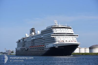
NIEUW STATENDAM
Passenger
Current Trip
| Time Travelled | 13 h, 58 mins |
|---|---|
| Remaining Time | 1 day |
| Distance Travelled | 228.04 nm |
| Remaining Distance | 417.31 nm |
| AVG Speed | 16.6 Noeuds |
| MAX Speed | 18.2 Noeuds |
| AVG Wind | 13.1 knots |
| MAX Wind | 22.9 knots |
| MIN Temp | 9.8°C / 49.64°F |
| MAX Temp | 14.1°C / 57.38°F |
| Tirant d eau | 8.3 m |
| Position reçue | 19 m depuis |
Current Position
| Longitude | 2.98714° |
|---|---|
| Latitude | 57.80446° |
| Etat | Under way using engine |
| Vitesse | 16.5 Noeuds |
| Parcours | 90.6° |
| Zone | North Sea |
| Station | T-AIS |
| Position reçue | 19 m depuis |
Info
Information
The current position of NIEUW STATENDAM is in North Sea with coordinates 57.80446° / 2.98714° as reported on 2024-06-14 06:21 by AIS to our vessel tracker app. The vessel's current speed is 16.5 Noeuds and is heading at the port of COPENHAGEN. The estimated time of arrival as calculated by MyShipTracking vessel tracking app is 2024-06-15 06:48 LT
The vessel NIEUW STATENDAM (IMO: 9767106, MMSI: 244140580) is a Passenger It's sailing under the flag of [NL] Netherlands.
In this page you can find informations about the vessels current position, last detected port calls, and current voyage information. If the vessels is not in coverage by AIS you will find the latest position.
The current position of NIEUW STATENDAM is detected by our AIS receivers and we are not responsible for the reliability of the data. The last position was recorded while the vessel was in Coverage by the Ais receivers of our vessel tracking app.
The current draught of NIEUW STATENDAM as reported by AIS is 8.3 meters
Weather
| Temperature | 11.3°C / 52.34°F |
|---|---|
| Wind Speed | 23 knots |
| Direction | 124° SE |
| Pressure | 1002.2 hPa |
| Humidity | 86.5 % |
| Cloud Coverage | 100 % |
Featured Company
Last Port Calls
| Port | Arrival | Departure | Time In Port |
|---|---|---|---|
| 2024-06-13 05:43 | 2024-06-13 16:43 | 11 h | |
| 2024-06-12 05:19 | 2024-06-12 15:52 | 10 h | |
| 2024-06-08 06:37 | 2024-06-08 19:01 | 12 h | |
| 2024-06-07 06:37 | 2024-06-07 17:04 | 10 h | |
| 2024-06-06 11:19 | |||
| 2024-06-04 04:56 | 2024-06-04 15:10 | 10 h | |
| 2024-06-02 07:20 | 2024-06-02 16:11 | 8 h | |
| 2024-05-30 04:50 | 2024-05-30 17:21 | 12 h | |
| 2024-05-25 06:09 | 2024-05-25 16:18 | 10 h | |
| 2024-05-24 06:51 | 2024-05-24 15:56 | 9 h |
Most Visited Ports (Last year)
| Port | Arrivals | |
|---|---|---|
| 19 | ||
| 16 | ||
| 12 | ||
| 7 | ||
| 6 | ||
| 5 |
Last Trips
| Origin | Departure | Destination | Arrival | Distance | |
|---|---|---|---|---|---|
| 2024-06-12 16:52 | 2024-06-13 06:43 | 125.53 nm | |||
| 2024-06-08 19:01 | 2024-06-12 06:19 | 865.93 nm | |||
| 2024-06-07 17:04 | 2024-06-08 06:37 | 200.03 nm | |||
| 2024-06-04 17:10 | 2024-06-06 11:19 | 762.14 nm | |||
| 2024-06-02 18:11 | 2024-06-04 06:56 | 528.52 nm | |||
| 2024-05-30 18:21 | 2024-06-02 09:20 | 862.39 nm | |||
| 2024-05-25 18:18 | 2024-05-30 05:50 | 1102.71 nm | |||
| 2024-05-24 17:56 | 2024-05-25 08:09 | 245.66 nm | |||
| 2024-05-23 17:02 | 2024-05-24 08:51 | 297.25 nm | |||
| 2024-05-21 15:49 | 2024-05-23 08:47 | 697.85 nm |
Events
| Heure | Evenement | Détails | Position/ Destination | Info |
|---|---|---|---|---|
| 2024-06-14 06:21 | Changement de zone | Norwegian part of the North Sea United Kingdom part of the North Sea |
57.80446 / 2.98714
North Sea
GB INV > DK CPH
|
Vitesse: 16.5 kn Parcours: 90.6° |
| 2024-06-14 06:21 | Etat Changé | Under way using engine Default |
57.80446 / 2.98714
GB INV > DK CPH
|
Vitesse: 16 kn Parcours: 91° |
| 2024-06-14 06:08 | Dans la zone couverte |
57.80446 / 2.98714
North Sea
GB INV > DK CPH
|
Vitesse: 16.5 kn Parcours: 90.6° |
|
| 2024-06-13 22:03 | Etat Changé | Default Under way using engine |
57.77223 / -1.37342
GB INV > DK CPH
|
Vitesse: 16.4 kn Parcours: 89.8° |
| 2024-06-13 21:55 | Hors de la zone couverte |
57.77217 / -1.44424
North Sea
GB INV > DK CPH
|
Vitesse: 16.4 kn Parcours: 89.8° |
|
| 2024-06-13 20:02 | Etat Changé | Under way using engine Default |
57.77215 / -2.42874
GB INV > DK CPH
|
Vitesse: 17.4 kn Parcours: 90° |
| 2024-06-13 19:59 | Etat Changé | Default Under way using engine |
57.77222 / -2.44859
GB INV > DK CPH
|
Vitesse: 17.4 kn Parcours: 90.6° |
| 2024-06-13 18:54 | Etat Changé | Under way using engine Default |
57.77229 / -3.03934
GB INV > DK CPH
|
Vitesse: 17.2 kn Parcours: 89° |
| 2024-06-13 18:35 | Etat Changé | Default Under way using engine |
57.77229 / -3.20404
GB INV > DK CPH
|
Vitesse: 18.1 kn Parcours: 81.5° |
| 2024-06-13 18:22 | Etat Changé | Under way using engine Default |
57.76592 / -3.32532
GB INV > DK CPH
|
Vitesse: 18.2 kn Parcours: 81° |