
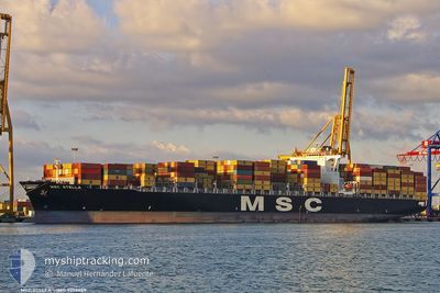
MSC STELLA
Container Ship
Current Trip
| Time Travelled | 2 days |
|---|---|
| Remaining Time | --- |
| Distance Travelled | 606.51 nm |
| Remaining Distance | --- |
| AVG Speed | 15.4 Noeuds |
| MAX Speed | 16.7 Noeuds |
| AVG Wind | 8.3 knots |
| MAX Wind | 15.6 knots |
| MIN Temp | 25.4°C / 77.72°F |
| MAX Temp | 28°C / 82.4°F |
| Tirant d eau | 10.9 m |
| Position reçue | 2 d depuis |
Current Position
| Longitude | -96.79913° |
|---|---|
| Latitude | 23.22043° |
| Etat | Under way using engine |
| Vitesse | 15.6 Noeuds |
| Parcours | 51.1° |
| Zone | Gulf of Mexico |
| Station | T-AIS |
| Position reçue | 2 d depuis |
Info
Information
The current position of MSC STELLA is in Gulf of Mexico with coordinates 23.22043° / -96.79913° as reported on 2024-05-21 11:29 by AIS to our vessel tracker app. The vessel's current speed is 15.6 Noeuds
The vessel MSC STELLA (IMO: 9279989, MMSI: 352983000) is a Container Ship that was built in 2004 ( 20 Age ). It's sailing under the flag of [PA] Panama.
In this page you can find informations about the vessels current position, last detected port calls, and current voyage information. If the vessels is not in coverage by AIS you will find the latest position.
The current position of MSC STELLA is detected by our AIS receivers and we are not responsible for the reliability of the data. The last position was recorded while the vessel was in Coverage by the Ais receivers of our vessel tracking app.
The current draught of MSC STELLA as reported by AIS is 10.9 meters
Weather
| Temperature | 25.9°C / 78.62°F |
|---|---|
| Wind Speed | 10 knots |
| Direction | 157° SSE |
| Pressure | 1014.6 hPa |
| Humidity | 79.6 % |
| Cloud Coverage | 55 % |
Featured Company
Last Port Calls
| Port | Arrival | Departure | Time In Port |
|---|---|---|---|
| 2024-05-20 07:20 | 2024-05-21 06:44 | 23 h | |
| 2024-05-13 01:06 | 2024-05-13 22:34 | 21 h | |
| 2024-05-09 08:09 | 2024-05-11 06:29 | 1 d | |
| 2024-04-29 19:55 | 2024-05-01 00:56 | 1 d | |
| 2024-04-27 20:28 | 2024-04-29 00:03 | 1 d | |
| 2024-04-26 02:32 | 2024-04-26 20:53 | 18 h | |
| 2024-04-14 12:31 | 2024-04-15 23:02 | 1 d | |
| 2024-04-11 07:01 | 2024-04-13 09:32 | 2 d | |
| 2024-04-03 21:55 | 2024-04-04 17:55 | 20 h | |
| 2024-04-01 05:11 | 2024-04-02 14:51 | 1 d |
Most Visited Ports (Last year)
| Port | Arrivals | |
|---|---|---|
| 15 | ||
| 8 | ||
| 8 | ||
| 7 | ||
| 7 | ||
| 7 |
Last Trips
| Origin | Departure | Destination | Arrival | Distance | |
|---|---|---|---|---|---|
| 2024-05-13 18:34 | 2024-05-20 02:20 | 1834.10 nm | |||
| 2024-05-11 02:29 | 2024-05-12 21:06 | 662.84 nm | |||
| 2024-05-01 02:56 | 2024-05-09 04:09 | 3381.11 nm | |||
| 2024-04-29 02:03 | 2024-04-29 21:55 | 288.84 nm | |||
| 2024-04-26 22:53 | 2024-04-27 22:28 | 371.02 nm | |||
| 2024-04-15 19:02 | 2024-04-26 04:32 | 3885.56 nm | |||
| 2024-04-13 05:32 | 2024-04-14 08:31 | 406.10 nm | |||
| 2024-04-04 12:55 | 2024-04-11 03:01 | 1084.85 nm | |||
| 2024-04-02 09:51 | 2024-04-03 16:55 | 298.54 nm | |||
| 2024-03-29 14:54 | 2024-04-01 00:11 | 720.96 nm |
Events
| Heure | Evenement | Détails | Position/ Destination | Info |
|---|---|---|---|---|
| 2024-05-23 00:06 | Arret | 18.97 nm, South of PILOTTOWN |
28.87234 / -89.34547
NEW ORLEANS
|
Vitesse: 0.3 kn Parcours: 46° |
| 2024-05-21 11:32 | Etat Changé | Default Under way using engine |
23.22833 / -96.78667
NEW ORLEANS
|
Vitesse: 15.6 kn Parcours: 51.1° |
| 2024-05-21 11:29 | Hors de la zone couverte |
23.22043 / -96.79913
Gulf of Mexico
NEW ORLEANS
|
Vitesse: 15.6 kn Parcours: 51.1° |
|
| 2024-05-21 11:28 | Etat Changé | Under way using engine Default |
23.21910 / -96.80097
NEW ORLEANS
|
Vitesse: 15 kn Parcours: 51° |
| 2024-05-21 11:08 | Etat Changé | Default Under way using engine |
23.16437 / -96.87356
NEW ORLEANS
|
Vitesse: 15.6 kn Parcours: 51.1° |
| 2024-05-21 11:05 | Etat Changé | Under way using engine Default |
23.15436 / -96.88673
NEW ORLEANS
|
Vitesse: 15 kn Parcours: 51° |
| 2024-05-21 11:02 | Dans la zone couverte |
23.15436 / -96.88673
Gulf of Mexico
NEW ORLEANS
|
Vitesse: 15.6 kn Parcours: 51.1° |
|
| 2024-05-21 08:21 | Etat Changé | Default Under way using engine |
22.68074 / -97.48995
NEW ORLEANS
|
Vitesse: 16.2 kn Parcours: 50.9° |
| 2024-05-21 08:17 | Hors de la zone couverte |
22.67173 / -97.50212
Gulf of Mexico
NEW ORLEANS
|
Vitesse: 16.2 kn Parcours: 50.9° |
|
| 2024-05-21 06:44 | PORT DE DEPART |
|
22.48743 / -97.85688
NEW ORLEANS
|
Vitesse: 7.3 kn Parcours: 90° |