
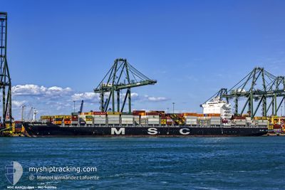
MSC BARCELONA
Container Ship
Current Trip
| Time Travelled | 1 day |
|---|---|
| Remaining Time | --- |
| Distance Travelled | 661.02 nm |
| Remaining Distance | --- |
| AVG Speed | 14.8 Noeuds |
| MAX Speed | 19.3 Noeuds |
| AVG Wind | 9.7 knots |
| MAX Wind | 13.3 knots |
| MIN Temp | 23.4°C / 74.12°F |
| MAX Temp | 28.9°C / 84.02°F |
| Tirant d eau | 13.6 m |
| Position reçue | 1 d depuis |
Current Position
| Longitude | -34.63212° |
|---|---|
| Latitude | -8.10859° |
| Etat | Under way using engine |
| Vitesse | 15 Noeuds |
| Parcours | 43.2° |
| Zone | South Atlantic Ocean |
| Station | T-AIS |
| Position reçue | 1 d depuis |
Info
Information
The current position of MSC BARCELONA is in South Atlantic Ocean with coordinates -8.10859° / -34.63212° as reported on 2024-05-18 04:12 by AIS to our vessel tracker app. The vessel's current speed is 15 Noeuds and is heading at the port of COLON. The estimated time of arrival as calculated by MyShipTracking vessel tracking app is 2024-05-26 22:00 LT
The vessel MSC BARCELONA (IMO: 9480186, MMSI: 256573000) is a Container Ship that was built in 2011 ( 13 Age ). It's sailing under the flag of [MT] Malta.
In this page you can find informations about the vessels current position, last detected port calls, and current voyage information. If the vessels is not in coverage by AIS you will find the latest position.
The current position of MSC BARCELONA is detected by our AIS receivers and we are not responsible for the reliability of the data. The last position was recorded while the vessel was in Coverage by the Ais receivers of our vessel tracking app.
The current draught of MSC BARCELONA as reported by AIS is 13.6 meters
Weather
| Temperature | 28.4°C / 83.12°F |
|---|---|
| Wind Speed | 13 knots |
| Direction | 91° E |
| Pressure | 1012.4 hPa |
| Humidity | 78.1 % |
| Cloud Coverage | 51 % |
Featured Company
Last Port Calls
| Port | Arrival | Departure | Time In Port |
|---|---|---|---|
| 2024-05-17 00:15 | 2024-05-17 23:30 | 23 h | |
| 2024-05-12 02:42 | 2024-05-12 13:33 | 10 h | |
| 2024-05-10 10:08 | 2024-05-10 10:14 | 5 m | |
| 2024-05-08 16:31 | 2024-05-08 16:38 | 6 m | |
| 2024-05-05 20:01 | 2024-05-05 20:56 | 54 m | |
| 2024-05-03 12:27 | 2024-05-03 20:51 | 8 h | |
| 2024-04-29 20:53 | 2024-04-30 10:57 | 14 h | |
| 2024-04-27 15:26 | 2024-04-28 15:20 | 23 h | |
| 2024-04-23 14:33 | 2024-04-23 14:40 | 6 m | |
| 2024-04-10 11:58 | 2024-04-11 19:51 | 1 d |
Most Visited Ports (Last year)
| Port | Arrivals | |
|---|---|---|
| 5 | ||
| 4 | ||
| 3 | ||
| 2 | ||
| 2 | ||
| 2 |
Last Trips
| Origin | Departure | Destination | Arrival | Distance | |
|---|---|---|---|---|---|
| 2024-05-12 13:33 | 2024-05-17 00:15 | 399.39 nm | |||
| 2024-05-10 10:14 | 2024-05-12 02:42 | 763.19 nm | |||
| 2024-05-08 16:38 | 2024-05-10 10:08 | 3.14 nm | |||
| 2024-05-05 20:56 | 2024-05-08 16:31 | 240.43 nm | |||
| 2024-05-03 20:51 | 2024-05-05 20:01 | 185.39 nm | |||
| 2024-04-30 10:57 | 2024-05-03 12:27 | 796.01 nm | |||
| 2024-04-28 15:20 | 2024-04-29 20:53 | 150.36 nm | |||
| 2024-04-23 14:40 | 2024-04-27 15:26 | 1156.02 nm | |||
| 2024-04-11 19:51 | 2024-04-23 14:33 | 4302.42 nm | |||
| 2024-04-06 18:20 | 2024-04-10 11:58 | 1302.09 nm |
Events
| Heure | Evenement | Détails | Position/ Destination | Info |
|---|---|---|---|---|
| 2024-05-18 04:17 | Etat Changé | Default Under way using engine |
-8.09370 / -34.61857
BRSUA>PAONX
|
Vitesse: 15 kn Parcours: 43.2° |
| 2024-05-18 04:12 | Hors de la zone couverte |
-8.10859 / -34.63212
South Atlantic Ocean
BRSUA>PAONX
|
Vitesse: 15 kn Parcours: 43.2° |
|
| 2024-05-18 04:10 | Etat Changé | Under way using engine Default |
-8.11293 / -34.63612
BRSUA>PAONX
|
Vitesse: 15.2 kn Parcours: 43° |
| 2024-05-18 03:48 | Etat Changé | Default Under way using engine |
-8.18167 / -34.70167
BRSUA>PAONX
|
Vitesse: 15.1 kn Parcours: 44.6° |
| 2024-05-18 03:44 | Etat Changé | Under way using engine Default |
-8.19325 / -34.71263
BRSUA>PAONX
|
Vitesse: 15 kn Parcours: 44° |
| 2024-05-18 03:33 | Etat Changé | Default Under way using engine |
-8.22667 / -34.74500
BRSUA>PAONX
|
Vitesse: 14.9 kn Parcours: 44.6° |
| 2024-05-18 03:03 | Tirant d'eau modifié | 13.6 13.5 |
-8.32589 / -34.84310
BRSUA>PAONX
|
Vitesse: 15.1 kn Parcours: 44.6° |
| 2024-05-18 03:03 | Changement de destination | BRSUA>PAONX BRRIO>BRSSA |
-8.32589 / -34.84310
BRSUA>PAONX
|
Vitesse: 15.1 kn Parcours: 44.6° |
| 2024-05-18 03:03 | Changement d'ETA | 2024/05/27 03:00 2024/05/12 05:00 |
-8.32589 / -34.84310
BRSUA>PAONX
|
Vitesse: 15.1 kn Parcours: 44.6° |
| 2024-05-18 02:56 | Etat Changé | Under way using engine Default |
-8.33787 / -34.85490
BRRIO>BRSSA
|
Vitesse: 15 kn Parcours: 45° |