
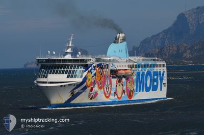
MOBY AKI
Ro-Ro/Passenger Ship
Current Trip
| Time Travelled | 4 h, 28 mins |
|---|---|
| Remaining Time | 4 h, 50 mins |
| Distance Travelled | 109.77 nm |
| Remaining Distance | --- |
| AVG Speed | 25.5 Noeuds |
| MAX Speed | 25.8 Noeuds |
| AVG Wind | 3.7 knots |
| MAX Wind | 5 knots |
| MIN Temp | 14.9°C / 58.82°F |
| MAX Temp | 18.6°C / 65.48°F |
| Tirant d eau | 6.8 m |
| Position reçue | Maintenant |
Current Position
| Longitude | 8.48289° |
|---|---|
| Latitude | 42.70926° |
| Etat | Under way using engine |
| Vitesse | 25.3 Noeuds |
| Parcours | 14° |
| Zone | Mediterranean Sea - Western Basin |
| Station | T-AIS |
| Position reçue | Maintenant |
Info
Information
The current position of MOBY AKI is in Mediterranean Sea - Western Basin with coordinates 42.70926° / 8.48289° as reported on 2024-05-17 23:21 by AIS to our vessel tracker app. The vessel's current speed is 25.3 Noeuds and is heading at the port of GENOVA. The estimated time of arrival as calculated by MyShipTracking vessel tracking app is 2024-05-18 04:12 LT
The vessel MOBY AKI (IMO: 9299393, MMSI: 247132400) is a Ro-Ro/Passenger Ship that was built in 2005 ( 19 Age ). It's sailing under the flag of [IT] Italy.
In this page you can find informations about the vessels current position, last detected port calls, and current voyage information. If the vessels is not in coverage by AIS you will find the latest position.
The current position of MOBY AKI is detected by our AIS receivers and we are not responsible for the reliability of the data. The last position was recorded while the vessel was in Coverage by the Ais receivers of our vessel tracking app.
The current draught of MOBY AKI as reported by AIS is 6.8 meters
Weather
| Temperature | 18.1°C / 64.58°F |
|---|---|
| Wind Speed | 4 knots |
| Direction | 192° SSW |
| Pressure | 1012.9 hPa |
| Humidity | 84 % |
| Cloud Coverage | --- |
Featured Company
Last Port Calls
| Port | Arrival | Departure | Time In Port |
|---|---|---|---|
| 2024-05-17 05:39 | 2024-05-17 18:54 | 13 h | |
| 2024-05-16 05:35 | 2024-05-16 19:27 | 13 h | |
| 2024-05-15 05:26 | 2024-05-15 18:58 | 13 h | |
| 2024-05-14 16:34 | 2024-05-14 19:53 | 3 h | |
| 2024-05-14 05:08 | 2024-05-14 07:56 | 2 h | |
| 2024-05-13 05:25 | 2024-05-13 19:17 | 13 h | |
| 2024-05-12 05:36 | 2024-05-12 18:51 | 13 h | |
| 2024-05-11 05:43 | 2024-05-11 19:01 | 13 h | |
| 2024-05-10 05:28 | 2024-05-10 18:47 | 13 h | |
| 2024-05-09 05:38 | 2024-05-09 20:40 | 15 h |
Most Visited Ports (Last year)
| Port | Arrivals | |
|---|---|---|
| 130 | ||
| 126 | ||
| 64 | ||
| 46 | ||
| 37 | ||
| 12 |
Last Trips
| Origin | Departure | Destination | Arrival | Distance | |
|---|---|---|---|---|---|
| 2024-05-16 21:27 | 2024-05-17 07:39 | 215.45 nm | |||
| 2024-05-15 20:58 | 2024-05-16 07:35 | 215.60 nm | |||
| 2024-05-14 21:53 | 2024-05-15 07:26 | 214.79 nm | |||
| 2024-05-14 09:56 | 2024-05-14 18:34 | 221.21 nm | |||
| 2024-05-13 21:17 | 2024-05-14 07:08 | 215.26 nm | |||
| 2024-05-12 20:51 | 2024-05-13 07:25 | 214.32 nm | |||
| 2024-05-11 21:01 | 2024-05-12 07:36 | 214.93 nm | |||
| 2024-05-10 20:47 | 2024-05-11 07:43 | 214.48 nm | |||
| 2024-05-09 22:40 | 2024-05-10 07:28 | 215.01 nm | |||
| 2024-05-08 20:54 | 2024-05-09 07:38 | 189.58 nm |
Events
| Heure | Evenement | Détails | Position/ Destination | Info |
|---|---|---|---|---|
| 2024-05-17 22:24 | Etat Changé | Under way using engine Default |
42.31739 / 8.40494
ITGOA
|
Vitesse: 25.2 kn Parcours: 355° |
| 2024-05-17 21:56 | Etat Changé | Default Under way using engine |
42.11907 / 8.41367
ITGOA
|
Vitesse: 25.2 kn Parcours: 355° |
| 2024-05-17 20:14 | Changement de zone | French part of the Mediterranean Sea - Western Basin Italian part of the Mediterranean Sea - Western Basin |
41.39972 / 8.46035
Mediterranean Sea - Western Basin
|
Vitesse: 25.6 kn Parcours: 2° |
| 2024-05-17 19:44 | Changement de destination | ITGOA ITPTO |
41.18910 / 8.45035
ITGOA
|
Vitesse: 25.5 kn Parcours: 1° |
| 2024-05-17 19:44 | Changement d'ETA | 2024/05/17 03:30 2024/05/17 05:30 |
41.18910 / 8.45035
ITGOA
|
Vitesse: 25.5 kn Parcours: 1° |
| 2024-05-17 19:41 | Changement de zone | Italian part of the Mediterranean Sea - Western Basin French part of the Mediterranean Sea - Western Basin |
41.16647 / 8.44903
Mediterranean Sea - Western Basin
|
Vitesse: 25.4 kn Parcours: 4° |
| 2024-05-17 19:41 | Etat Changé | Under way using engine Default |
41.16177 / 8.44858
ITPTO
|
Vitesse: 25.5 kn Parcours: 7° |
| 2024-05-17 19:33 | Dans la zone couverte |
41.16647 / 8.44903
Mediterranean Sea - Western Basin
|
Vitesse: 25.4 kn Parcours: 4° |
|
| 2024-05-17 18:55 | Démarrage | 1.27 nm, East of PORTO TORRES |
40.85383 / 8.40833
ITPTO
|
Vitesse: 12.2 kn Parcours: 1° |
| 2024-05-17 18:54 | PORT DE DEPART |
|
40.85383 / 8.40833
ITPTO
|
Vitesse: Parcours: 43° |