
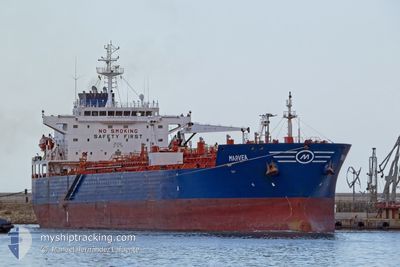
MARVEA
Oil/Chemical Tanker
Current Trip
CYVAS
| Time Travelled | --- |
|---|---|
| Remaining Time | --- |
| Distance Travelled | --- |
| Remaining Distance | --- |
| AVG Speed | --- |
| MAX Speed | --- |
| AVG Wind | --- |
| MAX Wind | --- |
| MIN Temp | --- |
| MAX Temp | --- |
| Tirant d eau | 9.4 m |
| Position reçue | 1 h, 45 m depuis |
Current Position
| Longitude | 35.48980° |
|---|---|
| Latitude | 33.81845° |
| Etat | Moored |
| Vitesse | |
| Parcours | 226° |
| Zone | Mediterranean Sea - Eastern Basin |
| Station | T-AIS |
| Position reçue | 1 h, 45 m depuis |
Info
Information
The current position of MARVEA is in Mediterranean Sea - Eastern Basin with coordinates 33.81845° / 35.48980° as reported on 2024-04-29 05:32 by AIS to our vessel tracker app. The vessel's current speed is 0 Noeuds
The vessel MARVEA (IMO: 9301897, MMSI: 256210000) is a Oil/Chemical Tanker that was built in 2006 ( 18 Age ). It's sailing under the flag of [MT] Malta.
In this page you can find informations about the vessels current position, last detected port calls, and current voyage information. If the vessels is not in coverage by AIS you will find the latest position.
The current position of MARVEA is detected by our AIS receivers and we are not responsible for the reliability of the data. The last position was recorded while the vessel was in Coverage by the Ais receivers of our vessel tracking app.
The current draught of MARVEA as reported by AIS is 9.4 meters
Weather
| Temperature | 21.3°C / 70.34°F |
|---|---|
| Wind Speed | 3 knots |
| Direction | 221° SW |
| Pressure | 1012 hPa |
| Humidity | 65.5 % |
| Cloud Coverage | 87 % |
Featured Company
Last Port Calls
| Port | Arrival | Departure | Time In Port |
|---|---|---|---|
| 2024-04-27 16:15 | |||
| 2024-04-15 11:42 | 2024-04-17 11:00 | 1 d | |
| 2024-04-03 08:25 | 2024-04-05 02:08 | 1 d | |
| 2024-03-24 20:27 | 2024-03-25 23:52 | 1 d | |
| 2024-03-18 18:22 | 2024-03-21 01:49 | 2 d | |
| 2024-02-29 17:55 | 2024-03-03 04:29 | 2 d | |
| 2024-02-23 08:30 | 2024-02-24 13:55 | 1 d | |
| 2024-02-20 09:57 | 2024-02-20 12:43 | 2 h | |
| 2024-02-04 19:58 |
Last Trips
| Origin | Departure | Destination | Arrival | Distance | |
|---|---|---|---|---|---|
| 2024-04-17 14:00 | 2024-04-27 19:15 | 2303.64 nm | |||
| 2024-04-05 03:08 | 2024-04-15 14:42 | 2570.45 nm | |||
| 2024-03-25 23:52 | 2024-04-03 09:25 | 839.83 nm | |||
| 2024-03-21 02:49 | 2024-03-24 20:27 | 1180.71 nm | |||
| 2024-03-03 05:29 | 2024-03-18 19:22 | 4042.39 nm | |||
| 2024-02-24 14:55 | 2024-02-29 18:55 | 720.91 nm | |||
| 2024-02-20 13:43 | 2024-02-23 09:30 | 143.36 nm | |||
| 2024-02-04 20:58 | 2024-02-20 10:57 | 2270.87 nm |
Events
| Heure | Evenement | Détails | Position/ Destination | Info |
|---|---|---|---|---|
| 2024-04-29 05:33 | Etat Changé | Default Moored |
33.81847 / 35.48987
CYVAS
|
Vitesse: Parcours: 226° |
| 2024-04-29 05:32 | Dans la zone couverte |
33.81845 / 35.48980
Mediterranean Sea - Eastern Basin
|
Vitesse: Parcours: 173° |
|
| 2024-04-29 05:32 | Hors de la zone couverte |
33.81845 / 35.48980
Mediterranean Sea - Eastern Basin
|
Vitesse: Parcours: 173° |
|
| 2024-04-29 02:29 | Hors de la zone couverte |
33.81729 / 35.49037
Mediterranean Sea - Eastern Basin
|
Vitesse: 8.1 kn Parcours: 199.3° |
|
| 2024-04-29 01:51 | Dans la zone couverte |
33.78393 / 35.49637
Mediterranean Sea - Eastern Basin
|
Vitesse: 83.3 kn Parcours: 177° |
|
| 2024-04-28 16:11 | Etat Changé | Default Moored |
33.82007 / 35.49024
CYVAS
|
Vitesse: 60.2 kn Parcours: 336° |
| 2024-04-28 16:11 | Arret | 6.05 nm, South of BEIRUT |
33.82007 / 35.49024
CYVAS
|
Vitesse: 0.1 kn Parcours: 226° |
| 2024-04-28 15:45 | Etat Changé | Moored Default |
33.82038 / 35.48968
CYVAS
|
Vitesse: 8.7 kn Parcours: 227° |
| 2024-04-28 15:45 | Dans la zone couverte |
33.82038 / 35.48968
Mediterranean Sea - Eastern Basin
|
Vitesse: 60.2 kn Parcours: 336° |
|
| 2024-04-28 15:45 | Hors de la zone couverte |
33.82038 / 35.48968
Mediterranean Sea - Eastern Basin
|
Vitesse: 60.2 kn Parcours: 336° |