
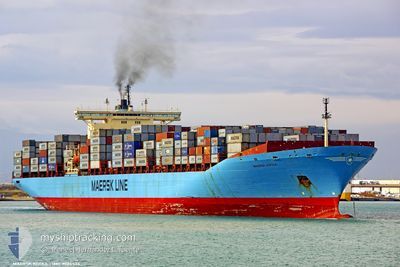
KOTKA
Container Ship
Current Trip
| Time Travelled | 20 days |
|---|---|
| Remaining Time | --- |
| Distance Travelled | 8209.81 nm |
| Remaining Distance | --- |
| AVG Speed | 15.7 Noeuds |
| MAX Speed | 20.2 Noeuds |
| AVG Wind | 10.7 knots |
| MAX Wind | 34.6 knots |
| MIN Temp | 12°C / 53.6°F |
| MAX Temp | 28.5°C / 83.3°F |
| Tirant d eau | 13 m |
| Position reçue | 1 d depuis |
Current Position
| Longitude | 32.78186° |
|---|---|
| Latitude | -28.88096° |
| Etat | Under way using engine |
| Vitesse | 17 Noeuds |
| Parcours | 42.3° |
| Zone | Indian Ocean |
| Station | T-AIS |
| Position reçue | 1 d depuis |
Info
Information
The current position of KOTKA is in Indian Ocean with coordinates -28.88096° / 32.78186° as reported on 2024-06-05 15:57 by AIS to our vessel tracker app. The vessel's current speed is 17 Noeuds and is heading at the port of ABU DHABI. The estimated time of arrival as calculated by MyShipTracking vessel tracking app is 2024-06-15 00:01 LT
The vessel KOTKA (IMO: 9085534, MMSI: 636018933) is a Container Ship that was built in 1996 ( 28 Age ). It's sailing under the flag of [LR] Liberia.
In this page you can find informations about the vessels current position, last detected port calls, and current voyage information. If the vessels is not in coverage by AIS you will find the latest position.
The current position of KOTKA is detected by our AIS receivers and we are not responsible for the reliability of the data. The last position was recorded while the vessel was in Coverage by the Ais receivers of our vessel tracking app.
The current draught of KOTKA as reported by AIS is 13 meters
Weather
| Temperature | 26.3°C / 79.34°F |
|---|---|
| Wind Speed | 4 knots |
| Direction | 39° NE |
| Pressure | 1017 hPa |
| Humidity | 66.9 % |
| Cloud Coverage | --- |
Featured Company
Last Port Calls
| Port | Arrival | Departure | Time In Port |
|---|---|---|---|
| 2024-05-16 13:40 | 2024-05-17 11:56 | 22 h | |
| 2024-05-14 11:45 | 2024-05-15 14:42 | 1 d | |
| 2024-05-11 19:54 | 2024-05-12 17:58 | 22 h | |
| 2024-05-07 09:34 | 2024-05-08 00:12 | 14 h | |
| 2024-05-02 18:52 | 2024-05-04 01:52 | 1 d | |
| 2024-04-23 13:53 | 2024-04-24 09:23 | 19 h |
Last Trips
| Origin | Departure | Destination | Arrival | Distance | |
|---|---|---|---|---|---|
| 2024-05-15 10:42 | 2024-05-16 09:40 | 386.63 nm | |||
| 2024-05-12 13:58 | 2024-05-14 07:45 | 419.33 nm | |||
| 2024-05-07 20:12 | 2024-05-11 15:54 | 291.88 nm | |||
| 2024-05-03 21:52 | 2024-05-07 05:34 | 720.05 nm | |||
| 2024-04-24 10:23 | 2024-05-02 14:52 | 2995.81 nm | |||
| 2024-03-31 04:43 | 2024-04-23 14:53 | 8904.66 nm |
Events
| Heure | Evenement | Détails | Position/ Destination | Info |
|---|---|---|---|---|
| 2024-06-05 16:04 | Etat Changé | Default Under way using engine |
-28.85696 / 32.80562
AEAUH
|
Vitesse: 17 kn Parcours: 42.3° |
| 2024-06-05 15:57 | Hors de la zone couverte |
-28.88096 / 32.78186
Indian Ocean
AEAUH
|
Vitesse: 17 kn Parcours: 42.3° |
|
| 2024-06-05 15:37 | Etat Changé | Under way using engine Default |
-28.95106 / 32.70942
AEAUH
|
Vitesse: 17.3 kn Parcours: 42° |
| 2024-06-05 15:21 | Etat Changé | Default Under way using engine |
-29.00885 / 32.64967
AEAUH
|
Vitesse: 17.1 kn Parcours: 40.8° |
| 2024-06-05 15:20 | Etat Changé | Under way using engine Default |
-29.01443 / 32.64402
AEAUH
|
Vitesse: 17.2 kn Parcours: 42° |
| 2024-06-05 15:01 | Dans la zone couverte |
-29.01443 / 32.64402
Indian Ocean
AEAUH
|
Vitesse: 17.1 kn Parcours: 41.2° |
|
| 2024-06-05 14:28 | Etat Changé | Default Under way using engine |
-29.19869 / 32.45433
AEAUH
|
Vitesse: 17.2 kn Parcours: 42° |
| 2024-06-05 14:17 | Hors de la zone couverte |
-29.23590 / 32.41617
Indian Ocean
AEAUH
|
Vitesse: 17.2 kn Parcours: 42° |
|
| 2024-06-05 08:00 | Changement d'ETA | 2024/06/15 00:01 2024/06/12 22:00 |
-30.54025 / 31.11357
AEAUH
|
Vitesse: 16.7 kn Parcours: 42.3° |
| 2024-06-05 07:55 | Etat Changé | Under way using engine Default |
-30.55842 / 31.09452
AEAUH
|
Vitesse: 16.7 kn Parcours: 42° |