
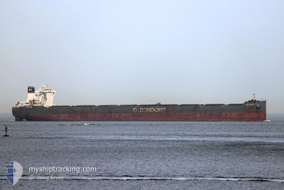
HERMANN OLDENDORFF
Cargo
Current Trip
| Trip Time | 12 days |
|---|---|
| Trip Distance | 2848.92 nm |
| AVG Speed | 10.9 Noeuds |
| MAX Speed | 14.2 Noeuds |
| Tirant d eau | 18.1 m |
| AVG Wind | 12.3 knots |
| MAX Wind | 30 knots |
| MIN Temp | 21.2°C / 70.16°F |
| MAX Temp | 30.7°C / 87.26°F |
| Position reçue | 3 d depuis |
Current Position
| Longitude | 119.89986° |
|---|---|
| Latitude | 22.73055° |
| Etat | Under way using engine |
| Vitesse | 12.2 Noeuds |
| Parcours | 357° |
| Zone | South China Sea |
| Station | T-AIS |
| Position reçue | 3 d depuis |
Info
Information
The current position of HERMANN OLDENDORFF is in South China Sea with coordinates 22.73055° / 119.89986° as reported on 2024-05-28 16:20 by AIS to our vessel tracker app. The vessel's current speed is 12.2 Noeuds and is currently inside the port of XIUYU.
The vessel HERMANN OLDENDORFF (IMO: 9731585, MMSI: 255805682) is a Cargo It's sailing under the flag of [PT] Portugal.
In this page you can find informations about the vessels current position, last detected port calls, and current voyage information. If the vessels is not in coverage by AIS you will find the latest position.
The current position of HERMANN OLDENDORFF is detected by our AIS receivers and we are not responsible for the reliability of the data. The last position was recorded while the vessel was in Coverage by the Ais receivers of our vessel tracking app.
The current draught of HERMANN OLDENDORFF as reported by AIS is 18.1 meters
Weather
| Temperature | 21.1°C / 69.98°F |
|---|---|
| Wind Speed | 10 knots |
| Direction | 50° NE |
| Pressure | 1011.4 hPa |
| Humidity | 95.9 % |
| Cloud Coverage | 100 % |
Featured Company
Last Port Calls
| Port | Arrival | Departure | Time In Port |
|---|---|---|---|
| 2024-05-31 03:58 | |||
| 2024-05-16 07:14 | 2024-05-18 11:20 | 2 d | |
| 2024-04-29 03:12 | 2024-04-29 06:36 | 3 h | |
| 2024-04-25 17:19 | 2024-04-28 15:56 | 2 d | |
| 2024-04-03 12:01 | 2024-04-25 16:43 | 22 d | |
| 2024-04-01 09:29 |
Most Visited Ports (Last year)
| Port | Arrivals | |
|---|---|---|
| 3 | ||
| 2 | ||
| 1 | ||
| 1 | ||
| 1 | ||
| 1 |
Last Trips
| Origin | Departure | Destination | Arrival | Distance | |
|---|---|---|---|---|---|
| 2024-05-18 19:20 | 2024-05-31 11:58 | 2848.92 nm | |||
| 2024-04-29 15:36 | 2024-05-16 15:14 | 3545.41 nm | |||
| 2024-04-29 00:56 | 2024-04-29 12:12 | 5.22 nm | |||
| 2024-04-26 01:43 | 2024-04-26 02:19 | 0.51 nm | |||
| 2024-04-01 18:29 | 2024-04-03 21:01 | 464.63 nm |
Events
| Heure | Evenement | Détails | Position/ Destination | Info |
|---|---|---|---|---|
| 2024-05-31 03:58 | Port d'arrivée |
|
25.18332 / 119.01212
[CN] XIUYU
|
Vitesse: 1.6 kn Parcours: 27° |
| 2024-05-30 22:34 | Démarrage | 20.01 nm, East of QUANZHOU |
24.75953 / 119.03576
LUOYU
|
Vitesse: 3.3 kn Parcours: 340° |
| 2024-05-29 05:50 | Arret | 20.13 nm, East of QUANZHOU |
24.75124 / 119.03584
LUOYU
|
Vitesse: 0.3 kn Parcours: 53° |
| 2024-05-28 16:28 | Etat Changé | Default Under way using engine |
22.75798 / 119.89825
LUOYU
|
Vitesse: 12.2 kn Parcours: 357° |
| 2024-05-28 16:20 | Hors de la zone couverte |
22.73055 / 119.89986
South China Sea
|
Vitesse: 12.2 kn Parcours: 357° |
|
| 2024-05-28 15:38 | Changement de zone | Taiwanese part of the South China Sea Philippines part of the South China Sea |
22.58664 / 119.90345
South China Sea
|
Vitesse: 12.1 kn Parcours: 0.5° |
| 2024-05-28 15:36 | Etat Changé | Under way using engine Default |
22.57982 / 119.90329
LUOYU
|
Vitesse: 12.3 kn Parcours: 2° |
| 2024-05-28 15:21 | Dans la zone couverte |
22.58664 / 119.90345
South China Sea
|
Vitesse: 12.1 kn Parcours: 0.5° |
|
| 2024-05-27 09:06 | Démarrage |
16.19667 / 119.43333
LUOYU
|
Vitesse: 5 kn Parcours: 352° |
|
| 2024-05-27 06:31 | Arret |
16.19170 / 119.42121
LUOYU
|
Vitesse: Parcours: 262° |