
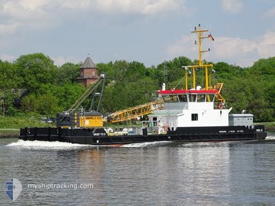
GRIEP TO II
Dredging or underwater ops
Current Trip
KIEL HOLTENAU AREA
| Time Travelled | 19 days |
|---|---|
| Remaining Time | --- |
| Distance Travelled | 10.32 nm |
| Remaining Distance | --- |
| AVG Speed | 4.5 Noeuds |
| MAX Speed | 7.3 Noeuds |
| AVG Wind | 7.5 knots |
| MAX Wind | 15.9 knots |
| MIN Temp | 11.8°C / 53.24°F |
| MAX Temp | 21.3°C / 70.34°F |
| Tirant d eau | 1.5 m |
| Position reçue | 2 m depuis |
Current Position
| Longitude | 10.13616° |
|---|---|
| Latitude | 54.36881° |
| Etat | Restricted manoeuverability |
| Vitesse | |
| Parcours | 52° |
| Zone | North Sea |
| Station | T-AIS |
| Position reçue | 2 m depuis |
Info
Information
The current position of GRIEP TO II is in North Sea with coordinates 54.36881° / 10.13616° as reported on 2024-06-05 03:12 by AIS to our vessel tracker app. The vessel's current speed is 0 Noeuds
The vessel GRIEP TO II (MMSI: 211747930) is a Dredging or underwater ops It's sailing under the flag of [DE] Germany.
In this page you can find informations about the vessels current position, last detected port calls, and current voyage information. If the vessels is not in coverage by AIS you will find the latest position.
The current position of GRIEP TO II is detected by our AIS receivers and we are not responsible for the reliability of the data. The last position was recorded while the vessel was in Coverage by the Ais receivers of our vessel tracking app.
The current draught of GRIEP TO II as reported by AIS is 1.5 meters
Weather
| Temperature | 12.6°C / 54.68°F |
|---|---|
| Wind Speed | 12 knots |
| Direction | 206° SSW |
| Pressure | 1004.5 hPa |
| Humidity | 96.1 % |
| Cloud Coverage | 100 % |
Featured Company
Most Visited Ports (Last year)
| Port | Arrivals | |
|---|---|---|
| 11 | ||
| 6 | ||
| 1 | ||
| 1 |
Events
| Heure | Evenement | Détails | Position/ Destination | Info |
|---|---|---|---|---|
| 2024-06-04 08:35 | Arret | 1.4 nm, South West of STICKENHΟRN SPORT |
54.36881 / 10.13615
KIEL HOLTENAU AREA
|
Vitesse: 0.3 kn Parcours: 56° |
| 2024-06-04 08:33 | Démarrage | 1.49 nm, South West of STICKENHΟRN SPORT |
54.36774 / 10.13440
KIEL HOLTENAU AREA
|
Vitesse: 4.6 kn Parcours: 44° |
| 2024-06-04 08:07 | Arret | 1.52 nm, South West of STICKENHΟRN SPORT |
54.36606 / 10.13564
KIEL HOLTENAU AREA
|
Vitesse: 0.2 kn Parcours: 201° |
| 2024-06-04 08:05 | Démarrage | 1.45 nm, South West of STICKENHΟRN SPORT |
54.36677 / 10.13713
KIEL HOLTENAU AREA
|
Vitesse: 5.3 kn Parcours: 284° |
| 2024-06-04 07:10 | Arret | 1.39 nm, South West of STICKENHΟRN SPORT |
54.36623 / 10.14021
KIEL HOLTENAU AREA
|
Vitesse: 0.1 kn Parcours: 288° |
| 2024-06-04 07:05 | Démarrage | 1.29 nm, South West of STICKENHΟRN SPORT |
54.36536 / 10.14677
KIEL HOLTENAU AREA
|
Vitesse: 3.3 kn Parcours: 288° |
| 2024-06-04 06:20 | Arret | 1.41 nm, South West of STICKENHΟRN SPORT |
54.36595 / 10.14008
KIEL HOLTENAU AREA
|
Vitesse: 0.3 kn Parcours: 107° |
| 2024-06-04 06:17 | Démarrage | 1.48 nm, South West of STICKENHΟRN SPORT |
54.36639 / 10.13652
KIEL HOLTENAU AREA
|
Vitesse: 3.3 kn Parcours: 103° |
| 2024-05-30 07:50 | Arret | 1.22 nm, South West of STICKENHΟRN SPORT |
54.36953 / 10.14188
KIEL HOLTENAU AREA
|
Vitesse: 0.1 kn Parcours: 166° |
| 2024-05-30 07:44 | Démarrage | 1.39 nm, South West of STICKENHΟRN SPORT |
54.36895 / 10.13611
KIEL HOLTENAU AREA
|
Vitesse: 3.7 kn Parcours: 57° |