
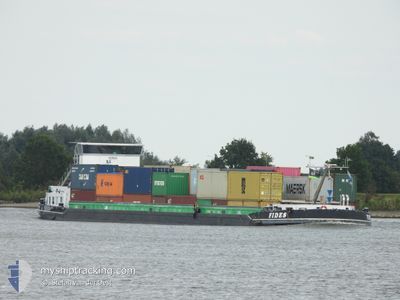
FIDES
Not available
Current Trip
| Time Travelled | 15 h, 32 mins |
|---|---|
| Remaining Time | 2 h, 28 mins |
| Distance Travelled | 90.01 nm |
| Remaining Distance | 21.37 nm |
| AVG Speed | 6.2 Noeuds |
| MAX Speed | 7.9 Noeuds |
| AVG Wind | 14.8 knots |
| MAX Wind | 22 knots |
| MIN Temp | 8.4°C / 47.12°F |
| MAX Temp | 13.4°C / 56.12°F |
| Tirant d eau | 0 m |
| Position reçue | Maintenant |
Current Position
| Longitude | 5.01379° |
|---|---|
| Latitude | 52.33288° |
| Etat | Under way using engine |
| Vitesse | 7.2 Noeuds |
| Parcours | 148° |
| Zone | North Sea |
| Station | T-AIS |
| Position reçue | Maintenant |
Info
Information
The current position of FIDES is in North Sea with coordinates 52.33288° / 5.01379° as reported on 2024-06-11 09:46 by AIS to our vessel tracker app. The vessel's current speed is 7.2 Noeuds and is heading at the port of NIEUWEGEIN. The estimated time of arrival as calculated by MyShipTracking vessel tracking app is 2024-06-11 14:15 LT
The vessel FIDES (MMSI: 244650105) is a Not available It's sailing under the flag of [NL] Netherlands.
In this page you can find informations about the vessels current position, last detected port calls, and current voyage information. If the vessels is not in coverage by AIS you will find the latest position.
The current position of FIDES is detected by our AIS receivers and we are not responsible for the reliability of the data. The last position was recorded while the vessel was in Coverage by the Ais receivers of our vessel tracking app.
Weather
| Temperature | 13.2°C / 55.76°F |
|---|---|
| Wind Speed | 11 knots |
| Direction | 274° W |
| Pressure | 1014.1 hPa |
| Humidity | 69.2 % |
| Cloud Coverage | 67 % |
Featured Company
Last Port Calls
| Port | Arrival | Departure | Time In Port |
|---|---|---|---|
| 2024-06-10 19:09 | 2024-06-10 20:15 | 1 h | |
| 2024-06-09 15:52 | 2024-06-10 18:01 | 1 d | |
| 2024-06-09 13:05 | 2024-06-09 15:12 | 2 h | |
| 2024-06-08 05:22 | 2024-06-08 12:05 | 6 h | |
| 2024-06-08 04:37 | 2024-06-08 05:15 | 38 m | |
| 2024-06-07 21:05 | 2024-06-07 23:53 | 2 h | |
| 2024-06-07 18:22 | 2024-06-07 20:35 | 2 h | |
| 2024-06-07 17:47 | 2024-06-07 18:05 | 18 m | |
| 2024-06-07 15:15 | 2024-06-07 17:35 | 2 h | |
| 2024-06-07 12:44 | 2024-06-07 14:58 | 2 h |
Most Visited Ports (Last year)
| Port | Arrivals | |
|---|---|---|
| 222 | ||
| 159 | ||
| 150 | ||
| 146 | ||
| 100 | ||
| 76 |
Last Trips
| Origin | Departure | Destination | Arrival | Distance | |
|---|---|---|---|---|---|
| 2024-06-10 18:01 | 2024-06-10 19:09 | 3.07 nm | |||
| 2024-06-09 15:12 | 2024-06-09 15:52 | 2.66 nm | |||
| 2024-06-08 12:05 | 2024-06-09 13:05 | 107.41 nm | |||
| 2024-06-08 05:15 | 2024-06-08 05:22 | 0.70 nm | |||
| 2024-06-07 23:53 | 2024-06-08 04:37 | 28.98 nm | |||
| 2024-06-07 20:35 | 2024-06-07 21:05 | 4.28 nm | |||
| 2024-06-07 18:05 | 2024-06-07 18:22 | 2.12 nm | |||
| 2024-06-07 17:35 | 2024-06-07 17:47 | 1.18 nm | |||
| 2024-06-07 14:58 | 2024-06-07 15:15 | 1.93 nm | |||
| 2024-06-07 10:24 | 2024-06-07 12:44 | 17.08 nm |
Events
| Heure | Evenement | Détails | Position/ Destination | Info |
|---|---|---|---|---|
| 2024-06-11 09:14 | Démarrage | 0.22 nm, West of SCHELLINGWOUDE |
52.38019 / 4.95891
OUDE MAAS
|
Vitesse: 3.3 kn Parcours: 296.1° |
| 2024-06-11 09:02 | Changement d'ETA | 2024/06/07 09:38 |
52.37985 / 4.96025
OUDE MAAS
|
Vitesse: Parcours: 0° |
| 2024-06-11 08:50 | Changement d'ETA | 2024/06/07 09:38 |
52.37868 / 4.96462
OUDE MAAS
|
Vitesse: 0.3 kn Parcours: 511° |
| 2024-06-11 08:46 | Arret | 0.15 nm, South of SCHELLINGWOUDE |
52.37858 / 4.96469
OUDE MAAS
|
Vitesse: 0.3 kn Parcours: 296° |
| 2024-06-11 08:20 | Changement d'ETA | 2024/06/07 09:38 |
52.37532 / 5.03349
OUDE MAAS
|
Vitesse: 7.2 kn Parcours: 245° |
| 2024-06-11 06:00 | Démarrage | 0.18 nm, West of LELYSTAD |
52.52636 / 5.43397
OUDE MAAS
|
Vitesse: 3.5 kn Parcours: 183.6° |
| 2024-06-11 05:52 | Arret | 0.21 nm, North West of LELYSTAD |
52.52826 / 5.43419
OUDE MAAS
|
Vitesse: 0.3 kn Parcours: 511° |
| 2024-06-11 02:46 | Démarrage | 0.92 nm, West of LEMMER |
52.84931 / 5.67516
OUDE MAAS
|
Vitesse: 3.8 kn Parcours: 203.3° |
| 2024-06-11 02:43 | Etat Changé | Under way using engine Default |
52.85146 / 5.67647
OUDE MAAS
|
Vitesse: 0.1 kn Parcours: -1° |
| 2024-06-11 02:41 | Etat Changé | Default Under way using engine |
52.85157 / 5.67655
OUDE MAAS
|
Vitesse: 0.3 kn Parcours: 511° |