
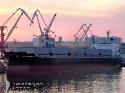
COS PROSPERITY
Bulk Carrier
Current Trip
| Time Travelled | 7 days |
|---|---|
| Remaining Time | --- |
| Distance Travelled | 2135.32 nm |
| Remaining Distance | --- |
| AVG Speed | 11.8 Noeuds |
| MAX Speed | 13.1 Noeuds |
| AVG Wind | 15.2 knots |
| MAX Wind | 21.9 knots |
| MIN Temp | 18.2°C / 64.76°F |
| MAX Temp | 28.5°C / 83.3°F |
| Tirant d eau | 12 m |
| Position reçue | 6 d depuis |
Current Position
| Longitude | -13.64588° |
|---|---|
| Latitude | 28.09770° |
| Etat | Under way using engine |
| Vitesse | 12 Noeuds |
| Parcours | 216.4° |
| Zone | North Atlantic Ocean |
| Station | T-AIS |
| Position reçue | 6 d depuis |
Info
Information
The current position of COS PROSPERITY is in North Atlantic Ocean with coordinates 28.09770° / -13.64588° as reported on 2024-05-27 00:10 by AIS to our vessel tracker app. The vessel's current speed is 12 Noeuds and is heading at the port of KANDLA. The estimated time of arrival as calculated by MyShipTracking vessel tracking app is 2024-06-28 06:30 LT
The vessel COS PROSPERITY (IMO: 9308716, MMSI: 565101000) is a Bulk Carrier that was built in 2006 ( 18 Age ). It's sailing under the flag of [SG] Singapore.
In this page you can find informations about the vessels current position, last detected port calls, and current voyage information. If the vessels is not in coverage by AIS you will find the latest position.
The current position of COS PROSPERITY is detected by our AIS receivers and we are not responsible for the reliability of the data. The last position was recorded while the vessel was in Coverage by the Ais receivers of our vessel tracking app.
The current draught of COS PROSPERITY as reported by AIS is 12 meters
Weather
| Temperature | 27.6°C / 81.68°F |
|---|---|
| Wind Speed | 16 knots |
| Direction | 156° SSE |
| Pressure | 1014.6 hPa |
| Humidity | 73.4 % |
| Cloud Coverage | 100 % |
Featured Company
Last Port Calls
| Port | Arrival | Departure | Time In Port |
|---|---|---|---|
| 2024-05-21 11:35 | 2024-05-25 14:30 | 4 d | |
| 2024-05-07 17:31 | 2024-05-15 19:13 | 8 d |
Most Visited Ports (Last year)
| Port | Arrivals | |
|---|---|---|
| 2 | ||
| 1 | ||
| 1 | ||
| 1 | ||
| 1 | ||
| 1 |
Last Trips
| Origin | Departure | Destination | Arrival | Distance | |
|---|---|---|---|---|---|
| 2024-05-15 20:13 | 2024-05-21 12:35 | 1676.92 nm | |||
| 2024-03-14 14:26 | 2024-05-07 18:31 | 9924.37 nm |
Events
| Heure | Evenement | Détails | Position/ Destination | Info |
|---|---|---|---|---|
| 2024-05-27 00:14 | Etat Changé | Default Under way using engine |
28.08333 / -13.65500
KANDLA
|
Vitesse: 12 kn Parcours: 216.4° |
| 2024-05-27 00:10 | Etat Changé | Under way using engine Default |
28.09770 / -13.64588
KANDLA
|
Vitesse: 12.1 kn Parcours: 212° |
| 2024-05-27 00:10 | Hors de la zone couverte |
28.09770 / -13.64588
North Atlantic Ocean
|
Vitesse: 12 kn Parcours: 216.4° |
|
| 2024-05-27 00:07 | Etat Changé | Default Under way using engine |
28.10599 / -13.63947
KANDLA
|
Vitesse: 12.1 kn Parcours: 212.6° |
| 2024-05-26 23:52 | Etat Changé | Under way using engine Default |
28.14714 / -13.60807
KANDLA
|
Vitesse: 11.9 kn Parcours: 215° |
| 2024-05-26 23:35 | Etat Changé | Default Under way using engine |
28.19264 / -13.57265
KANDLA
|
Vitesse: 12.1 kn Parcours: 216.3° |
| 2024-05-26 23:26 | Etat Changé | Under way using engine Default |
28.21995 / -13.55101
KANDLA
|
Vitesse: 12 kn Parcours: 216° |
| 2024-05-26 23:10 | Etat Changé | Default Under way using engine |
28.26352 / -13.51717
KANDLA
|
Vitesse: 12.1 kn Parcours: 213.8° |
| 2024-05-26 22:54 | Etat Changé | Under way using engine Default |
28.30901 / -13.48245
KANDLA
|
Vitesse: 12 kn Parcours: 214° |
| 2024-05-26 22:50 | Etat Changé | Default Under way using engine |
28.31667 / -13.47500
KANDLA
|
Vitesse: 12.1 kn Parcours: 216.9° |