
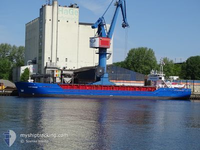
COE MIEKE
General Cargo
Current Trip
| Time Travelled | 1 day |
|---|---|
| Remaining Time | 4 h, 47 mins |
| Distance Travelled | 272.13 nm |
| Remaining Distance | 46.57 nm |
| AVG Speed | 8.4 Noeuds |
| MAX Speed | 11.3 Noeuds |
| AVG Wind | 17.7 knots |
| MAX Wind | 25 knots |
| MIN Temp | 11.6°C / 52.88°F |
| MAX Temp | 15.3°C / 59.54°F |
| Tirant d eau | 4.7 m |
| Position reçue | 1 m depuis |
Current Position
| Longitude | 10.89505° |
|---|---|
| Latitude | 55.88785° |
| Etat | Under way using engine |
| Vitesse | 10.6 Noeuds |
| Parcours | 219.7° |
| Zone | Kattegat |
| Station | T-AIS |
| Position reçue | 1 m depuis |
Info
Information
The current position of COE MIEKE is in Kattegat with coordinates 55.88785° / 10.89505° as reported on 2024-06-12 13:01 by AIS to our vessel tracker app. The vessel's current speed is 10.6 Noeuds and is heading at the port of HORSENS. The estimated time of arrival as calculated by MyShipTracking vessel tracking app is 2024-06-12 19:49 LT
The vessel COE MIEKE (IMO: 8912481, MMSI: 352001928) is a General Cargo that was built in 1990 ( 34 Age ). It's sailing under the flag of [PA] Panama.
In this page you can find informations about the vessels current position, last detected port calls, and current voyage information. If the vessels is not in coverage by AIS you will find the latest position.
The current position of COE MIEKE is detected by our AIS receivers and we are not responsible for the reliability of the data. The last position was recorded while the vessel was in Coverage by the Ais receivers of our vessel tracking app.
The current draught of COE MIEKE as reported by AIS is 4.7 meters
Weather
| Temperature | 13.3°C / 55.94°F |
|---|---|
| Wind Speed | 18 knots |
| Direction | 258° WSW |
| Pressure | 1010.8 hPa |
| Humidity | 65.4 % |
| Cloud Coverage | 100 % |
Featured Company
Last Port Calls
| Port | Arrival | Departure | Time In Port |
|---|---|---|---|
| 2024-06-08 20:22 | 2024-06-10 17:14 | 1 d | |
| 2024-06-05 22:12 | 2024-06-07 02:06 | 1 d | |
| 2024-06-03 17:44 | 2024-06-04 15:56 | 22 h | |
| 2024-05-29 20:19 | 2024-05-31 15:42 | 1 d | |
| 2024-05-28 14:59 | 2024-05-29 10:03 | 19 h | |
| 2024-05-25 13:06 | 2024-05-27 14:11 | 2 d | |
| 2024-05-22 21:52 | 2024-05-23 12:18 | 14 h | |
| 2024-05-22 03:05 | 2024-05-22 14:27 | 11 h | |
| 2024-05-20 06:11 | 2024-05-21 17:04 | 1 d | |
| 2024-05-18 14:42 | 2024-05-19 22:08 | 1 d |
Last Trips
| Origin | Departure | Destination | Arrival | Distance | |
|---|---|---|---|---|---|
| 2024-06-07 02:06 | 2024-06-08 20:22 | 435.96 nm | |||
| 2024-06-04 15:56 | 2024-06-05 22:12 | 267.35 nm | |||
| 2024-05-31 15:42 | 2024-06-03 17:44 | 588.58 nm | |||
| 2024-05-29 10:03 | 2024-05-29 20:19 | 84.89 nm | |||
| 2024-05-27 14:11 | 2024-05-28 14:59 | 236.18 nm | |||
| 2024-05-23 12:18 | 2024-05-25 13:06 | 238.94 nm | |||
| 2024-05-22 14:27 | 2024-05-22 21:52 | 67.86 nm | |||
| 2024-05-21 17:04 | 2024-05-22 03:05 | 97.90 nm | |||
| 2024-05-19 22:08 | 2024-05-20 06:11 | 66.54 nm | |||
| 2024-05-16 14:06 | 2024-05-18 14:42 | 449.21 nm |
Events
| Heure | Evenement | Détails | Position/ Destination | Info |
|---|---|---|---|---|
| 2024-06-12 00:40 | Changement de zone | Danish part of the Kattegat Danish part of the Skaggerak |
57.75948 / 10.77312
Kattegat
DKHOR
|
Vitesse: 10.2 kn Parcours: 180° |
| 2024-06-11 16:04 | Changement de zone | Danish part of the Skaggerak Danish part of the North Sea |
57.17286 / 8.52970
Skaggerak
DKHOR
|
Vitesse: 9.3 kn Parcours: 36.9° |
| 2024-06-11 12:16 | Tirant d'eau modifié | 4.7 3.2 |
56.68227 / 8.23447
DKHOR
|
Vitesse: 6.9 kn Parcours: 33.8° |
| 2024-06-11 12:16 | Changement de destination | DKHOR DKTYB |
56.68227 / 8.23447
DKHOR
|
Vitesse: 6.9 kn Parcours: 33.8° |
| 2024-06-11 12:16 | Changement d'ETA | 2024/06/12 18:00 2024/06/10 21:00 |
56.68227 / 8.23447
DKHOR
|
Vitesse: 6.9 kn Parcours: 33.8° |
| 2024-06-11 12:13 | Etat Changé | Under way using engine Moored |
56.67867 / 8.22964
DKTYB
|
Vitesse: 4 kn Parcours: 42° |
| 2024-06-11 12:13 | Démarrage | 1.2 nm, South of THYBORON |
56.67854 / 8.22944
DKTYB
|
Vitesse: 4 kn Parcours: 42° |
| 2024-06-10 20:41 | Etat Changé | Moored Under way using engine |
56.67715 / 8.22740
DKTYB
|
Vitesse: Parcours: 24° |
| 2024-06-10 20:08 | Arret | 1.31 nm, South of THYBORON |
56.67661 / 8.22896
DKTYB
|
Vitesse: 0.1 kn Parcours: 336° |
| 2024-06-10 15:23 | Changement de zone | Danish part of the North Sea Danish part of the Skaggerak |
57.13873 / 8.58503
North Sea
DKTYB
|
Vitesse: 6.1 kn Parcours: 271.8° |