
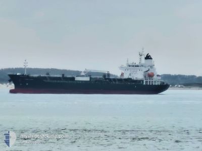
CHEM SPICA
Tanker
Current Trip
| Time Travelled | 12 days |
|---|---|
| Remaining Time | 3 days |
| Distance Travelled | 4026.62 nm |
| Remaining Distance | 1298.65 nm |
| AVG Speed | 13.9 Noeuds |
| MAX Speed | 16.3 Noeuds |
| AVG Wind | 7.2 knots |
| MAX Wind | 18.3 knots |
| MIN Temp | 16.5°C / 61.7°F |
| MAX Temp | 29.2°C / 84.56°F |
| Tirant d eau | 8.5 m |
| Position reçue | 8 d depuis |
Current Position
| Longitude | -77.16098° |
|---|---|
| Latitude | 28.04936° |
| Etat | Under way using engine |
| Vitesse | 12.2 Noeuds |
| Parcours | 79.9° |
| Zone | North Atlantic Ocean |
| Station | T-AIS |
| Position reçue | 8 d depuis |
Info
Information
The current position of CHEM SPICA is in North Atlantic Ocean with coordinates 28.04936° / -77.16098° as reported on 2024-05-22 01:28 by AIS to our vessel tracker app. The vessel's current speed is 12.2 Noeuds and is heading at the port of ANTWERP. The estimated time of arrival as calculated by MyShipTracking vessel tracking app is 2024-06-03 01:08 LT
The vessel CHEM SPICA (IMO: 9739264, MMSI: 636022066) is a Tanker It's sailing under the flag of [LR] Liberia.
In this page you can find informations about the vessels current position, last detected port calls, and current voyage information. If the vessels is not in coverage by AIS you will find the latest position.
The current position of CHEM SPICA is detected by our AIS receivers and we are not responsible for the reliability of the data. The last position was recorded while the vessel was in Coverage by the Ais receivers of our vessel tracking app.
The current draught of CHEM SPICA as reported by AIS is 8.5 meters
Weather
| Temperature | 16.5°C / 61.7°F |
|---|---|
| Wind Speed | 15 knots |
| Direction | 138° SE |
| Pressure | 1016 hPa |
| Humidity | 93 % |
| Cloud Coverage | 100 % |
Featured Company
Last Port Calls
| Port | Arrival | Departure | Time In Port |
|---|---|---|---|
| 2024-05-16 15:54 | 2024-05-17 22:01 | 1 d | |
| 2024-05-11 08:27 | 2024-05-12 04:05 | 19 h | |
| 2024-05-08 18:58 | 2024-05-10 18:41 | 1 d | |
| 2024-04-29 20:37 | 2024-04-30 10:46 | 14 h | |
| 2024-04-25 03:00 | 2024-04-25 22:37 | 19 h | |
| 2024-04-21 21:56 | 2024-04-24 13:04 | 2 d | |
| 2024-03-30 14:09 | 2024-04-06 14:47 | 6 d | |
| 2024-03-20 22:01 | 2024-03-26 10:12 | 5 d | |
| 2024-03-01 12:15 | 2024-03-03 10:23 | 1 d | |
| 2024-03-01 00:31 |
Most Visited Ports (Last year)
| Port | Arrivals | |
|---|---|---|
| 9 | ||
| 4 | ||
| 3 | ||
| 3 | ||
| 3 | ||
| 2 |
Last Trips
| Origin | Departure | Destination | Arrival | Distance | |
|---|---|---|---|---|---|
| 2024-05-12 04:05 | 2024-05-16 15:54 | 58.79 nm | |||
| 2024-05-10 18:41 | 2024-05-11 08:27 | 28.09 nm | |||
| 2024-04-30 10:46 | 2024-05-08 18:58 | 720.87 nm | |||
| 2024-04-25 22:37 | 2024-04-29 20:37 | 1256.49 nm | |||
| 2024-04-24 13:04 | 2024-04-25 03:00 | 163.83 nm | |||
| 2024-04-06 14:47 | 2024-04-21 21:56 | 4099.28 nm | |||
| 2024-03-26 10:12 | 2024-03-30 14:09 | 228.94 nm | |||
| 2024-03-03 10:23 | 2024-03-20 22:01 | 5201.16 nm | |||
| 2024-03-01 00:31 | 2024-03-01 12:15 | 27.91 nm |
Events
| Heure | Evenement | Détails | Position/ Destination | Info |
|---|---|---|---|---|
| 2024-05-22 01:45 | Etat Changé | Default Under way using engine |
28.05999 / -77.09671
USHOU>BEANR
|
Vitesse: 12.2 kn Parcours: 79.9° |
| 2024-05-22 01:28 | Hors de la zone couverte |
28.04936 / -77.16098
North Atlantic Ocean
USHOU>BEANR
|
Vitesse: 12.2 kn Parcours: 79.9° |
|
| 2024-05-22 00:45 | Dans la zone couverte |
28.01127 / -77.32451
North Atlantic Ocean
USHOU>BEANR
|
Vitesse: 12.4 kn Parcours: 75.5° |
|
| 2024-05-21 12:01 | Etat Changé | Default Under way using engine |
26.39982 / -79.41013
USHOU>BEANR
|
Vitesse: 15.2 kn Parcours: 6.9° |
| 2024-05-21 11:47 | Hors de la zone couverte |
26.34593 / -79.41688
North Atlantic Ocean
USHOU>BEANR
|
Vitesse: 15.2 kn Parcours: 6.9° |
|
| 2024-05-21 11:47 | Etat Changé | Under way using engine Default |
26.34430 / -79.41711
USHOU>BEANR
|
Vitesse: 15.1 kn Parcours: 7° |
| 2024-05-21 11:44 | Etat Changé | Default Under way using engine |
26.33089 / -79.41897
USHOU>BEANR
|
Vitesse: 15 kn Parcours: 7.5° |
| 2024-05-21 08:57 | Tirant d'eau modifié | 8.5 8.7 |
25.60410 / -79.49807
USHOU>BEANR
|
Vitesse: 15.9 kn Parcours: 5.2° |
| 2024-05-21 08:57 | Changement d'ETA | 2024/06/03 06:00 2024/05/07 13:00 |
25.60410 / -79.49807
USHOU>BEANR
|
Vitesse: 15.9 kn Parcours: 5.2° |
| 2024-05-21 08:41 | Etat Changé | Under way using engine Default |
25.53033 / -79.50601
USHOU>BEANR
|
Vitesse: 15.9 kn Parcours: 4° |