
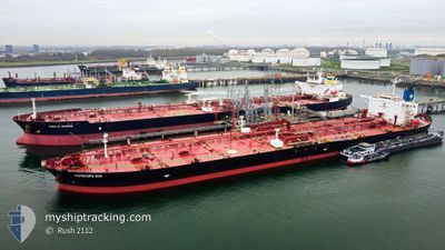
CAPRICORN SUN
Crude Oil Tanker
Current Trip
| Time Travelled | 2 days |
|---|---|
| Remaining Time | --- |
| Distance Travelled | 666.97 nm |
| Remaining Distance | --- |
| AVG Speed | 11.9 Noeuds |
| MAX Speed | 13.6 Noeuds |
| AVG Wind | 12.3 knots |
| MAX Wind | 19.8 knots |
| MIN Temp | 27.1°C / 80.78°F |
| MAX Temp | 33.1°C / 91.58°F |
| Tirant d eau | 11.2 m |
| Position reçue | 2 h, 31 m depuis |
Current Position
| Longitude | -94.45307° |
|---|---|
| Latitude | 29.23043° |
| Etat | At anchor |
| Vitesse | |
| Parcours | 95° |
| Zone | Gulf of Mexico |
| Station | T-AIS |
| Position reçue | 2 h, 31 m depuis |
Info
Information
The current position of CAPRICORN SUN is in Gulf of Mexico with coordinates 29.23043° / -94.45307° as reported on 2024-05-30 09:02 by AIS to our vessel tracker app. The vessel's current speed is 0 Noeuds
The vessel CAPRICORN SUN (IMO: 9333785, MMSI: 636016274) is a Crude Oil Tanker that was built in 2007 ( 17 Age ). It's sailing under the flag of [LR] Liberia.
In this page you can find informations about the vessels current position, last detected port calls, and current voyage information. If the vessels is not in coverage by AIS you will find the latest position.
The current position of CAPRICORN SUN is detected by our AIS receivers and we are not responsible for the reliability of the data. The last position was recorded while the vessel was in Coverage by the Ais receivers of our vessel tracking app.
The current draught of CAPRICORN SUN as reported by AIS is 11.2 meters
Weather
| Temperature | 27.3°C / 81.14°F |
|---|---|
| Wind Speed | 13 knots |
| Direction | 157° SSE |
| Pressure | 1014.9 hPa |
| Humidity | 80.5 % |
| Cloud Coverage | 13 % |
Featured Company
Last Port Calls
| Port | Arrival | Departure | Time In Port |
|---|---|---|---|
| 2024-05-23 18:22 | 2024-05-27 12:35 | 3 d | |
| 2024-05-14 18:52 | 2024-05-16 09:21 | 1 d | |
| 2024-05-10 09:28 | 2024-05-12 09:10 | 1 d | |
| 2024-05-06 03:58 | 2024-05-08 02:52 | 1 d | |
| 2024-04-16 23:23 | 2024-04-19 16:08 | 2 d |
Most Visited Ports (Last year)
| Port | Arrivals | |
|---|---|---|
| 5 | ||
| 3 | ||
| 3 | ||
| 3 | ||
| 2 | ||
| 2 |
Last Trips
| Origin | Departure | Destination | Arrival | Distance | |
|---|---|---|---|---|---|
| 2024-05-16 09:21 | 2024-05-23 18:22 | 822.79 nm | |||
| 2024-05-12 09:10 | 2024-05-14 18:52 | 222.24 nm | |||
| 2024-05-08 02:52 | 2024-05-10 09:28 | 133.51 nm | |||
| 2024-04-19 16:08 | 2024-05-06 03:58 | 1284.04 nm | |||
| 2024-02-29 15:22 | 2024-04-16 23:23 | 4137.18 nm |
Events
| Heure | Evenement | Détails | Position/ Destination | Info |
|---|---|---|---|---|
| 2024-05-30 09:05 | Etat Changé | Default At anchor |
29.23045 / -94.45310
MXCOA=>USHOU
|
Vitesse: Parcours: 95° |
| 2024-05-30 09:02 | Hors de la zone couverte |
29.23043 / -94.45307
Gulf of Mexico
|
Vitesse: Parcours: 27° |
|
| 2024-05-30 08:41 | Etat Changé | At anchor Default |
29.23042 / -94.45313
MXCOA=>USHOU
|
Vitesse: 0.1 kn Parcours: 103° |
| 2024-05-30 08:26 | Etat Changé | Default At anchor |
29.23037 / -94.45337
MXCOA=>USHOU
|
Vitesse: 0.1 kn Parcours: 98° |
| 2024-05-30 07:53 | Etat Changé | At anchor Default |
29.23027 / -94.45315
MXCOA=>USHOU
|
Vitesse: 0.1 kn Parcours: 101° |
| 2024-05-30 07:50 | Etat Changé | Default At anchor |
29.23038 / -94.45320
MXCOA=>USHOU
|
Vitesse: Parcours: 98° |
| 2024-05-30 07:08 | Etat Changé | At anchor Default |
29.22965 / -94.45305
MXCOA=>USHOU
|
Vitesse: 0.1 kn Parcours: 87° |
| 2024-05-30 07:02 | Etat Changé | Default At anchor |
29.22975 / -94.45302
MXCOA=>USHOU
|
Vitesse: 0.2 kn Parcours: 93° |
| 2024-05-30 06:42 | Changement d'ETA | 2024/05/30 01:00 2024/05/30 00:01 |
29.22953 / -94.45315
MXCOA=>USHOU
|
Vitesse: 0.2 kn Parcours: 69° |
| 2024-05-30 06:32 | Changement de zone | United States part of the Gulf of Mexico Mexican part of the Gulf of Mexico |
29.22938 / -94.45290
Gulf of Mexico
|
Vitesse: 0.1 kn Parcours: 233° |