
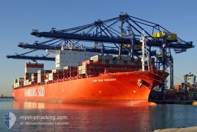
CAP SAN VINCENT
Cargo A
Current Trip
| Time Travelled | 22 days |
|---|---|
| Remaining Time | 1 day |
| Distance Travelled | 9295.11 nm |
| Remaining Distance | 514.26 nm |
| AVG Speed | 17.1 Noeuds |
| MAX Speed | 21 Noeuds |
| AVG Wind | 13.8 knots |
| MAX Wind | 36 knots |
| MIN Temp | 15.1°C / 59.18°F |
| MAX Temp | 30.3°C / 86.54°F |
| Tirant d eau | 14.7 m |
| Position reçue | 6 h, 36 m depuis |
Current Position
| Longitude | -12.80097° |
|---|---|
| Latitude | 28.65608° |
| Etat | Under way using engine |
| Vitesse | 16.9 Noeuds |
| Parcours | 40.9° |
| Zone | North Atlantic Ocean |
| Station | T-AIS |
| Position reçue | 6 h, 36 m depuis |
Info
Information
The current position of CAP SAN VINCENT is in North Atlantic Ocean with coordinates 28.65608° / -12.80097° as reported on 2024-06-15 04:12 by AIS to our vessel tracker app. The vessel's current speed is 16.9 Noeuds and is heading at the port of TANGER MED. The estimated time of arrival as calculated by MyShipTracking vessel tracking app is 2024-06-16 15:22 LT
The vessel CAP SAN VINCENT (IMO: 9717228, MMSI: 538008133) is a Cargo A It's sailing under the flag of [MH] Marshall Is.
In this page you can find informations about the vessels current position, last detected port calls, and current voyage information. If the vessels is not in coverage by AIS you will find the latest position.
The current position of CAP SAN VINCENT is detected by our AIS receivers and we are not responsible for the reliability of the data. The last position was recorded while the vessel was in Coverage by the Ais receivers of our vessel tracking app.
The current draught of CAP SAN VINCENT as reported by AIS is 14.7 meters
Weather
| Temperature | 19.9°C / 67.82°F |
|---|---|
| Wind Speed | 16 knots |
| Direction | 14° NNE |
| Pressure | 1018.9 hPa |
| Humidity | 78 % |
| Cloud Coverage | 94 % |
Featured Company
Last Port Calls
Most Visited Ports (Last year)
| Port | Arrivals | |
|---|---|---|
| 10 | ||
| 10 | ||
| 8 | ||
| 7 | ||
| 6 | ||
| 6 |
Last Trips
| Origin | Departure | Destination | Arrival | Distance | |
|---|---|---|---|---|---|
| 2024-05-20 20:54 | 2024-05-22 20:46 | 431.39 nm | |||
| 2024-05-17 10:32 | 2024-05-19 23:26 | 985.75 nm | |||
| 2024-05-12 00:43 | 2024-05-15 01:01 | 1006.70 nm | |||
| 2024-04-14 22:50 | 2024-05-08 22:13 | 9551.51 nm | |||
| 2024-03-19 17:58 | 2024-04-14 02:03 | 9906.67 nm |
Events
| Heure | Evenement | Détails | Position/ Destination | Info |
|---|---|---|---|---|
| 2024-06-15 04:18 | Etat Changé | Default Under way using engine |
28.67670 / -12.78062
TANGER MED 2
|
Vitesse: 16.9 kn Parcours: 40.9° |
| 2024-06-15 04:12 | Hors de la zone couverte |
28.65608 / -12.80097
North Atlantic Ocean
TANGER MED 2
|
Vitesse: 16.9 kn Parcours: 40.9° |
|
| 2024-06-15 04:09 | Etat Changé | Under way using engine Default |
28.64612 / -12.81080
TANGER MED 2
|
Vitesse: 17 kn Parcours: 41° |
| 2024-06-15 03:59 | Dans la zone couverte |
28.65002 / -12.80693
North Atlantic Ocean
TANGER MED 2
|
Vitesse: 16.9 kn Parcours: 41.2° |
|
| 2024-06-15 02:47 | Etat Changé | Default Under way using engine |
28.35617 / -13.09273
TANGER MED 2
|
Vitesse: 16.5 kn Parcours: 39.6° |
| 2024-06-15 02:40 | Etat Changé | Under way using engine Default |
28.33177 / -13.11586
TANGER MED 2
|
Vitesse: 16.5 kn Parcours: 40° |
| 2024-06-15 02:40 | Hors de la zone couverte |
28.33177 / -13.11586
North Atlantic Ocean
TANGER MED 2
|
Vitesse: 16.5 kn Parcours: 39.6° |
|
| 2024-06-15 02:39 | Etat Changé | Default Under way using engine |
28.32860 / -13.11883
TANGER MED 2
|
Vitesse: 16.4 kn Parcours: 40.3° |
| 2024-06-15 02:34 | Etat Changé | Under way using engine Default |
28.30920 / -13.13706
TANGER MED 2
|
Vitesse: 16.5 kn Parcours: 40° |
| 2024-06-15 02:11 | Etat Changé | Default Under way using engine |
28.22695 / -13.21447
TANGER MED 2
|
Vitesse: 16.6 kn Parcours: 40.4° |