
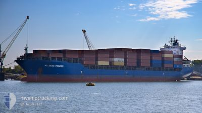
ALLSEAS PIONEER
General Cargo
Current Trip
| Time Travelled | 8 days |
|---|---|
| Remaining Time | --- |
| Distance Travelled | 2416.21 nm |
| Remaining Distance | --- |
| AVG Speed | 11.1 Noeuds |
| MAX Speed | 14.1 Noeuds |
| AVG Wind | 10.6 knots |
| MAX Wind | 33.4 knots |
| MIN Temp | 9.6°C / 49.28°F |
| MAX Temp | 18.6°C / 65.48°F |
| Tirant d eau | 11 m |
| Position reçue | Maintenant |
Current Position
| Longitude | -10.10273° |
|---|---|
| Latitude | 39.92584° |
| Etat | Under way using engine |
| Vitesse | 11.8 Noeuds |
| Parcours | 177.3° |
| Zone | North Atlantic Ocean |
| Station | T-AIS |
| Position reçue | Maintenant |
Info
Information
The current position of ALLSEAS PIONEER is in North Atlantic Ocean with coordinates 39.92584° / -10.10273° as reported on 2024-06-02 19:42 by AIS to our vessel tracker app. The vessel's current speed is 11.8 Noeuds and is heading at the port of EL DEKHEILA. The estimated time of arrival as calculated by MyShipTracking vessel tracking app is 2024-06-10 11:00 LT
The vessel ALLSEAS PIONEER (IMO: 9262558, MMSI: 636093075) is a General Cargo that was built in 2003 ( 21 Age ). It's sailing under the flag of [LR] Liberia.
In this page you can find informations about the vessels current position, last detected port calls, and current voyage information. If the vessels is not in coverage by AIS you will find the latest position.
The current position of ALLSEAS PIONEER is detected by our AIS receivers and we are not responsible for the reliability of the data. The last position was recorded while the vessel was in Coverage by the Ais receivers of our vessel tracking app.
The current draught of ALLSEAS PIONEER as reported by AIS is 11 meters
Weather
| Temperature | 18.6°C / 65.48°F |
|---|---|
| Wind Speed | 9 knots |
| Direction | 10° N |
| Pressure | 1014.6 hPa |
| Humidity | 77.7 % |
| Cloud Coverage | --- |
Featured Company
Last Port Calls
| Port | Arrival | Departure | Time In Port |
|---|---|---|---|
| 2024-05-23 15:26 | 2024-05-24 22:38 | 1 d | |
| 2024-05-20 04:25 | 2024-05-22 21:33 | 2 d | |
| 2024-04-29 15:02 | 2024-05-02 03:17 | 2 d | |
| 2024-04-25 06:14 | 2024-04-25 13:21 | 7 h | |
| 2024-04-24 17:00 | 2024-04-25 00:54 | 7 h | |
| 2024-04-21 03:55 | 2024-04-21 13:19 | 9 h | |
| 2024-04-17 15:27 | 2024-04-18 12:17 | 20 h | |
| 2024-04-15 03:46 | 2024-04-15 12:14 | 8 h | |
| 2024-04-04 21:48 | 2024-04-07 11:22 | 2 d |
Most Visited Ports (Last year)
| Port | Arrivals | |
|---|---|---|
| 7 | ||
| 4 | ||
| 3 | ||
| 2 | ||
| 2 | ||
| 2 |
Last Trips
| Origin | Departure | Destination | Arrival | Distance | |
|---|---|---|---|---|---|
| 2024-05-23 00:33 | 2024-05-23 18:26 | 51.56 nm | |||
| 2024-05-02 06:17 | 2024-05-20 07:25 | 5111.31 nm | |||
| 2024-04-25 16:21 | 2024-04-29 18:02 | 539.16 nm | |||
| 2024-04-25 03:54 | 2024-04-25 09:14 | 55.08 nm | |||
| 2024-04-18 15:17 | 2024-04-24 20:00 | 1514.29 nm | |||
| 2024-04-18 15:17 | 2024-04-21 05:55 | 626.92 nm | |||
| 2024-04-07 14:22 | 2024-04-17 18:27 | 2080.59 nm | |||
| 2024-04-07 14:22 | 2024-04-15 05:46 | 1360.02 nm | |||
| 2024-03-29 11:27 | 2024-04-05 00:48 | 1471.33 nm |
Events
| Heure | Evenement | Détails | Position/ Destination | Info |
|---|---|---|---|---|
| 2024-06-02 14:38 | Tirant d'eau modifié | 11 10.9 |
40.95722 / -10.10329
EGEDK
|
Vitesse: 12.3 kn Parcours: 181.8° |
| 2024-06-02 14:32 | Etat Changé | Under way using engine Default |
40.97903 / -10.10259
EGEDK
|
Vitesse: 12.3 kn Parcours: 181° |
| 2024-06-02 14:20 | Etat Changé | Default Under way using engine |
41.02002 / -10.10195
EGEDK
|
Vitesse: 12.3 kn Parcours: 178.4° |
| 2024-06-02 14:13 | Etat Changé | Under way using engine Default |
41.04244 / -10.10250
EGEDK
|
Vitesse: 12 kn Parcours: 178° |
| 2024-06-02 14:03 | Etat Changé | Default Under way using engine |
41.07834 / -10.10333
EGEDK
|
Vitesse: 12.1 kn Parcours: 179° |
| 2024-06-02 13:45 | Changement de zone | Portuguese part of the North Atlantic Ocean French part of the Celtic Sea |
41.13776 / -10.10568
North Atlantic Ocean
EGEDK
|
Vitesse: 12 kn Parcours: 177.6° |
| 2024-06-02 13:44 | Etat Changé | Under way using engine Default |
41.14162 / -10.10587
EGEDK
|
Vitesse: 12 kn Parcours: 177° |
| 2024-06-02 13:39 | Dans la zone couverte |
41.13776 / -10.10568
North Atlantic Ocean
EGEDK
|
Vitesse: 12 kn Parcours: 177.6° |
|
| 2024-05-31 21:54 | Etat Changé | Default Under way using engine |
48.29666 / -6.28333
EGEDK
|
Vitesse: 11.4 kn Parcours: 210.1° |
| 2024-05-31 21:50 | Hors de la zone couverte |
48.30741 / -6.27528
Celtic Sea
EGEDK
|
Vitesse: 11.4 kn Parcours: 210.1° |