
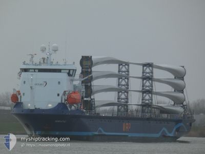
ADRIATIC
Cargo
Current Trip
| Time Travelled | 4 days |
|---|---|
| Remaining Time | --- |
| Distance Travelled | 1152.97 nm |
| Remaining Distance | --- |
| AVG Speed | 11.9 Noeuds |
| MAX Speed | 13.4 Noeuds |
| AVG Wind | 9.4 knots |
| MAX Wind | 21.1 knots |
| MIN Temp | 20.7°C / 69.26°F |
| MAX Temp | 30.8°C / 87.44°F |
| Tirant d eau | 4.4 m |
| Position reçue | 4 m depuis |
Current Position
| Longitude | 4.40245° |
|---|---|
| Latitude | 37.20357° |
| Etat | Under way using engine |
| Vitesse | 12.1 Noeuds |
| Parcours | 263.9° |
| Zone | Mediterranean Sea - Western Basin |
| Station | T-AIS |
| Position reçue | 4 m depuis |
Info
Information
The current position of ADRIATIC is in Mediterranean Sea - Western Basin with coordinates 37.20357° / 4.40245° as reported on 2024-06-13 23:36 by AIS to our vessel tracker app. The vessel's current speed is 12.1 Noeuds and is heading at the port of GLASGOW. The estimated time of arrival as calculated by MyShipTracking vessel tracking app is 2024-06-21 06:00 LT
The vessel ADRIATIC (IMO: 9944871, MMSI: 246269000) is a Cargo It's sailing under the flag of [NL] Netherlands.
In this page you can find informations about the vessels current position, last detected port calls, and current voyage information. If the vessels is not in coverage by AIS you will find the latest position.
The current position of ADRIATIC is detected by our AIS receivers and we are not responsible for the reliability of the data. The last position was recorded while the vessel was in Coverage by the Ais receivers of our vessel tracking app.
The current draught of ADRIATIC as reported by AIS is 4.4 meters
Weather
| Temperature | 21.2°C / 70.16°F |
|---|---|
| Wind Speed | 16 knots |
| Direction | 113° ESE |
| Pressure | 1019.7 hPa |
| Humidity | 83.4 % |
| Cloud Coverage | --- |
Featured Company
Last Port Calls
| Port | Arrival | Departure | Time In Port |
|---|---|---|---|
| 2024-06-07 16:05 | 2024-06-09 22:28 | 2 d | |
| 2024-06-04 11:08 | 2024-06-05 15:41 | 1 d | |
| 2024-05-23 02:14 | 2024-05-23 09:29 | 7 h | |
| 2024-05-21 15:48 | 2024-05-22 13:26 | 21 h | |
| 2024-05-16 05:17 | 2024-05-17 19:52 | 1 d | |
| 2024-05-03 14:00 | 2024-05-04 23:55 | 1 d | |
| 2024-04-30 14:59 | 2024-05-01 13:32 | 22 h | |
| 2024-04-18 05:35 | 2024-04-18 11:55 | 6 h | |
| 2024-04-16 16:03 | 2024-04-17 15:51 | 23 h | |
| 2024-04-11 04:05 | 2024-04-12 19:38 | 1 d |
Last Trips
| Origin | Departure | Destination | Arrival | Distance | |
|---|---|---|---|---|---|
| 2024-06-05 18:41 | 2024-06-07 19:05 | 588.12 nm | |||
| 2024-05-23 11:29 | 2024-06-04 14:08 | 3449.24 nm | |||
| 2024-05-22 14:26 | 2024-05-23 04:14 | 126.50 nm | |||
| 2024-05-17 20:52 | 2024-05-21 16:48 | 775.04 nm | |||
| 2024-05-05 02:55 | 2024-05-16 06:17 | 3043.57 nm | |||
| 2024-05-01 16:32 | 2024-05-03 17:00 | 597.62 nm | |||
| 2024-04-18 13:55 | 2024-04-30 17:59 | 3451.82 nm | |||
| 2024-04-17 16:51 | 2024-04-18 07:35 | 115.89 nm | |||
| 2024-04-12 20:38 | 2024-04-16 17:03 | 788.34 nm | |||
| 2024-03-31 01:32 | 2024-04-11 05:05 | 3036.41 nm |
Events
| Heure | Evenement | Détails | Position/ Destination | Info |
|---|---|---|---|---|
| 2024-06-13 23:32 | Changement de zone | Algerian part of the Mediterranean Sea - Western Basin Tunisian part of the Mediterranean Sea - Western Basin |
37.20538 / 4.42256
Mediterranean Sea - Western Basin
GLASGOW
|
Vitesse: 11.9 kn Parcours: 263.6° |
| 2024-06-13 23:29 | Etat Changé | Under way using engine Default |
37.20627 / 4.43224
GLASGOW
|
Vitesse: 11.8 kn Parcours: 263° |
| 2024-06-13 23:13 | Dans la zone couverte |
37.20538 / 4.42256
Mediterranean Sea - Western Basin
GLASGOW
|
Vitesse: 11.9 kn Parcours: 263.6° |
|
| 2024-06-12 20:22 | Etat Changé | Default Under way using engine |
37.54500 / 11.00167
GLASGOW
|
Vitesse: 11.2 kn Parcours: 286.5° |
| 2024-06-12 20:14 | Hors de la zone couverte |
37.53911 / 11.02728
Mediterranean Sea - Western Basin
GLASGOW
|
Vitesse: 11.2 kn Parcours: 286.5° |
|
| 2024-06-12 19:47 | Etat Changé | Under way using engine Default |
37.51441 / 11.13060
GLASGOW
|
Vitesse: 11.1 kn Parcours: 286° |
| 2024-06-12 19:18 | Etat Changé | Default Under way using engine |
37.48833 / 11.23667
GLASGOW
|
Vitesse: 11.5 kn Parcours: 286.8° |
| 2024-06-12 19:09 | Detecté en mer | Tunisian part of the Mediterranean Sea - Western Basin |
37.48075 / 11.27081
Mediterranean Sea - Western Basin
GLASGOW
|
Vitesse: 11.5 kn Parcours: 286.8° |
| 2024-06-12 19:09 | Etat Changé | Under way using engine Default |
37.48075 / 11.27081
GLASGOW
|
Vitesse: 11 kn Parcours: 287° |
| 2024-06-12 19:03 | Dans la zone couverte |
37.48075 / 11.27081
Mediterranean Sea - Western Basin
GLASGOW
|
Vitesse: 11.5 kn Parcours: 286.8° |