
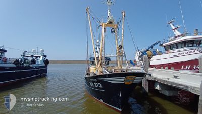
WR212 REIN WILLEM
Fishing
Current Trip
FISHING GROUND
| Time Travelled | 5 h, 29 mins |
|---|---|
| Remaining Time | --- |
| Distance Travelled | 9.98 nm |
| Remaining Distance | --- |
| AVG Speed | 3.4 Knots |
| MAX Speed | 4.9 Knots |
| AVG Wind | 10.6 knots |
| MAX Wind | 12.1 knots |
| MIN Temp | 13.2°C / 55.76°F |
| MAX Temp | 13.4°C / 56.12°F |
| Dybgang | 0 m |
| Position Modtaget | 1 m siden |
Current Position
| Longitude | 4.91730° |
|---|---|
| Latitude | 53.02956° |
| Status | Engaged in Fishing |
| Fart | 3.3 Knots |
| Kurs | 68° |
| Område | North Sea |
| Station | T-AIS |
| Position Modtaget | 1 m siden |
Info
Information
The current position of WR212 REIN WILLEM is in North Sea with coordinates 53.02956° / 4.91730° as reported on 2024-06-03 01:20 by AIS to our vessel tracker app. The vessel's current speed is 3.3 Knots
The vessel WR212 REIN WILLEM (IMO: 9853802, MMSI: 244170098) is a Fishing It's sailing under the flag of [NL] Netherlands.
In this page you can find informations about the vessels current position, last detected port calls, and current voyage information. If the vessels is not in coverage by AIS you will find the latest position.
The current position of WR212 REIN WILLEM is detected by our AIS receivers and we are not responsible for the reliability of the data. The last position was recorded while the vessel was in Coverage by the Ais receivers of our vessel tracking app.
Weather
| Temperature | 13.4°C / 56.12°F |
|---|---|
| Wind Speed | 11 knots |
| Direction | 323° NW |
| Pressure | 1021.4 hPa |
| Humidity | 70.4 % |
| Cloud Coverage | 100 % |
Featured Company
Last Port Calls
| Port | Arrival | Departure | Time In Port |
|---|---|---|---|
| 2024-05-31 01:59 | 2024-06-02 19:52 | 2 d | |
| 2024-05-29 11:32 | 2024-05-29 12:49 | 1 h | |
| 2024-05-24 05:30 | 2024-05-26 20:09 | 2 d | |
| 2024-05-20 08:10 | 2024-05-20 16:32 | 8 h | |
| 2024-05-17 16:25 | 2024-05-20 06:49 | 2 d | |
| 2024-05-16 03:57 | 2024-05-17 15:19 | 1 d | |
| 2024-05-13 06:02 | 2024-05-14 10:48 | 1 d | |
| 2024-05-10 05:02 | 2024-05-12 21:15 | 2 d | |
| 2024-05-03 05:59 | 2024-05-05 21:00 | 2 d | |
| 2024-04-26 06:00 | 2024-04-28 20:07 | 2 d |
Most Visited Ports (Last year)
| Port | Arrivals | |
|---|---|---|
| 34 | ||
| 24 | ||
| 5 | ||
| 3 | ||
| 1 | ||
| 1 |
Last Trips
| Origin | Departure | Destination | Arrival | Distance | |
|---|---|---|---|---|---|
| 2024-05-29 14:49 | 2024-05-31 03:59 | 145.20 nm | |||
| 2024-05-26 22:09 | 2024-05-29 13:32 | 221.23 nm | |||
| 2024-05-20 18:32 | 2024-05-24 07:30 | 280.18 nm | |||
| 2024-05-20 08:49 | 2024-05-20 10:10 | 10.49 nm | |||
| 2024-05-17 17:19 | 2024-05-17 18:25 | 9.83 nm | |||
| 2024-05-14 12:48 | 2024-05-16 05:57 | 152.12 nm | |||
| 2024-05-12 23:15 | 2024-05-13 08:02 | 6.58 nm | |||
| 2024-05-05 23:00 | 2024-05-10 07:02 | 292.28 nm | |||
| 2024-04-28 22:07 | 2024-05-03 07:59 | 329.65 nm | |||
| 2024-04-21 23:24 | 2024-04-26 08:00 | 339.03 nm |
Events
| Tid | Hændelsen | Detaljer | Position / Dest | Info |
|---|---|---|---|---|
| 2024-06-02 22:06 | Indenfor Dækning |
52.99303 / 4.85698
North Sea
|
Fart: 3 kn Kurs: 96.5° |
|
| 2024-06-02 19:52 | Afsejlet fra sidste havn |
|
52.99329 / 4.85548
FISHING GROUND
|
Fart: Kurs: 317° |
| 2024-06-02 10:15 | Udenfor Dækning |
52.93490 / 5.03599
North Sea
[NL] DEN OEVER
|
Fart: Kurs: 249.5° |
|
| 2024-05-31 02:00 | STOP Sejllads |
52.93501 / 5.03583
[NL] DEN OEVER
|
Fart: 0.3 kn Kurs: 128° |
|
| 2024-05-31 01:59 | Skibe i havn |
|
52.93502 / 5.03585
[NL] DEN OEVER
|
Fart: 0.7 kn Kurs: 134° |
| 2024-05-30 17:18 | START Sejllads | 2.91 nm, East of VLIELAND |
53.30736 / 5.16044
FISHING GROUND
|
Fart: 4.8 kn Kurs: 169° |
| 2024-05-30 17:13 | STOP Sejllads | 2.88 nm, East of VLIELAND |
53.30897 / 5.15878
FISHING GROUND
|
Fart: 0.1 kn Kurs: 127° |
| 2024-05-30 06:48 | START Sejllads | 4.05 nm, East of VLIELAND |
53.27666 / 5.19053
FISHING GROUND
|
Fart: 3.3 kn Kurs: 155° |
| 2024-05-30 06:22 | STOP Sejllads | 4 nm, East of VLIELAND |
53.27457 / 5.18804
FISHING GROUND
|
Fart: 0.2 kn Kurs: 176° |
| 2024-05-29 12:49 | Afsejlet fra sidste havn |
|
53.17670 / 5.39963
FISHING GROUND
|
Fart: 8.3 kn Kurs: 273° |