
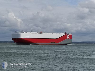
VICTORIA HIGHWAY
Cargo
Current Trip
| Time Travelled | 9 days |
|---|---|
| Remaining Time | 8 h, 0 mins |
| Distance Travelled | 3705.15 nm |
| Remaining Distance | 50.72 nm |
| AVG Speed | 16.5 Knots |
| MAX Speed | 22 Knots |
| AVG Wind | 9.1 knots |
| MAX Wind | 21.8 knots |
| MIN Temp | 12.4°C / 54.32°F |
| MAX Temp | 27.2°C / 80.96°F |
| Dybgang | 9.8 m |
| Position Modtaget | 1 m siden |
Current Position
| Longitude | -1.59545° |
|---|---|
| Latitude | 50.46448° |
| Status | Under way using engine |
| Fart | 0.9 Knots |
| Kurs | 81° |
| Område | English Channel |
| Station | T-AIS |
| Position Modtaget | 1 m siden |
Info
Information
The current position of VICTORIA HIGHWAY is in English Channel with coordinates 50.46448° / -1.59545° as reported on 2024-06-18 13:22 by AIS to our vessel tracker app. The vessel's current speed is 0.9 Knots and is heading at the port of SOUTHAMPTON. The estimated time of arrival as calculated by MyShipTracking vessel tracking app is 2024-06-18 22:23 LT
The vessel VICTORIA HIGHWAY (IMO: 9827255, MMSI: 374069000) is a Cargo It's sailing under the flag of [PA] Panama.
In this page you can find informations about the vessels current position, last detected port calls, and current voyage information. If the vessels is not in coverage by AIS you will find the latest position.
The current position of VICTORIA HIGHWAY is detected by our AIS receivers and we are not responsible for the reliability of the data. The last position was recorded while the vessel was in Coverage by the Ais receivers of our vessel tracking app.
The current draught of VICTORIA HIGHWAY as reported by AIS is 9.8 meters
Weather
| Temperature | 16.7°C / 62.06°F |
|---|---|
| Wind Speed | 3 knots |
| Direction | 141° SE |
| Pressure | 1013.8 hPa |
| Humidity | 82.5 % |
| Cloud Coverage | 100 % |
Featured Company
Last Port Calls
| Port | Arrival | Departure | Time In Port |
|---|---|---|---|
| 2024-06-08 04:45 | 2024-06-09 00:25 | 19 h | |
| 2024-06-05 20:26 | 2024-06-07 16:43 | 1 d | |
| 2024-06-02 19:45 | 2024-06-03 18:31 | 22 h | |
| 2024-06-01 22:10 | 2024-06-02 19:22 | 21 h | |
| 2024-06-01 10:07 | 2024-06-01 21:22 | 11 h | |
| 2024-05-19 21:32 | 2024-05-23 00:13 | 3 d | |
| 2024-05-17 04:04 | 2024-05-18 14:11 | 1 d | |
| 2024-05-15 19:11 | 2024-05-16 23:33 | 1 d | |
| 2024-05-13 19:51 | 2024-05-14 13:17 | 17 h | |
| 2024-04-29 10:20 | 2024-04-30 03:33 | 17 h |
Most Visited Ports (Last year)
| Port | Arrivals | |
|---|---|---|
| 4 | ||
| 4 | ||
| 4 | ||
| 4 | ||
| 3 | ||
| 3 |
Last Trips
| Origin | Departure | Destination | Arrival | Distance | |
|---|---|---|---|---|---|
| 2024-06-07 16:43 | 2024-06-08 04:45 | 167.75 nm | |||
| 2024-06-03 18:31 | 2024-06-05 20:26 | 700.61 nm | |||
| 2024-06-02 19:22 | 2024-06-02 19:45 | 1.11 nm | |||
| 2024-06-01 21:22 | 2024-06-01 22:10 | 4.50 nm | |||
| 2024-05-23 00:13 | 2024-06-01 10:07 | 3933.08 nm | |||
| 2024-05-18 14:11 | 2024-05-19 21:32 | 359.08 nm | |||
| 2024-05-16 23:33 | 2024-05-17 04:04 | 65.48 nm | |||
| 2024-05-14 13:17 | 2024-05-15 19:11 | 481.97 nm | |||
| 2024-04-30 03:33 | 2024-05-13 19:51 | 3840.61 nm | |||
| 2024-04-28 17:32 | 2024-04-29 10:20 | 168.44 nm |
Events
| Tid | Hændelsen | Detaljer | Position / Dest | Info |
|---|---|---|---|---|
| 2024-06-18 09:53 | START Sejllads |
50.31793 / -1.48103
US CHS > GBSOU
|
Fart: 3.1 kn Kurs: 31° |
|
| 2024-06-18 01:23 | STOP Sejllads | 17.79 nm, South East of SWANAGE |
50.37058 / -1.67177
US CHS > GBSOU
|
Fart: 0.3 kn Kurs: 242° |
| 2024-06-17 19:02 | Fundet i havområde | United Kingdom part of the English Channel |
50.13882 / -1.14721
English Channel
US CHS > GBSOU
|
Fart: 12.3 kn Kurs: 73.6° |
| 2024-06-17 16:31 | Ændre havområde | French part of the English Channel Guernsey part of the English Channel |
49.97705 / -2.01896
English Channel
US CHS > GBSOU
|
Fart: 14.5 kn Kurs: 73.5° |
| 2024-06-17 13:24 | Status er ændret | Under way using engine Default |
49.78458 / -3.05337
US CHS > GBSOU
|
Fart: 12.6 kn Kurs: 66° |
| 2024-06-17 13:23 | Status er ændret | Default Under way using engine |
49.78318 / -3.05831
US CHS > GBSOU
|
Fart: 12.6 kn Kurs: 66.4° |
| 2024-06-17 13:23 | Status er ændret | Under way using engine Default |
49.78220 / -3.06179
US CHS > GBSOU
|
Fart: 12.5 kn Kurs: 66° |
| 2024-06-17 13:15 | Status er ændret | Default Under way using engine |
49.77250 / -3.09723
US CHS > GBSOU
|
Fart: 12.5 kn Kurs: 79.7° |
| 2024-06-17 13:08 | Status er ændret | Under way using engine Default |
49.76574 / -3.13519
US CHS > GBSOU
|
Fart: 12.5 kn Kurs: 82° |
| 2024-06-17 13:07 | Status er ændret | Default Under way using engine |
49.76536 / -3.13866
US CHS > GBSOU
|
Fart: 12.6 kn Kurs: 85.6° |