
ULTRA ESTERHAZY
Cargo
Current Trip
| Time Travelled | 3 days |
|---|---|
| Remaining Time | 17 h, 7 mins |
| Distance Travelled | 977.28 nm |
| Remaining Distance | 217.67 nm |
| AVG Speed | 13 Knots |
| MAX Speed | 14.8 Knots |
| AVG Wind | 10.6 knots |
| MAX Wind | 21.9 knots |
| MIN Temp | 13.3°C / 55.94°F |
| MAX Temp | 23.4°C / 74.12°F |
| Dybgang | 6.8 m |
| Position Modtaget | 1 m siden |
Current Position
| Longitude | -55.16184° |
|---|---|
| Latitude | -35.05005° |
| Status | Under way using engine |
| Fart | 13.1 Knots |
| Kurs | 272° |
| Område | Rio de La Plata |
| Station | T-AIS |
| Position Modtaget | 1 m siden |
Info
Information
The current position of ULTRA ESTERHAZY is in Rio de La Plata with coordinates -35.05005° / -55.16184° as reported on 2024-06-10 21:41 by AIS to our vessel tracker app. The vessel's current speed is 13.1 Knots and is heading at the port of CAMPANA. The estimated time of arrival as calculated by MyShipTracking vessel tracking app is 2024-06-11 11:49 LT
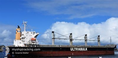
The vessel ULTRA ESTERHAZY (IMO: 9643946, MMSI: 373821000) is a Cargo It's sailing under the flag of [PA] Panama.
In this page you can find informations about the vessels current position, last detected port calls, and current voyage information. If the vessels is not in coverage by AIS you will find the latest position.
The current position of ULTRA ESTERHAZY is detected by our AIS receivers and we are not responsible for the reliability of the data. The last position was recorded while the vessel was in Coverage by the Ais receivers of our vessel tracking app.
The current draught of ULTRA ESTERHAZY as reported by AIS is 6.8 meters
Weather
| Temperature | 13.1°C / 55.58°F |
|---|---|
| Wind Speed | 7 knots |
| Direction | 169° S |
| Pressure | 1017.4 hPa |
| Humidity | 82.5 % |
| Cloud Coverage | 55 % |
Featured Company
Last Port Calls
| Port | Arrival | Departure | Time In Port |
|---|---|---|---|
| 2024-05-24 11:06 | 2024-06-07 16:20 | 14 d | |
| 2024-05-09 03:51 | 2024-05-19 04:53 | 10 d | |
| 2024-05-06 23:36 | 2024-05-08 20:36 | 1 d | |
| 2024-05-04 14:57 | 2024-05-06 10:56 | 1 d | |
| 2024-05-02 12:46 | 2024-05-03 21:01 | 1 d | |
| 2024-04-06 07:14 | 2024-04-10 00:23 | 3 d |
Most Visited Ports (Last year)
| Port | Arrivals | |
|---|---|---|
| 2 | ||
| 1 | ||
| 1 | ||
| 1 | ||
| 1 | ||
| 1 |
Last Trips
| Origin | Departure | Destination | Arrival | Distance | |
|---|---|---|---|---|---|
| 2024-05-19 04:53 | 2024-05-24 11:06 | 1344.44 nm | |||
| 2024-05-08 20:36 | 2024-05-09 03:51 | 57.66 nm | |||
| 2024-05-06 10:56 | 2024-05-06 23:36 | 116.06 nm | |||
| 2024-05-03 21:01 | 2024-05-04 14:57 | 177.76 nm | |||
| 2024-04-10 00:23 | 2024-05-02 12:46 | 6566.38 nm | |||
| 2024-03-28 23:48 | 2024-04-06 07:14 | 1428.38 nm |
Events
| Tid | Hændelsen | Detaljer | Position / Dest | Info |
|---|---|---|---|---|
| 2024-06-10 21:23 | Ændre havområde | Uruguayan part of the Rio de La Plata Uruguayan part of the South Atlantic Ocean |
-35.05167 / -55.08443
Rio de La Plata
AR CMP
|
Fart: 12.7 kn Kurs: 271° |
| 2024-06-10 20:08 | ETA er ændret | 2024/06/11 01:30 2024/06/11 04:00 |
-35.05325 / -54.76295
AR CMP
|
Fart: 12.3 kn Kurs: 270.5° |
| 2024-06-10 19:55 | Status er ændret | Under way using engine Default |
-35.04507 / -54.71400
AR CMP
|
Fart: 12.5 kn Kurs: 256° |
| 2024-06-10 19:49 | Status er ændret | Default Under way using engine |
-35.03984 / -54.68997
AR CMP
|
Fart: 12.5 kn Kurs: 255° |
| 2024-06-10 19:42 | Fundet i havområde | Uruguayan part of the South Atlantic Ocean |
-35.03301 / -54.65846
South Atlantic Ocean
AR CMP
|
Fart: 12.5 kn Kurs: 255° |
| 2024-06-10 19:41 | Status er ændret | Under way using engine Default |
-35.03272 / -54.65717
AR CMP
|
Fart: 12.7 kn Kurs: 256° |
| 2024-06-10 19:37 | Indenfor Dækning |
-35.03301 / -54.65846
South Atlantic Ocean
AR CMP
|
Fart: 12.5 kn Kurs: 255° |
|
| 2024-06-07 22:33 | Status er ændret | Default Under way using engine |
-23.40876 / -43.51328
AR CMP
|
Fart: 12.8 kn Kurs: 218.1° |
| 2024-06-07 22:23 | Udenfor Dækning |
-23.38134 / -43.49050
South Atlantic Ocean
AR CMP
|
Fart: 12.8 kn Kurs: 218.1° |
|
| 2024-06-07 21:37 | Status er ændret | Under way using engine Default |
-23.24876 / -43.37975
AR CMP
|
Fart: 13.2 kn Kurs: 218° |