
RECOVERY
Tug
Current Trip
Current Position
| Longitude | 0.15611° |
|---|---|
| Latitude | 51.50705° |
| Status | Under way using engine |
| Fart | |
| Kurs | --- |
| Område | North Sea |
| Station | T-AIS |
| Position Modtaget | Nu |
Info
Information
The current position of RECOVERY is in North Sea with coordinates 51.50705° / 0.15611° as reported on 2024-05-25 09:13 by AIS to our vessel tracker app. The vessel's current speed is 0 Knots and is currently inside the port of ERITH.
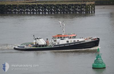
The vessel RECOVERY (MMSI: 235078634) is a Tug It's sailing under the flag of [GB] United Kingdom.
In this page you can find informations about the vessels current position, last detected port calls, and current voyage information. If the vessels is not in coverage by AIS you will find the latest position.
The current position of RECOVERY is detected by our AIS receivers and we are not responsible for the reliability of the data. The last position was recorded while the vessel was in Coverage by the Ais receivers of our vessel tracking app.
The current draught of RECOVERY as reported by AIS is 2.2 meters
Weather
| Temperature | 16.4°C / 61.52°F |
|---|---|
| Wind Speed | 3 knots |
| Direction | 128° SE |
| Pressure | 1017.9 hPa |
| Humidity | 63.2 % |
| Cloud Coverage | 5 % |
Featured Company
Last Port Calls
| Port | Arrival | Departure | Time In Port |
|---|---|---|---|
| 2024-05-25 09:26 | |||
| 2024-05-24 09:55 | 2024-05-24 16:56 | 7 h | |
| 2024-05-23 13:41 | 2024-05-23 13:45 | 4 m | |
| 2024-05-23 12:34 | 2024-05-23 12:54 | 20 m | |
| 2024-05-23 10:35 | 2024-05-23 11:39 | 1 h | |
| 2024-05-23 07:24 | 2024-05-23 09:20 | 1 h | |
| 2024-05-22 19:08 | 2024-05-22 19:14 | 5 m | |
| 2024-05-22 16:10 | 2024-05-22 18:02 | 1 h | |
| 2024-05-22 09:52 | 2024-05-22 15:24 | 5 h | |
| 2024-05-21 10:18 | 2024-05-21 14:40 | 4 h |
Most Visited Ports (Last year)
| Port | Arrivals | |
|---|---|---|
| 395 | ||
| 343 | ||
| 53 | ||
| 16 | ||
| 1 |
Last Trips
| Origin | Departure | Destination | Arrival | Distance | |
|---|---|---|---|---|---|
| 2024-05-24 16:56 | 2024-05-25 09:26 | 5.79 nm | |||
| 2024-05-23 13:45 | 2024-05-24 09:55 | 0.66 nm | |||
| 2024-05-23 12:54 | 2024-05-23 13:41 | 5.50 nm | |||
| 2024-05-23 11:39 | 2024-05-23 12:34 | 7.85 nm | |||
| 2024-05-23 09:20 | 2024-05-23 10:35 | 7.50 nm | |||
| 2024-05-22 19:14 | 2024-05-23 07:24 | 5.69 nm | |||
| 2024-05-22 18:02 | 2024-05-22 19:08 | 5.48 nm | |||
| 2024-05-22 15:24 | 2024-05-22 16:10 | 5.71 nm | |||
| 2024-05-21 14:40 | 2024-05-22 09:52 | 0.82 nm | |||
| 2024-05-21 09:31 | 2024-05-21 10:18 | 6.56 nm |
Events
| Tid | Hændelsen | Detaljer | Position / Dest | Info |
|---|---|---|---|---|
| 2024-05-25 08:48 | STOP Sejllads |
51.50881 / .15074
[GB] ERITH
|
Fart: Kurs: 511° |
|
| 2024-05-25 08:30 | START Sejllads |
51.50732 / .15425
[GB] ERITH
|
Fart: 4.1 kn Kurs: 109.6° |
|
| 2024-05-25 08:27 | STOP Sejllads |
51.50866 / .15200
[GB] ERITH
|
Fart: Kurs: 511° |
|
| 2024-05-25 08:26 | Skibe i havn |
|
51.50866 / .15200
[GB] ERITH
|
Fart: 0.8 kn Kurs: 511° |
| 2024-05-25 08:03 | START Sejllads | 0.74 nm, East of GALLIONS POINT |
51.50943 / .08796
THAMES/OPPS
|
Fart: 5.6 kn Kurs: 57.3° |
| 2024-05-25 07:58 | STOP Sejllads | 0.74 nm, East of GALLIONS POINT |
51.50767 / .08855
THAMES/OPPS
|
Fart: Kurs: 511° |
| 2024-05-25 07:39 | START Sejllads | 0.65 nm, West of SILVERTOWN |
51.49559 / .02866
THAMES/OPPS
|
Fart: 8.6 kn Kurs: 91.3° |
| 2024-05-25 07:36 | Status er ændret | Under way using engine Moored |
51.49453 / .02617
THAMES/OPPS
|
Fart: Kurs: 511° |
| 2024-05-24 15:58 | STOP Sejllads | 0.76 nm, West of SILVERTOWN |
51.49459 / .02618
THAMES/OPPS
|
Fart: Kurs: 511° |
| 2024-05-24 15:56 | START Sejllads | 0.86 nm, West of SILVERTOWN |
51.49613 / .02267
THAMES/OPPS
|
Fart: 11.6 kn Kurs: 99.8° |