
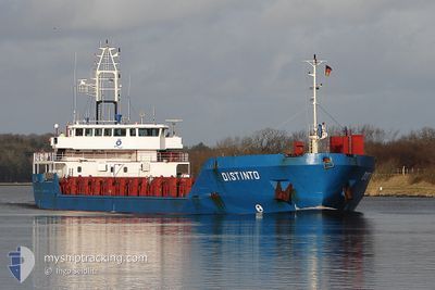
OZKAN-2
General Cargo
Current Trip
| Time Travelled | 5 days |
|---|---|
| Remaining Time | --- |
| Distance Travelled | 326.88 nm |
| Remaining Distance | --- |
| AVG Speed | 7.9 Knots |
| MAX Speed | 7.9 Knots |
| AVG Wind | 10.1 knots |
| MAX Wind | 14 knots |
| MIN Temp | 20.7°C / 69.26°F |
| MAX Temp | 29.1°C / 84.38°F |
| Dybgang | 3 m |
| Position Modtaget | 3 d siden |
Current Position
| Longitude | 29.78176° |
|---|---|
| Latitude | 41.47727° |
| Status | Under way using engine |
| Fart | 6.6 Knots |
| Kurs | 66° |
| Område | Black Sea |
| Station | T-AIS |
| Position Modtaget | 3 d siden |
Info
Information
The current position of OZKAN-2 is in Black Sea with coordinates 41.47727° / 29.78176° as reported on 2024-06-07 19:02 by AIS to our vessel tracker app. The vessel's current speed is 6.6 Knots
The vessel OZKAN-2 (IMO: 9199414, MMSI: 314752000) is a General Cargo that was built in 2000 ( 24 år gamle ). It's sailing under the flag of [BB] Barbados.
In this page you can find informations about the vessels current position, last detected port calls, and current voyage information. If the vessels is not in coverage by AIS you will find the latest position.
The current position of OZKAN-2 is detected by our AIS receivers and we are not responsible for the reliability of the data. The last position was recorded while the vessel was in Coverage by the Ais receivers of our vessel tracking app.
The current draught of OZKAN-2 as reported by AIS is 3 meters
Weather
| Temperature | 22.1°C / 71.78°F |
|---|---|
| Wind Speed | 8 knots |
| Direction | 73° ENE |
| Pressure | 1012.1 hPa |
| Humidity | 74.9 % |
| Cloud Coverage | --- |
Featured Company
Last Port Calls
| Port | Arrival | Departure | Time In Port |
|---|---|---|---|
| 2024-06-04 13:31 | 2024-06-05 23:08 | 1 d | |
| 2024-05-14 14:36 | 2024-05-16 09:57 | 1 d | |
| 2024-04-17 16:15 | 2024-04-19 20:29 | 2 d | |
| 2024-04-16 15:07 | 2024-04-17 16:07 | 1 d | |
| 2024-04-16 10:25 | 2024-04-16 14:29 | 4 h | |
| 2024-04-15 15:22 | 2024-04-16 10:11 | 18 h | |
| 2024-04-10 13:06 | 2024-04-11 14:29 | 1 d |
Last Trips
| Origin | Departure | Destination | Arrival | Distance | |
|---|---|---|---|---|---|
| 2024-05-16 09:57 | 2024-06-04 13:31 | 1566.09 nm | |||
| 2024-04-19 20:29 | 2024-05-14 14:36 | 1574.36 nm | |||
| 2024-04-17 16:07 | 2024-04-17 16:15 | 1.18 nm | |||
| 2024-04-16 14:29 | 2024-04-16 15:07 | 2.06 nm | |||
| 2024-04-16 10:11 | 2024-04-16 10:25 | 0.59 nm | |||
| 2024-04-11 14:29 | 2024-04-15 15:22 | 383.34 nm | |||
| 2024-03-28 13:46 | 2024-04-10 13:06 | 984.26 nm |
Events
| Tid | Hændelsen | Detaljer | Position / Dest | Info |
|---|---|---|---|---|
| 2024-06-08 18:29 | STOP Sejllads |
42.67191 / 32.78384
RU YEY
|
Fart: Kurs: 59° |
|
| 2024-06-08 04:37 | STOP Sejllads |
41.96473 / 30.99930
RU YEY
|
Fart: Kurs: 66° |
|
| 2024-06-07 19:09 | Status er ændret | Default Under way using engine |
41.48291 / 29.79818
RU YEY
|
Fart: 6.6 kn Kurs: 66° |
| 2024-06-07 19:02 | Udenfor Dækning |
41.47727 / 29.78176
Black Sea
RU YEY
|
Fart: 6.6 kn Kurs: 66° |
|
| 2024-06-07 18:22 | Status er ændret | Under way using engine Default |
41.44859 / 29.69327
RU YEY
|
Fart: 6.5 kn Kurs: 66° |
| 2024-06-07 18:17 | Status er ændret | Default Under way using engine |
41.44510 / 29.68312
RU YEY
|
Fart: 6.4 kn Kurs: 64.6° |
| 2024-06-07 18:11 | Status er ændret | Under way using engine Default |
41.44034 / 29.66917
RU YEY
|
Fart: 6.4 kn Kurs: 65° |
| 2024-06-07 18:05 | Status er ændret | Default Under way using engine |
41.43572 / 29.65613
RU YEY
|
Fart: 6.3 kn Kurs: 64.2° |
| 2024-06-07 17:57 | Status er ændret | Under way using engine Default |
41.42982 / 29.63968
RU YEY
|
Fart: 6.3 kn Kurs: 63° |
| 2024-06-07 17:57 | Indenfor Dækning |
41.42982 / 29.63968
Black Sea
RU YEY
|
Fart: 6.3 kn Kurs: 64.2° |