
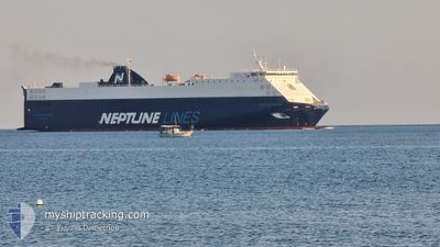
NEPTUNE OKEANIS
Vehicles Carrier
Current Trip
| Time Travelled | 17 h, 28 mins |
|---|---|
| Remaining Time | 2 h, 17 mins |
| Distance Travelled | 183.15 nm |
| Remaining Distance | 74.83 nm |
| AVG Speed | 13.2 Knots |
| MAX Speed | 14.3 Knots |
| AVG Wind | 16.1 knots |
| MAX Wind | 30.7 knots |
| MIN Temp | 19.7°C / 67.46°F |
| MAX Temp | 21.1°C / 69.98°F |
| Dybgang | 5.4 m |
| Position Modtaget | 6 h, 6 m siden |
Current Position
| Longitude | 7.13565° |
|---|---|
| Latitude | 42.98667° |
| Status | Under way using engine |
| Fart | 12.5 Knots |
| Kurs | 260° |
| Område | Mediterranean Sea - Western Basin |
| Station | T-AIS |
| Position Modtaget | 6 h, 6 m siden |
Info
Information
The current position of NEPTUNE OKEANIS is in Mediterranean Sea - Western Basin with coordinates 42.98667° / 7.13565° as reported on 2024-06-11 17:47 by AIS to our vessel tracker app. The vessel's current speed is 12.5 Knots and is heading at the port of FOS. The estimated time of arrival as calculated by MyShipTracking vessel tracking app is 2024-06-12 02:11 LT
The vessel NEPTUNE OKEANIS (IMO: 9306706, MMSI: 215912000) is a Vehicles Carrier that was built in 2005 ( 19 år gamle ). It's sailing under the flag of [MT] Malta.
In this page you can find informations about the vessels current position, last detected port calls, and current voyage information. If the vessels is not in coverage by AIS you will find the latest position.
The current position of NEPTUNE OKEANIS is detected by our AIS receivers and we are not responsible for the reliability of the data. The last position was recorded while the vessel was in Coverage by the Ais receivers of our vessel tracking app.
The current draught of NEPTUNE OKEANIS as reported by AIS is 5.4 meters
Weather
| Temperature | 18.4°C / 65.12°F |
|---|---|
| Wind Speed | 24 knots |
| Direction | 313° NW |
| Pressure | 1012.2 hPa |
| Humidity | 65.9 % |
| Cloud Coverage | 100 % |
Featured Company
Last Port Calls
| Port | Arrival | Departure | Time In Port |
|---|---|---|---|
| 2024-06-10 08:50 | 2024-06-11 06:26 | 21 h | |
| 2024-06-06 14:42 | 2024-06-07 20:22 | 1 d | |
| 2024-06-03 08:36 | 2024-06-03 22:51 | 14 h | |
| 2024-06-01 01:02 | 2024-06-01 13:42 | 12 h | |
| 2024-05-31 03:19 | 2024-05-31 19:30 | 16 h | |
| 2024-05-29 10:30 | 2024-05-29 14:53 | 4 h | |
| 2024-05-25 17:24 | 2024-05-26 09:53 | 16 h | |
| 2024-05-24 03:11 | 2024-05-24 14:08 | 10 h | |
| 2024-05-22 19:58 | 2024-05-23 12:46 | 16 h | |
| 2024-05-18 01:22 | 2024-05-18 19:57 | 18 h |
Last Trips
| Origin | Departure | Destination | Arrival | Distance | |
|---|---|---|---|---|---|
| 2024-06-07 21:22 | 2024-06-10 10:50 | 886.56 nm | |||
| 2024-06-04 00:51 | 2024-06-06 15:42 | 918.04 nm | |||
| 2024-06-01 15:42 | 2024-06-03 10:36 | 393.96 nm | |||
| 2024-05-31 21:30 | 2024-06-01 03:02 | 54.89 nm | |||
| 2024-05-29 16:53 | 2024-05-31 05:19 | 489.41 nm | |||
| 2024-05-26 12:53 | 2024-05-29 12:30 | 1119.68 nm | |||
| 2024-05-24 17:08 | 2024-05-25 20:24 | 78.13 nm | |||
| 2024-05-23 15:46 | 2024-05-24 06:11 | 19.45 nm | |||
| 2024-05-18 21:57 | 2024-05-22 22:58 | 1498.80 nm | |||
| 2024-05-17 12:32 | 2024-05-18 03:22 | 184.60 nm |
Events
| Tid | Hændelsen | Detaljer | Position / Dest | Info |
|---|---|---|---|---|
| 2024-06-11 18:34 | Status er ændret | Default Under way using engine |
42.96084 / 6.91257
FRFOS
|
Fart: 12.5 kn Kurs: 260° |
| 2024-06-11 17:47 | Udenfor Dækning |
42.98667 / 7.13565
Mediterranean Sea - Western Basin
FRFOS
|
Fart: 12.5 kn Kurs: 260° |
|
| 2024-06-11 15:53 | Ændre havområde | French part of the Mediterranean Sea - Western Basin Mon�gasque part of the Mediterranean Sea - Western Basin |
43.05250 / 7.67587
Mediterranean Sea - Western Basin
FRFOS
|
Fart: 13 kn Kurs: 261° |
| 2024-06-11 15:45 | Ændre havområde | Mon�gasque part of the Mediterranean Sea - Western Basin French part of the Mediterranean Sea - Western Basin |
43.05673 / 7.71495
Mediterranean Sea - Western Basin
FRFOS
|
Fart: 13 kn Kurs: 261° |
| 2024-06-11 15:11 | Ændre havområde | French part of the Mediterranean Sea - Western Basin Italian part of the Mediterranean Sea - Western Basin |
43.07528 / 7.88232
Mediterranean Sea - Western Basin
FRFOS
|
Fart: 13 kn Kurs: 262° |
| 2024-06-11 14:47 | Fundet i havområde | Italian part of the Mediterranean Sea - Western Basin |
43.08872 / 7.99932
Mediterranean Sea - Western Basin
FRFOS
|
Fart: 13 kn Kurs: 261° |
| 2024-06-11 13:56 | ETA er ændret | 2024/06/14 02:00 2024/06/12 03:00 |
43.11680 / 8.24707
FRFOS
|
Fart: 12.9 kn Kurs: 261° |
| 2024-06-11 13:26 | Status er ændret | Under way using engine Default |
43.13313 / 8.39152
FRFOS
|
Fart: 12.7 kn Kurs: 262° |
| 2024-06-11 13:01 | Status er ændret | Default Under way using engine |
43.14452 / 8.51030
FRFOS
|
Fart: 12.5 kn Kurs: 261° |
| 2024-06-11 12:10 | Fundet i havområde | French part of the Mediterranean Sea - Western Basin |
43.17073 / 8.75298
Mediterranean Sea - Western Basin
FRFOS
|
Fart: 12.2 kn Kurs: 261° |