
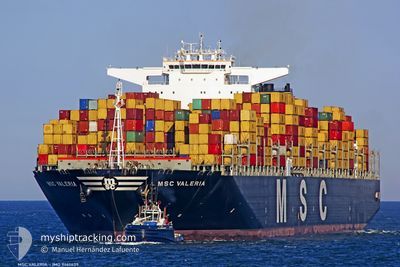
MSC VALERIA
Container Ship
Current Trip
| Time Travelled | 20 days |
|---|---|
| Remaining Time | --- |
| Distance Travelled | 8030.82 nm |
| Remaining Distance | --- |
| AVG Speed | 17.1 Knots |
| MAX Speed | 21.2 Knots |
| AVG Wind | 12.1 knots |
| MAX Wind | 27.7 knots |
| MIN Temp | 15.3°C / 59.54°F |
| MAX Temp | 30.6°C / 87.08°F |
| Dybgang | 14.7 m |
| Position Modtaget | 1 d siden |
Current Position
| Longitude | 76.48210° |
|---|---|
| Latitude | 8.18641° |
| Status | Under way using engine |
| Fart | 19 Knots |
| Kurs | 319.7° |
| Område | Laccadive Sea |
| Station | T-AIS |
| Position Modtaget | 1 d siden |
Info
Information
The current position of MSC VALERIA is in Laccadive Sea with coordinates 8.18641° / 76.48210° as reported on 2024-06-01 06:21 by AIS to our vessel tracker app. The vessel's current speed is 19 Knots
The vessel MSC VALERIA (IMO: 9461439, MMSI: 370341000) is a Container Ship that was built in 2012 ( 12 år gamle ). It's sailing under the flag of [PA] Panama.
In this page you can find informations about the vessels current position, last detected port calls, and current voyage information. If the vessels is not in coverage by AIS you will find the latest position.
The current position of MSC VALERIA is detected by our AIS receivers and we are not responsible for the reliability of the data. The last position was recorded while the vessel was in Coverage by the Ais receivers of our vessel tracking app.
The current draught of MSC VALERIA as reported by AIS is 14.7 meters
Weather
| Temperature | 30.3°C / 86.54°F |
|---|---|
| Wind Speed | 3 knots |
| Direction | 241° WSW |
| Pressure | 1008.6 hPa |
| Humidity | 71.7 % |
| Cloud Coverage | 98 % |
Featured Company
Events
| Tid | Hændelsen | Detaljer | Position / Dest | Info |
|---|---|---|---|---|
| 2024-06-02 23:54 | STOP Sejllads | 18.95 nm, South West of MUMBAI |
18.79134 / 72.60790
INNSA
|
Fart: 0.1 kn Kurs: 259° |
| 2024-06-01 06:23 | Status er ændret | Default Under way using engine |
8.19167 / 76.47667
INNSA
|
Fart: 19 kn Kurs: 319.7° |
| 2024-06-01 06:21 | Udenfor Dækning |
8.18641 / 76.48210
Laccadive Sea
INNSA
|
Fart: 19 kn Kurs: 319.7° |
|
| 2024-06-01 06:12 | Status er ændret | Under way using engine Default |
8.14703 / 76.51527
INNSA
|
Fart: 19 kn Kurs: 320° |
| 2024-06-01 06:05 | Status er ændret | Default Under way using engine |
8.11833 / 76.53833
INNSA
|
Fart: 19.6 kn Kurs: 319° |
| 2024-06-01 03:20 | Status er ændret | Under way using engine Default |
7.47211 / 77.14073
INNSA
|
Fart: 19 kn Kurs: 287° |
| 2024-06-01 03:15 | Dybgangen er ændret | 14.7 15 |
7.44333 / 77.21667
INNSA
|
Fart: 19 kn Kurs: 287° |
| 2024-06-01 03:15 | Destination er ændret | INNSA INMUN |
7.44333 / 77.21667
INNSA
|
Fart: 19 kn Kurs: 287° |
| 2024-06-01 03:15 | ETA er ændret | 2024/06/02 20:30 2024/05/31 00:30 |
7.44333 / 77.21667
INNSA
|
Fart: 19 kn Kurs: 287° |
| 2024-06-01 02:59 | Status er ændret | Default Under way using engine |
7.43333 / 77.24667
INMUN
|
Fart: 19.5 kn Kurs: 287.4° |