
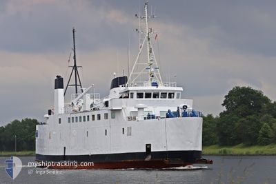
MEDMAR GIORGIA
Ro-Ro/Passenger Ship
Current Trip
ITALY-NAPLES
| Time Travelled | 2 days |
|---|---|
| Remaining Time | --- |
| Distance Travelled | 704.08 nm |
| Remaining Distance | --- |
| AVG Speed | 10.3 Knots |
| MAX Speed | 14.1 Knots |
| AVG Wind | 16.6 knots |
| MAX Wind | 30 knots |
| MIN Temp | 15.6°C / 60.08°F |
| MAX Temp | 20.6°C / 69.08°F |
| Dybgang | 3.1 m |
| Position Modtaget | 3 m siden |
Current Position
| Longitude | -4.12267° |
|---|---|
| Latitude | 36.24808° |
| Status | Under way using engine |
| Fart | 10.9 Knots |
| Kurs | 80.9° |
| Område | Alboran Sea |
| Station | T-AIS |
| Position Modtaget | 3 m siden |
Info
Information
The current position of MEDMAR GIORGIA is in Alboran Sea with coordinates 36.24808° / -4.12267° as reported on 2024-06-10 08:41 by AIS to our vessel tracker app. The vessel's current speed is 10.9 Knots
The vessel MEDMAR GIORGIA (IMO: 8027896, MMSI: 247445900) is a Ro-Ro/Passenger Ship that was built in 1982 ( 42 år gamle ). It's sailing under the flag of [IT] Italy.
In this page you can find informations about the vessels current position, last detected port calls, and current voyage information. If the vessels is not in coverage by AIS you will find the latest position.
The current position of MEDMAR GIORGIA is detected by our AIS receivers and we are not responsible for the reliability of the data. The last position was recorded while the vessel was in Coverage by the Ais receivers of our vessel tracking app.
The current draught of MEDMAR GIORGIA as reported by AIS is 3.1 meters
Weather
| Temperature | 19.4°C / 66.92°F |
|---|---|
| Wind Speed | 21 knots |
| Direction | 272° W |
| Pressure | 1011.9 hPa |
| Humidity | 86.3 % |
| Cloud Coverage | 3 % |
Featured Company
Events
| Tid | Hændelsen | Detaljer | Position / Dest | Info |
|---|---|---|---|---|
| 2024-06-10 05:02 | Ændre havområde | Spanish part of the Alboran Sea Gibraltarian part of the Alboran Sea |
36.08898 / -4.89238
Alboran Sea
ITALY-NAPLES
|
Fart: 11.3 kn Kurs: 66.1° |
| 2024-06-10 04:56 | Ændre havområde | Gibraltarian part of the Alboran Sea Spanish part of the Alboran Sea |
36.08132 / -4.91367
Alboran Sea
ITALY-NAPLES
|
Fart: 11.6 kn Kurs: 66.7° |
| 2024-06-10 03:19 | Ændre havområde | Spanish part of the Alboran Sea Spanish part of the Strait of Gibraltar |
35.98493 / -5.31134
Alboran Sea
ITALY-NAPLES
|
Fart: 13.3 kn Kurs: 72.3° |
| 2024-06-10 03:05 | Ændre havområde | Spanish part of the Strait of Gibraltar Moroccan part of the Strait of Gibraltar |
35.96798 / -5.37366
Strait of Gibraltar
ITALY-NAPLES
|
Fart: 12.7 kn Kurs: 71.5° |
| 2024-06-10 00:52 | Fundet i havområde | Moroccan part of the Strait of Gibraltar |
35.90242 / -5.83001
Strait of Gibraltar
ITALY-NAPLES
|
Fart: 10.1 kn Kurs: 91.7° |
| 2024-06-10 00:52 | Indenfor Dækning |
35.90242 / -5.83001
Strait of Gibraltar
ITALY-NAPLES
|
Fart: 10.1 kn Kurs: 91.7° |
|
| 2024-06-09 10:17 | Udenfor Dækning |
36.46351 / -8.84426
North Atlantic Ocean
ITALY-NAPLES
|
Fart: 9.8 kn Kurs: 104.8° |
|
| 2024-06-09 10:17 | Indenfor Dækning |
36.46351 / -8.84426
North Atlantic Ocean
ITALY-NAPLES
|
Fart: 9.8 kn Kurs: 104.8° |
|
| 2024-06-09 01:57 | Udenfor Dækning |
37.51690 / -9.74936
North Atlantic Ocean
ITALY-NAPLES
|
Fart: 10.2 kn Kurs: 164.7° |
|
| 2024-06-08 10:32 | Fundet i havområde | Portuguese part of the North Atlantic Ocean |
39.99768 / -9.60562
North Atlantic Ocean
ITALY-NAPLES
|
Fart: 10.5 kn Kurs: 185.4° |