
LOMBOK STRAIT
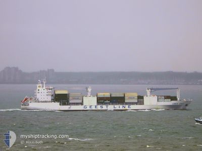
Reefer
Current Trip
| Trip Time | 1 day |
|---|---|
| Trip Distance | 653.48 nm |
| AVG Speed | 19.7 Knots |
| MAX Speed | 21 Knots |
| Dybgang | 7.6 m |
| AVG Wind | 11.7 knots |
| MAX Wind | 21 knots |
| MIN Temp | 27.7°C / 81.86°F |
| MAX Temp | 29.7°C / 85.46°F |
| Position Modtaget | 2 d siden |
Current Position
| Longitude | -74.39428° |
|---|---|
| Latitude | 11.23343° |
| Status | Under way using engine |
| Fart | 16.4 Knots |
| Kurs | 86.7° |
| Område | Caribbean Sea |
| Station | T-AIS |
| Position Modtaget | 2 d siden |
Info
Information
The current position of LOMBOK STRAIT is in Caribbean Sea with coordinates 11.23343° / -74.39428° as reported on 2024-06-07 07:42 by AIS to our vessel tracker app. The vessel's current speed is 16.4 Knots and is currently inside the port of PEPILLO SALCEDO.
The vessel LOMBOK STRAIT (IMO: 9204958, MMSI: 636019777) is a Reefer that was built in 2002 ( 22 år gamle ). It's sailing under the flag of [LR] Liberia.
In this page you can find informations about the vessels current position, last detected port calls, and current voyage information. If the vessels is not in coverage by AIS you will find the latest position.
The current position of LOMBOK STRAIT is detected by our AIS receivers and we are not responsible for the reliability of the data. The last position was recorded while the vessel was in Coverage by the Ais receivers of our vessel tracking app.
The current draught of LOMBOK STRAIT as reported by AIS is 7.6 meters
Weather
| Temperature | 27.6°C / 81.68°F |
|---|---|
| Wind Speed | 8 knots |
| Direction | 342° NNW |
| Pressure | 1014.9 hPa |
| Humidity | 81.6 % |
| Cloud Coverage | 100 % |
Featured Company
Last Port Calls
| Port | Arrival | Departure | Time In Port |
|---|---|---|---|
| 2024-06-08 23:24 | |||
| 2024-06-07 03:46 | 2024-06-07 12:47 | 9 h | |
| 2024-06-03 22:49 | |||
| 2024-06-02 05:40 | 2024-06-02 13:24 | 7 h | |
| 2024-05-31 06:20 | 2024-05-31 14:56 | 8 h | |
| 2024-05-30 05:38 | 2024-05-30 15:00 | 9 h | |
| 2024-05-28 11:05 | 2024-05-28 20:24 | 9 h | |
| 2024-05-17 10:01 | 2024-05-18 16:00 | 1 d | |
| 2024-05-15 11:25 | 2024-05-16 21:17 | 1 d | |
| 2024-05-05 00:15 | 2024-05-06 07:59 | 1 d |
Most Visited Ports (Last year)
| Port | Arrivals | |
|---|---|---|
| 11 | ||
| 11 | ||
| 11 | ||
| 11 | ||
| 11 | ||
| 11 |
Last Trips
| Origin | Departure | Destination | Arrival | Distance | |
|---|---|---|---|---|---|
| 2024-06-07 12:47 | 2024-06-08 23:24 | 653.48 nm | |||
| 2024-06-02 13:24 | 2024-06-03 22:49 | 610.76 nm | |||
| 2024-05-31 14:56 | 2024-06-02 05:40 | 524.47 nm | |||
| 2024-05-30 15:00 | 2024-05-31 06:20 | 207.77 nm | |||
| 2024-05-28 20:24 | 2024-05-30 05:38 | 162.60 nm | |||
| 2024-05-18 16:00 | 2024-05-28 11:05 | 3649.77 nm | |||
| 2024-05-16 21:17 | 2024-05-17 10:01 | 209.48 nm | |||
| 2024-05-06 07:59 | 2024-05-15 11:25 | 4025.93 nm | |||
| 2024-05-03 05:38 | 2024-05-05 00:15 | 654.10 nm | |||
| 2024-05-02 02:34 | 2024-05-02 23:25 | 275.48 nm |
Events
| Tid | Hændelsen | Detaljer | Position / Dest | Info |
|---|---|---|---|---|
| 2024-06-09 03:24 | STOP Sejllads |
19.71014 / -71.74258
[DO] PEPILLO SALCEDO
|
Fart: 0.2 kn Kurs: 182° |
|
| 2024-06-09 03:24 | Skibe i havn |
|
19.71014 / -71.74258
[DO] PEPILLO SALCEDO
|
Fart: 1 kn Kurs: -1° |
| 2024-06-07 17:47 | START Sejllads | 0.35 nm, North West of SANTA MARTA |
11.24692 / -74.22545
COSMR
|
Fart: 6.4 kn Kurs: 265° |
| 2024-06-07 17:47 | Afsejlet fra sidste havn |
|
11.24692 / -74.22545
COSMR
|
Fart: 2 kn Kurs: -1° |
| 2024-06-07 08:58 | STOP Sejllads |
11.24945 / -74.21616
[CO] SANTA MARTA
|
Fart: Kurs: 24° |
|
| 2024-06-07 08:46 | Skibe i havn |
|
11.24911 / -74.21661
[CO] SANTA MARTA
|
Fart: 5.1 kn Kurs: 59° |
| 2024-06-07 07:45 | Status er ændret | Default Under way using engine |
11.23333 / -74.38333
COSMR
|
Fart: 16.4 kn Kurs: 86.7° |
| 2024-06-07 07:42 | Udenfor Dækning |
11.23343 / -74.39428
Caribbean Sea
COSMR
|
Fart: 16.4 kn Kurs: 86.7° |
|
| 2024-06-07 03:28 | Dybgangen er ændret | 7.6 6.7 |
10.71544 / -75.62459
COSMR
|
Fart: 20.9 kn Kurs: 34.4° |
| 2024-06-07 03:28 | Destination er ændret | COSMR COTRB |
10.71544 / -75.62459
COSMR
|
Fart: 20.9 kn Kurs: 34.4° |