
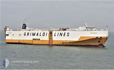
GRAND BENELUX
Vehicles Carrier
Current Trip
| Time Travelled | 4 days |
|---|---|
| Remaining Time | --- |
| Distance Travelled | 1802.16 nm |
| Remaining Distance | --- |
| AVG Speed | 16.7 Knots |
| MAX Speed | 16.7 Knots |
| AVG Wind | 12.2 knots |
| MAX Wind | 23 knots |
| MIN Temp | 17.1°C / 62.78°F |
| MAX Temp | 26.6°C / 79.88°F |
| Dybgang | 7.6 m |
| Position Modtaget | Nu |
Current Position
| Longitude | 28.79878° |
|---|---|
| Latitude | 34.65203° |
| Status | Under way using engine |
| Fart | 17.2 Knots |
| Kurs | 290° |
| Område | Mediterranean Sea - Eastern Basin |
| Station | T-AIS |
| Position Modtaget | Nu |
Info
Information
The current position of GRAND BENELUX is in Mediterranean Sea - Eastern Basin with coordinates 34.65203° / 28.79878° as reported on 2024-06-18 11:07 by AIS to our vessel tracker app. The vessel's current speed is 17.2 Knots and is heading at the port of LAVRIO. The estimated time of arrival as calculated by MyShipTracking vessel tracking app is 2024-06-19 10:00 LT
The vessel GRAND BENELUX (IMO: 9227900, MMSI: 247039400) is a Vehicles Carrier that was built in 2001 ( 23 år gamle ). It's sailing under the flag of [IT] Italy.
In this page you can find informations about the vessels current position, last detected port calls, and current voyage information. If the vessels is not in coverage by AIS you will find the latest position.
The current position of GRAND BENELUX is detected by our AIS receivers and we are not responsible for the reliability of the data. The last position was recorded while the vessel was in Coverage by the Ais receivers of our vessel tracking app.
The current draught of GRAND BENELUX as reported by AIS is 7.6 meters
Weather
| Temperature | 25°C / 77°F |
|---|---|
| Wind Speed | 10 knots |
| Direction | 305° NW |
| Pressure | 1010.8 hPa |
| Humidity | 79.2 % |
| Cloud Coverage | --- |
Featured Company
Last Port Calls
| Port | Arrival | Departure | Time In Port |
|---|---|---|---|
| 2024-06-11 16:39 | 2024-06-13 15:29 | 1 d | |
| 2024-06-10 04:09 | 2024-06-11 15:16 | 1 d | |
| 2024-06-06 07:59 | 2024-06-07 03:14 | 19 h | |
| 2024-06-04 13:19 | 2024-06-06 01:55 | 1 d | |
| 2024-06-04 07:35 | 2024-06-04 12:58 | 5 h | |
| 2024-05-29 20:25 | 2024-06-03 06:54 | 4 d | |
| 2024-05-25 23:44 | 2024-05-27 17:30 | 1 d | |
| 2024-05-24 06:17 | 2024-05-25 20:01 | 1 d | |
| 2024-05-20 06:15 | 2024-05-20 22:08 | 15 h | |
| 2024-05-18 00:44 | 2024-05-19 00:29 | 23 h |
Most Visited Ports (Last year)
| Port | Arrivals | |
|---|---|---|
| 21 | ||
| 21 | ||
| 18 | ||
| 17 | ||
| 12 | ||
| 9 |
Last Trips
| Origin | Departure | Destination | Arrival | Distance | |
|---|---|---|---|---|---|
| 2024-06-11 15:16 | 2024-06-11 16:39 | 15.49 nm | |||
| 2024-06-07 03:14 | 2024-06-10 04:09 | 1180.38 nm | |||
| 2024-06-06 01:55 | 2024-06-06 07:59 | 78.42 nm | |||
| 2024-06-04 12:58 | 2024-06-04 13:19 | 1.99 nm | |||
| 2024-06-03 06:54 | 2024-06-04 07:35 | 402.90 nm | |||
| 2024-05-27 17:30 | 2024-05-29 20:25 | 877.96 nm | |||
| 2024-05-25 20:01 | 2024-05-25 23:44 | 19.07 nm | |||
| 2024-05-20 22:08 | 2024-05-24 06:17 | 1189.93 nm | |||
| 2024-05-19 00:29 | 2024-05-20 06:15 | 83.99 nm | |||
| 2024-05-18 00:17 | 2024-05-18 00:44 | 1.83 nm |
Events
| Tid | Hændelsen | Detaljer | Position / Dest | Info |
|---|---|---|---|---|
| 2024-06-18 10:00 | ETA er ændret | 2024/06/19 07:00 2024/06/19 08:00 |
34.53944 / 29.16259
GRLAV
|
Fart: 17.3 kn Kurs: 290.9° |
| 2024-06-18 07:56 | START Sejllads |
34.32291 / 29.84569
GRLAV
|
Fart: 17.7 kn Kurs: 294.6° |
|
| 2024-06-18 07:56 | STOP Sejllads |
34.32218 / 29.84814
GRLAV
|
Fart: Kurs: 291° |
|
| 2024-06-18 07:05 | Ændre havområde | Greek part of the Mediterranean Sea - Eastern Basin Cypriote part of the Mediterranean Sea - Eastern Basin |
34.23348 / 30.13092
Mediterranean Sea - Eastern Basin
GRLAV
|
Fart: 17.7 kn Kurs: 291.2° |
| 2024-06-18 00:50 | Ændre havområde | Cypriote part of the Mediterranean Sea - Eastern Basin Israeli part of the Mediterranean Sea - Eastern Basin |
33.59449 / 32.20933
Mediterranean Sea - Eastern Basin
GRLAV
|
Fart: 17.9 kn Kurs: 291.2° |
| 2024-06-18 00:48 | Indenfor Dækning |
33.59449 / 32.20933
Mediterranean Sea - Eastern Basin
GRLAV
|
Fart: 17.9 kn Kurs: 291.2° |
|
| 2024-06-17 20:42 | Udenfor Dækning |
33.81827 / 35.49080
Mediterranean Sea - Eastern Basin
GRLAV
|
Fart: Kurs: 346.5° |
|
| 2024-06-17 19:36 | Indenfor Dækning |
33.81827 / 35.49079
Mediterranean Sea - Eastern Basin
GRLAV
|
Fart: Kurs: 346.5° |
|
| 2024-06-17 17:55 | Udenfor Dækning |
33.81828 / 35.49081
Mediterranean Sea - Eastern Basin
GRLAV
|
Fart: Kurs: 275.1° |
|
| 2024-06-17 15:46 | Status er ændret | Under way using engine Moored |
33.81829 / 35.49079
GRLAV
|
Fart: Kurs: 65° |