
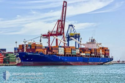
GENOA EXPRESS
Cargo D
Current Trip
| Time Travelled | 3 days |
|---|---|
| Remaining Time | --- |
| Distance Travelled | 978.57 nm |
| Remaining Distance | --- |
| AVG Speed | 12.9 Knots |
| MAX Speed | 21.2 Knots |
| AVG Wind | 9.8 knots |
| MAX Wind | 25.8 knots |
| MIN Temp | 8.2°C / 46.76°F |
| MAX Temp | 23.6°C / 74.48°F |
| Dybgang | 8.8 m |
| Position Modtaget | 2 d siden |
Current Position
| Longitude | -68.63625° |
|---|---|
| Latitude | 48.59977° |
| Status | Under way using engine |
| Fart | 11 Knots |
| Kurs | 57.7° |
| Område | Gulf of St-Lawrence |
| Station | T-AIS |
| Position Modtaget | 2 d siden |
Info
Information
The current position of GENOA EXPRESS is in Gulf of St-Lawrence with coordinates 48.59977° / -68.63625° as reported on 2024-06-08 07:05 by AIS to our vessel tracker app. The vessel's current speed is 11 Knots and is heading at the port of TANGER MED. The estimated time of arrival as calculated by MyShipTracking vessel tracking app is 2024-06-22 02:00 LT
The vessel GENOA EXPRESS (IMO: 9626041, MMSI: 477694200) is a Cargo D It's sailing under the flag of [HK] Hong Kong.
In this page you can find informations about the vessels current position, last detected port calls, and current voyage information. If the vessels is not in coverage by AIS you will find the latest position.
The current position of GENOA EXPRESS is detected by our AIS receivers and we are not responsible for the reliability of the data. The last position was recorded while the vessel was in Coverage by the Ais receivers of our vessel tracking app.
The current draught of GENOA EXPRESS as reported by AIS is 8.8 meters
Weather
| Temperature | 10.8°C / 51.44°F |
|---|---|
| Wind Speed | 21 knots |
| Direction | 192° SSW |
| Pressure | 1006.1 hPa |
| Humidity | 100 % |
| Cloud Coverage | 100 % |
Featured Company
Last Port Calls
| Port | Arrival | Departure | Time In Port |
|---|---|---|---|
| 2024-06-04 03:16 | 2024-06-07 06:39 | 3 d | |
| 2024-05-30 06:57 | 2024-05-30 17:54 | 10 h | |
| 2024-05-22 01:18 | 2024-05-22 10:20 | 9 h | |
| 2024-05-17 13:47 | 2024-05-18 01:34 | 11 h | |
| 2024-05-15 21:18 | 2024-05-16 13:24 | 16 h | |
| 2024-05-14 10:04 | 2024-05-14 18:00 | 7 h | |
| 2024-05-12 18:03 | 2024-05-13 18:00 | 23 h | |
| 2024-05-11 10:42 | 2024-05-12 08:44 | 22 h | |
| 2024-05-09 06:00 | 2024-05-10 14:32 | 1 d | |
| 2024-05-01 23:37 | 2024-05-02 15:26 | 15 h |
Last Trips
| Origin | Departure | Destination | Arrival | Distance | |
|---|---|---|---|---|---|
| 2024-05-30 17:54 | 2024-06-04 03:16 | 1319.18 nm | |||
| 2024-05-22 10:20 | 2024-05-30 06:57 | 2667.25 nm | |||
| 2024-05-18 01:34 | 2024-05-22 01:18 | 651.69 nm | |||
| 2024-05-16 13:24 | 2024-05-17 13:47 | 412.18 nm | |||
| 2024-05-14 18:00 | 2024-05-15 21:18 | 351.38 nm | |||
| 2024-05-13 18:00 | 2024-05-14 10:04 | 231.50 nm | |||
| 2024-05-12 08:44 | 2024-05-12 18:03 | 87.92 nm | |||
| 2024-05-10 14:32 | 2024-05-11 10:42 | 329.84 nm | |||
| 2024-05-02 15:26 | 2024-05-09 06:00 | 811.51 nm | |||
| 2024-04-30 02:02 | 2024-05-01 23:37 | 453.66 nm |
Events
| Tid | Hændelsen | Detaljer | Position / Dest | Info |
|---|---|---|---|---|
| 2024-06-08 07:11 | Status er ændret | Default Under way using engine |
48.61066 / -68.61009
MAPTM
|
Fart: 11 kn Kurs: 57.7° |
| 2024-06-08 07:05 | Udenfor Dækning |
48.59977 / -68.63625
Gulf of St-Lawrence
MAPTM
|
Fart: 11 kn Kurs: 57.7° |
|
| 2024-06-08 06:58 | Status er ændret | Under way using engine Default |
48.58862 / -68.66264
MAPTM
|
Fart: 11.2 kn Kurs: 55° |
| 2024-06-08 06:51 | Status er ændret | Default Under way using engine |
48.57674 / -68.68822
MAPTM
|
Fart: 11.3 kn Kurs: 55.2° |
| 2024-06-08 06:38 | Status er ændret | Under way using engine Default |
48.55285 / -68.73880
MAPTM
|
Fart: 11.2 kn Kurs: 55° |
| 2024-06-08 06:35 | Status er ændret | Default Under way using engine |
48.54779 / -68.74972
MAPTM
|
Fart: 11.3 kn Kurs: 57.2° |
| 2024-06-08 06:28 | Status er ændret | Under way using engine Default |
48.53513 / -68.77832
MAPTM
|
Fart: 11.3 kn Kurs: 58° |
| 2024-06-08 06:26 | Indenfor Dækning |
48.53513 / -68.77832
Gulf of St-Lawrence
MAPTM
|
Fart: 11.3 kn Kurs: 57.2° |
|
| 2024-06-07 22:50 | Status er ændret | Default Under way using engine |
47.26311 / -70.54974
MAPTM
|
Fart: 15.5 kn Kurs: 35° |
| 2024-06-07 22:40 | Udenfor Dækning |
47.22758 / -70.58630
Gulf of St-Lawrence
MAPTM
|
Fart: 15.5 kn Kurs: 35° |