
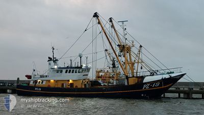
ELISABETH OF LADRAM
Trawler
Current Trip
| Time Travelled | 1 day |
|---|---|
| Remaining Time | 5 days |
| Distance Travelled | 137.90 nm |
| Remaining Distance | 446.97 nm |
| AVG Speed | 4 Knots |
| MAX Speed | 9.5 Knots |
| AVG Wind | 6.9 knots |
| MAX Wind | 11.9 knots |
| MIN Temp | 13.4°C / 56.12°F |
| MAX Temp | 15.8°C / 60.44°F |
| Dybgang | 3.6 m |
| Position Modtaget | Nu |
Current Position
| Longitude | -4.74719° |
|---|---|
| Latitude | 49.99135° |
| Status | Engaged in Fishing |
| Fart | 3.5 Knots |
| Kurs | 20° |
| Område | English Channel |
| Station | T-AIS |
| Position Modtaget | Nu |
Info
Information
The current position of ELISABETH OF LADRAM is in English Channel with coordinates 49.99135° / -4.74719° as reported on 2024-05-19 22:37 by AIS to our vessel tracker app. The vessel's current speed is 3.5 Knots and is heading at the port of DEN HELDER. The estimated time of arrival as calculated by MyShipTracking vessel tracking app is 2024-05-25 10:06 LT
The vessel ELISABETH OF LADRAM (IMO: 8807820, MMSI: 232040373) is a Trawler that was built in 1988 ( 36 år gamle ). It's sailing under the flag of [GB] United Kingdom.
In this page you can find informations about the vessels current position, last detected port calls, and current voyage information. If the vessels is not in coverage by AIS you will find the latest position.
The current position of ELISABETH OF LADRAM is detected by our AIS receivers and we are not responsible for the reliability of the data. The last position was recorded while the vessel was in Coverage by the Ais receivers of our vessel tracking app.
The current draught of ELISABETH OF LADRAM as reported by AIS is 3.6 meters
Weather
| Temperature | 14.8°C / 58.64°F |
|---|---|
| Wind Speed | 7 knots |
| Direction | 71° ENE |
| Pressure | 1014.3 hPa |
| Humidity | 82.5 % |
| Cloud Coverage | 25 % |
Featured Company
Last Port Calls
| Port | Arrival | Departure | Time In Port |
|---|---|---|---|
| 2024-05-18 12:21 | |||
| 2024-04-25 15:40 | 2024-04-29 18:26 | 4 d | |
| 2024-04-16 14:04 | 2024-04-18 13:01 | 1 d | |
| 2024-04-13 10:33 | 2024-04-13 18:57 | 8 h | |
| 2024-04-05 15:26 | 2024-04-08 07:46 | 2 d | |
| 2024-04-02 07:31 | 2024-04-03 15:19 | 1 d | |
| 2024-03-25 07:32 | 2024-03-26 19:45 | 1 d | |
| 2024-03-20 11:01 | 2024-03-20 20:13 | 9 h | |
| 2024-03-06 12:39 | 2024-03-15 20:10 | 9 d |
Most Visited Ports (Last year)
| Port | Arrivals | |
|---|---|---|
| 18 | ||
| 4 | ||
| 2 | ||
| 1 | ||
| 1 |
Last Trips
| Origin | Departure | Destination | Arrival | Distance | |
|---|---|---|---|---|---|
| 2024-04-18 13:01 | 2024-04-25 15:40 | 227.23 nm | |||
| 2024-04-13 18:57 | 2024-04-16 14:04 | 115.18 nm | |||
| 2024-04-08 07:46 | 2024-04-13 10:33 | 414.95 nm | |||
| 2024-04-03 15:19 | 2024-04-05 15:26 | 15.03 nm | |||
| 2024-03-26 19:45 | 2024-04-02 07:31 | 152.24 nm | |||
| 2024-03-20 20:13 | 2024-03-25 07:32 | 198.67 nm | |||
| 2024-03-15 20:10 | 2024-03-20 11:01 | 133.49 nm | |||
| 2024-02-28 17:21 | 2024-03-06 12:39 | 95.38 nm |
Events
| Tid | Hændelsen | Detaljer | Position / Dest | Info |
|---|---|---|---|---|
| 2024-05-19 18:40 | START Sejllads | 19.68 nm, South East of SAINT MAWES |
49.95431 / -4.61434
FISHING GROUNDS
|
Fart: 3.9 kn Kurs: 298° |
| 2024-05-19 18:31 | STOP Sejllads | 19.78 nm, South East of SAINT MAWES |
49.95403 / -4.61139
FISHING GROUNDS
|
Fart: 0.3 kn Kurs: 304° |
| 2024-05-19 11:42 | START Sejllads | 21.46 nm, South East of MEVAGISSEY |
49.94182 / -4.56144
FISHING GROUNDS
|
Fart: 4.2 kn Kurs: 120° |
| 2024-05-19 11:38 | STOP Sejllads | 21.37 nm, South East of MEVAGISSEY |
49.94266 / -4.56402
FISHING GROUNDS
|
Fart: 0.2 kn Kurs: 130° |
| 2024-05-19 07:12 | START Sejllads | 14.88 nm, South East of SAINT MAWES |
50.01564 / -4.69810
FISHING GROUNDS
|
Fart: 3.6 kn Kurs: 4° |
| 2024-05-19 07:08 | STOP Sejllads | 14.96 nm, South East of SAINT MAWES |
50.01364 / -4.69767
FISHING GROUNDS
|
Fart: 0.3 kn Kurs: 9° |
| 2024-05-19 00:12 | START Sejllads | 17.13 nm, South of MEVAGISSEY |
50.00314 / -4.62376
FISHING GROUNDS
|
Fart: 4.6 kn Kurs: 277° |
| 2024-05-18 23:56 | STOP Sejllads | 17.14 nm, South of MEVAGISSEY |
50.00388 / -4.62058
FISHING GROUNDS
|
Fart: 0.3 kn Kurs: 298° |
| 2024-05-18 22:30 | START Sejllads |
49.97192 / -4.43053
FISHING GROUNDS
|
Fart: 6 kn Kurs: 287° |
|
| 2024-05-18 22:26 | STOP Sejllads |
49.97165 / -4.42756
FISHING GROUNDS
|
Fart: 0.3 kn Kurs: 303° |