
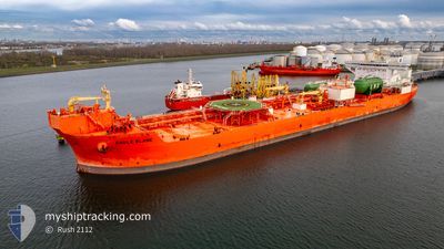
EAGLE BLANE
Tanker
Current Trip
| Time Travelled | 22 days |
|---|---|
| Remaining Time | --- |
| Distance Travelled | 1756.42 nm |
| Remaining Distance | --- |
| AVG Speed | 7.5 Knots |
| MAX Speed | 15.2 Knots |
| AVG Wind | 10.8 knots |
| MAX Wind | 24 knots |
| MIN Temp | 9.3°C / 48.74°F |
| MAX Temp | 18.2°C / 64.76°F |
| Dybgang | 9.5 m |
| Position Modtaget | 3 m siden |
Current Position
| Longitude | -3.08017° |
|---|---|
| Latitude | 58.88332° |
| Status | At anchor |
| Fart | |
| Kurs | 299° |
| Område | North Sea |
| Station | T-AIS |
| Position Modtaget | 3 m siden |
Info
Information
The current position of EAGLE BLANE is in North Sea with coordinates 58.88332° / -3.08017° as reported on 2024-06-01 20:33 by AIS to our vessel tracker app. The vessel's current speed is 0 Knots
The vessel EAGLE BLANE (IMO: 9833101, MMSI: 257089140) is a Tanker It's sailing under the flag of [NO] Norway.
In this page you can find informations about the vessels current position, last detected port calls, and current voyage information. If the vessels is not in coverage by AIS you will find the latest position.
The current position of EAGLE BLANE is detected by our AIS receivers and we are not responsible for the reliability of the data. The last position was recorded while the vessel was in Coverage by the Ais receivers of our vessel tracking app.
The current draught of EAGLE BLANE as reported by AIS is 9.5 meters
Weather
| Temperature | 11.6°C / 52.88°F |
|---|---|
| Wind Speed | 15 knots |
| Direction | 289° WNW |
| Pressure | 1028.5 hPa |
| Humidity | 70.8 % |
| Cloud Coverage | 100 % |
Featured Company
Events
| Tid | Hændelsen | Detaljer | Position / Dest | Info |
|---|---|---|---|---|
| 2024-06-01 00:04 | ETA er ændret | 2025/05/28 20:00 2024/05/28 20:00 |
58.88296 / -3.08061
SCAPA FLOW
|
Fart: 0.1 kn Kurs: 309° |
| 2024-05-31 23:29 | Status er ændret | At anchor Default |
58.88258 / -3.08138
SCAPA FLOW
|
Fart: Kurs: 324° |
| 2024-05-31 23:27 | Status er ændret | Default At anchor |
58.88254 / -3.08139
SCAPA FLOW
|
Fart: Kurs: 324° |
| 2024-05-29 23:29 | Status er ændret | At anchor Under way using engine |
58.88178 / -3.08464
SCAPA FLOW
|
Fart: 0.9 kn Kurs: 325° |
| 2024-05-29 23:18 | STOP Sejllads | 3.03 nm, North East of FLOTTA |
58.88291 / -3.08585
SCAPA FLOW
|
Fart: 0.3 kn Kurs: 323° |
| 2024-05-29 22:35 | START Sejllads | 3.85 nm, South West of SCAPA |
58.90990 / -3.05761
SCAPA FLOW
|
Fart: 3.1 kn Kurs: 119° |
| 2024-05-29 22:33 | Dybgangen er ændret | 9.5 12.4 |
58.91015 / -3.05992
SCAPA FLOW
|
Fart: 0.9 kn Kurs: 75° |
| 2024-05-29 22:32 | Status er ændret | Under way using engine Moored |
58.91018 / -3.05999
SCAPA FLOW
|
Fart: 0.8 kn Kurs: 66° |
| 2024-05-29 08:59 | Status er ændret | Moored Under way using engine |
58.91393 / -3.06371
SCAPA FLOW
|
Fart: Kurs: 129° |
| 2024-05-28 21:08 | STOP Sejllads | 3.78 nm, South West of SCAPA |
58.91506 / -3.06440
SCAPA FLOW
|
Fart: 0.3 kn Kurs: 150° |