
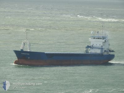
DAY BLUE
General Cargo
Current Trip
| Time Travelled | 23 days |
|---|---|
| Remaining Time | 12 h, 14 mins |
| Distance Travelled | 2065.90 nm |
| Remaining Distance | 129.19 nm |
| AVG Speed | 9.3 Knots |
| MAX Speed | 14.7 Knots |
| AVG Wind | 6.8 knots |
| MAX Wind | 21 knots |
| MIN Temp | 11.1°C / 51.98°F |
| MAX Temp | 32.6°C / 90.68°F |
| Dybgang | 5.2 m |
| Position Modtaget | Nu |
Current Position
| Longitude | 11.39216° |
|---|---|
| Latitude | 38.12255° |
| Status | Under way using engine |
| Fart | 10.6 Knots |
| Kurs | 298.4° |
| Område | Tyrrhenian Sea |
| Station | T-AIS |
| Position Modtaget | Nu |
Info
Information
The current position of DAY BLUE is in Tyrrhenian Sea with coordinates 38.12255° / 11.39216° as reported on 2024-06-09 18:06 by AIS to our vessel tracker app. The vessel's current speed is 10.6 Knots and is heading at the port of CAGLIARI. The estimated time of arrival as calculated by MyShipTracking vessel tracking app is 2024-06-10 06:20 LT
The vessel DAY BLUE (IMO: 9184811, MMSI: 312012000) is a General Cargo that was built in 1998 ( 26 år gamle ). It's sailing under the flag of [BZ] Belize.
In this page you can find informations about the vessels current position, last detected port calls, and current voyage information. If the vessels is not in coverage by AIS you will find the latest position.
The current position of DAY BLUE is detected by our AIS receivers and we are not responsible for the reliability of the data. The last position was recorded while the vessel was in Coverage by the Ais receivers of our vessel tracking app.
The current draught of DAY BLUE as reported by AIS is 5.2 meters
Weather
| Temperature | 21.9°C / 71.42°F |
|---|---|
| Wind Speed | 6 knots |
| Direction | 258° WSW |
| Pressure | 1009.8 hPa |
| Humidity | 80.1 % |
| Cloud Coverage | 96 % |
Featured Company
Last Port Calls
| Port | Arrival | Departure | Time In Port |
|---|---|---|---|
| 2024-05-14 03:13 | 2024-05-17 03:15 | 3 d | |
| 2024-04-29 08:28 | 2024-05-02 01:49 | 2 d | |
| 2024-04-22 16:38 | 2024-04-25 17:38 | 3 d | |
| 2024-04-14 06:54 | 2024-04-15 10:28 | 1 d | |
| 2024-04-09 04:12 | 2024-04-09 18:43 | 14 h | |
| 2024-04-05 08:31 | 2024-04-06 18:06 | 1 d | |
| 2024-04-04 18:03 |
Most Visited Ports (Last year)
| Port | Arrivals | |
|---|---|---|
| 2 | ||
| 1 | ||
| 1 | ||
| 1 | ||
| 1 | ||
| 1 |
Last Trips
| Origin | Departure | Destination | Arrival | Distance | |
|---|---|---|---|---|---|
| 2024-05-02 02:49 | 2024-05-14 06:13 | 3019.00 nm | |||
| 2024-04-25 19:38 | 2024-04-29 09:28 | 342.04 nm | |||
| 2024-04-15 11:28 | 2024-04-22 18:38 | 1758.42 nm | |||
| 2024-04-09 20:43 | 2024-04-14 07:54 | 454.47 nm | |||
| 2024-04-06 20:06 | 2024-04-09 06:12 | 558.19 nm | |||
| 2024-04-04 20:03 | 2024-04-05 10:31 | 45.53 nm |
Events
| Tid | Hændelsen | Detaljer | Position / Dest | Info |
|---|---|---|---|---|
| 2024-06-09 17:29 | Ændre havområde | Italian part of the Tyrrhenian Sea Italian part of the Mediterranean Sea - Western Basin |
38.06749 / 11.51384
Tyrrhenian Sea
ITCAG
|
Fart: 10.4 kn Kurs: 298.4° |
| 2024-06-09 16:20 | Status er ændret | Under way using engine Default |
37.97057 / 11.73489
ITCAG
|
Fart: 10.5 kn Kurs: 299° |
| 2024-06-09 16:09 | Status er ændret | Default Under way using engine |
37.95549 / 11.76817
ITCAG
|
Fart: 10.4 kn Kurs: 300.5° |
| 2024-06-09 16:01 | Status er ændret | Under way using engine Default |
37.94410 / 11.79376
ITCAG
|
Fart: 10.4 kn Kurs: 303° |
| 2024-06-09 15:41 | Status er ændret | Default Under way using engine |
37.91500 / 11.85571
ITCAG
|
Fart: 10.2 kn Kurs: 299.9° |
| 2024-06-09 14:54 | Status er ændret | Under way using engine Default |
37.84944 / 12.00259
ITCAG
|
Fart: 9.9 kn Kurs: 306° |
| 2024-06-09 14:51 | Status er ændret | Default Under way using engine |
37.84460 / 12.01122
ITCAG
|
Fart: 10 kn Kurs: 305.6° |
| 2024-06-09 14:43 | Status er ændret | Under way using engine Default |
37.83024 / 12.03612
ITCAG
|
Fart: 9.9 kn Kurs: 307° |
| 2024-06-09 14:41 | Status er ændret | Default Under way using engine |
37.82807 / 12.03980
ITCAG
|
Fart: 10.7 kn Kurs: 306.2° |
| 2024-06-09 13:31 | Ændre havområde | Italian part of the Mediterranean Sea - Western Basin Italian part of the Mediterranean Sea - Eastern Basin |
37.71705 / 12.24776
Mediterranean Sea - Western Basin
ITCAG
|
Fart: 10.4 kn Kurs: 303.9° |