
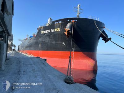
CRIMSON GRACE
Cargo
Current Trip
| Time Travelled | 10 days |
|---|---|
| Remaining Time | 18 h, 6 mins |
| Distance Travelled | 2967.39 nm |
| Remaining Distance | 229.17 nm |
| AVG Speed | 11.7 Knots |
| MAX Speed | 16.4 Knots |
| AVG Wind | 18 knots |
| MAX Wind | 37.8 knots |
| MIN Temp | 13°C / 55.4°F |
| MAX Temp | 28.2°C / 82.76°F |
| Dybgang | 6.7 m |
| Position Modtaget | 3 d siden |
Current Position
| Longitude | 118.92402° |
|---|---|
| Latitude | -35.53957° |
| Status | Under way using engine |
| Fart | 12.3 Knots |
| Kurs | 93.6° |
| Område | Indian Ocean |
| Station | T-AIS |
| Position Modtaget | 3 d siden |
Info
Information
The current position of CRIMSON GRACE is in Indian Ocean with coordinates -35.53957° / 118.92402° as reported on 2024-05-30 14:56 by AIS to our vessel tracker app. The vessel's current speed is 12.3 Knots and is heading at the port of PORTLAND-AU. The estimated time of arrival as calculated by MyShipTracking vessel tracking app is 2024-06-03 20:53 LT
The vessel CRIMSON GRACE (IMO: 9782261, MMSI: 563006200) is a Cargo It's sailing under the flag of [SG] Singapore.
In this page you can find informations about the vessels current position, last detected port calls, and current voyage information. If the vessels is not in coverage by AIS you will find the latest position.
The current position of CRIMSON GRACE is detected by our AIS receivers and we are not responsible for the reliability of the data. The last position was recorded while the vessel was in Coverage by the Ais receivers of our vessel tracking app.
The current draught of CRIMSON GRACE as reported by AIS is 6.7 meters
Weather
| Temperature | 13°C / 55.4°F |
|---|---|
| Wind Speed | 16 knots |
| Direction | 19° NNE |
| Pressure | 1019.5 hPa |
| Humidity | 64.9 % |
| Cloud Coverage | 100 % |
Featured Company
Last Port Calls
| Port | Arrival | Departure | Time In Port |
|---|---|---|---|
| 2024-05-15 19:07 | 2024-05-23 20:31 | 8 d | |
| 2024-05-03 18:40 | 2024-05-05 08:56 | 1 d | |
| 2024-04-08 15:21 |
Last Trips
| Origin | Departure | Destination | Arrival | Distance | |
|---|---|---|---|---|---|
| 2024-05-05 08:56 | 2024-05-15 19:07 | 1550.10 nm | |||
| 2024-04-08 15:21 | 2024-05-03 18:40 | 4709.80 nm |
Events
| Tid | Hændelsen | Detaljer | Position / Dest | Info |
|---|---|---|---|---|
| 2024-05-30 14:57 | Status er ændret | Default Under way using engine |
-35.53982 / 118.92970
AU PTJ
|
Fart: 12.3 kn Kurs: 93.6° |
| 2024-05-30 14:56 | Udenfor Dækning |
-35.53957 / 118.92402
Indian Ocean
AU PTJ
|
Fart: 12.3 kn Kurs: 93.6° |
|
| 2024-05-30 07:27 | Dybgangen er ændret | 6.7 12.3 |
-35.52862 / 117.06077
AU PTJ
|
Fart: 14.9 kn Kurs: 86.9° |
| 2024-05-30 07:27 | Destination er ændret | AU PTJ ID CIG |
-35.52862 / 117.06077
AU PTJ
|
Fart: 14.9 kn Kurs: 86.9° |
| 2024-05-30 07:27 | ETA er ændret | 2024/06/03 02:00 2024/05/15 16:00 |
-35.52862 / 117.06077
AU PTJ
|
Fart: 14.9 kn Kurs: 86.9° |
| 2024-05-30 07:11 | Ændre havområde | Australian part of the Indian Ocean Malaysian part of the Singapore Strait |
-35.53210 / 116.97472
Indian Ocean
|
Fart: 14.8 kn Kurs: 88.1° |
| 2024-05-30 07:11 | Status er ændret | Under way using engine Default |
-35.53210 / 116.97472
ID CIG
|
Fart: 15.1 kn Kurs: 87° |
| 2024-05-30 07:01 | Indenfor Dækning |
-35.53210 / 116.97472
Indian Ocean
|
Fart: 14.8 kn Kurs: 88.1° |