
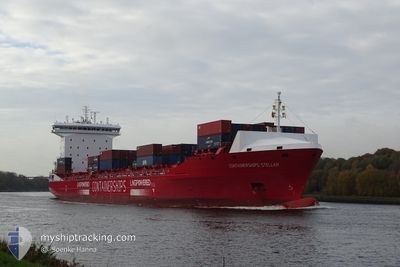
CONTSHIPS STELLAR
Cargo A
Current Trip
| Time Travelled | 2 days |
|---|---|
| Remaining Time | 7 h, 2 mins |
| Distance Travelled | 731.72 nm |
| Remaining Distance | 111.84 nm |
| AVG Speed | 10.9 Knots |
| MAX Speed | 19.7 Knots |
| AVG Wind | 13.5 knots |
| MAX Wind | 25 knots |
| MIN Temp | 10.6°C / 51.08°F |
| MAX Temp | 17.2°C / 62.96°F |
| Dybgang | 9.2 m |
| Position Modtaget | 3 m siden |
Current Position
| Longitude | 1.64287° |
|---|---|
| Latitude | 54.38043° |
| Status | Under way using engine |
| Fart | 15.9 Knots |
| Kurs | 282.9° |
| Område | North Sea |
| Station | T-AIS |
| Position Modtaget | 3 m siden |
Info
Information
The current position of CONTSHIPS STELLAR is in North Sea with coordinates 54.38043° / 1.64287° as reported on 2024-06-09 12:18 by AIS to our vessel tracker app. The vessel's current speed is 15.9 Knots and is heading at the port of TEES. The estimated time of arrival as calculated by MyShipTracking vessel tracking app is 2024-06-09 20:23 LT
The vessel CONTSHIPS STELLAR (IMO: 9866251, MMSI: 210195000) is a Cargo A It's sailing under the flag of [CY] Cyprus.
In this page you can find informations about the vessels current position, last detected port calls, and current voyage information. If the vessels is not in coverage by AIS you will find the latest position.
The current position of CONTSHIPS STELLAR is detected by our AIS receivers and we are not responsible for the reliability of the data. The last position was recorded while the vessel was in Coverage by the Ais receivers of our vessel tracking app.
The current draught of CONTSHIPS STELLAR as reported by AIS is 9.2 meters
Weather
| Temperature | 11.2°C / 52.16°F |
|---|---|
| Wind Speed | 17 knots |
| Direction | 301° WNW |
| Pressure | 1007.8 hPa |
| Humidity | 70.8 % |
| Cloud Coverage | 55 % |
Featured Company
Last Port Calls
| Port | Arrival | Departure | Time In Port |
|---|---|---|---|
| 2024-06-06 20:13 | 2024-06-07 07:22 | 11 h | |
| 2024-06-04 06:35 | 2024-06-04 16:22 | 9 h | |
| 2024-06-03 06:57 | 2024-06-04 03:13 | 20 h | |
| 2024-06-01 12:01 | 2024-06-01 12:04 | 2 m | |
| 2024-05-29 23:36 | 2024-05-31 05:10 | 1 d | |
| 2024-05-28 19:32 | 2024-05-29 16:08 | 20 h | |
| 2024-05-27 09:27 | 2024-05-28 00:43 | 15 h | |
| 2024-05-22 15:54 | 2024-05-23 01:18 | 9 h | |
| 2024-05-20 06:58 | 2024-05-21 22:38 | 1 d | |
| 2024-05-16 01:45 | 2024-05-17 03:16 | 1 d |
Last Trips
| Origin | Departure | Destination | Arrival | Distance | |
|---|---|---|---|---|---|
| 2024-06-04 16:22 | 2024-06-06 20:13 | 434.29 nm | |||
| 2024-06-04 03:13 | 2024-06-04 06:35 | 46.15 nm | |||
| 2024-06-01 12:04 | 2024-06-03 06:57 | 647.15 nm | |||
| 2024-05-31 05:10 | 2024-06-01 12:01 | 331.20 nm | |||
| 2024-05-29 16:08 | 2024-05-29 23:36 | 109.48 nm | |||
| 2024-05-28 00:43 | 2024-05-28 19:32 | 278.82 nm | |||
| 2024-05-23 01:18 | 2024-05-27 09:27 | 1284.00 nm | |||
| 2024-05-21 22:38 | 2024-05-22 15:54 | 48.48 nm | |||
| 2024-05-17 03:16 | 2024-05-20 06:58 | 978.07 nm | |||
| 2024-05-14 20:13 | 2024-05-16 01:45 | 113.21 nm |
Events
| Tid | Hændelsen | Detaljer | Position / Dest | Info |
|---|---|---|---|---|
| 2024-06-09 12:04 | Ændre havområde | United Kingdom part of the North Sea German part of the North Sea |
54.36800 / 1.74187
North Sea
GBTEE
|
Fart: 15.5 kn Kurs: 282.5° |
| 2024-06-09 12:02 | Status er ændret | Under way using engine Default |
54.36603 / 1.75798
GBTEE
|
Fart: 15 kn Kurs: 281° |
| 2024-06-09 11:53 | Indenfor Dækning |
54.36800 / 1.74187
North Sea
GBTEE
|
Fart: 15.5 kn Kurs: 282.5° |
|
| 2024-06-08 23:51 | Status er ændret | Default Under way using engine |
54.20049 / 6.82693
GBTEE
|
Fart: 14.5 kn Kurs: 269.3° |
| 2024-06-08 23:46 | Udenfor Dækning |
54.20070 / 6.85948
North Sea
GBTEE
|
Fart: 14.5 kn Kurs: 269.3° |
|
| 2024-06-08 23:37 | Status er ændret | Under way using engine Default |
54.20096 / 6.92216
GBTEE
|
Fart: 14.6 kn Kurs: 272° |
| 2024-06-08 23:17 | Status er ændret | Default Under way using engine |
54.19833 / 7.06333
GBTEE
|
Fart: 14.4 kn Kurs: 271.1° |
| 2024-06-08 23:13 | Status er ændret | Under way using engine Default |
54.19890 / 7.08791
GBTEE
|
Fart: 14.3 kn Kurs: 271° |
| 2024-06-08 23:06 | Status er ændret | Default Under way using engine |
54.19804 / 7.13915
GBTEE
|
Fart: 14.3 kn Kurs: 271.4° |
| 2024-06-08 20:11 | ETA er ændret | 2024/06/09 17:00 2024/06/09 15:00 |
54.00744 / 8.26346
GBTEE
|
Fart: 12.8 kn Kurs: 280.6° |