
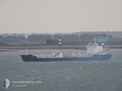
ASKHOLMEN
Oil/Chemical Tanker
Current Trip
| Time Travelled | 1 day |
|---|---|
| Remaining Time | 1 day |
| Distance Travelled | 439.00 nm |
| Remaining Distance | 422.70 nm |
| AVG Speed | 11.7 Knots |
| MAX Speed | 14.5 Knots |
| AVG Wind | 10.3 knots |
| MAX Wind | 21.2 knots |
| MIN Temp | 12.2°C / 53.96°F |
| MAX Temp | 15.9°C / 60.62°F |
| Dybgang | 9.1 m |
| Position Modtaget | 1 m siden |
Current Position
| Longitude | 1.15892° |
|---|---|
| Latitude | 50.89748° |
| Status | Under way using engine |
| Fart | 13.8 Knots |
| Kurs | 229.5° |
| Område | English Channel |
| Station | T-AIS |
| Position Modtaget | 1 m siden |
Info
Information
The current position of ASKHOLMEN is in English Channel with coordinates 50.89748° / 1.15892° as reported on 2024-06-03 16:10 by AIS to our vessel tracker app. The vessel's current speed is 13.8 Knots and is heading at the port of WHITEGATE. The estimated time of arrival as calculated by MyShipTracking vessel tracking app is 2024-06-04 21:40 LT
The vessel ASKHOLMEN (IMO: 9436381, MMSI: 538005552) is a Oil/Chemical Tanker that was built in 2009 ( 15 år gamle ). It's sailing under the flag of [MH] Marshall Is.
In this page you can find informations about the vessels current position, last detected port calls, and current voyage information. If the vessels is not in coverage by AIS you will find the latest position.
The current position of ASKHOLMEN is detected by our AIS receivers and we are not responsible for the reliability of the data. The last position was recorded while the vessel was in Coverage by the Ais receivers of our vessel tracking app.
The current draught of ASKHOLMEN as reported by AIS is 9.1 meters
Weather
| Temperature | 14.9°C / 58.82°F |
|---|---|
| Wind Speed | 6 knots |
| Direction | 221° SW |
| Pressure | 1019.8 hPa |
| Humidity | 87.9 % |
| Cloud Coverage | 100 % |
Featured Company
Last Port Calls
| Port | Arrival | Departure | Time In Port |
|---|---|---|---|
| 2024-05-31 09:38 | 2024-06-02 02:00 | 1 d | |
| 2024-05-26 12:07 | 2024-05-28 16:03 | 2 d | |
| 2024-05-21 04:47 | 2024-05-25 07:18 | 4 d | |
| 2024-05-18 11:53 | 2024-05-19 23:45 | 1 d | |
| 2024-05-15 11:14 | 2024-05-16 21:11 | 1 d | |
| 2024-05-10 14:19 | 2024-05-11 19:11 | 1 d | |
| 2024-05-04 18:02 | 2024-05-06 21:32 | 2 d | |
| 2024-05-03 00:33 | 2024-05-04 07:55 | 1 d | |
| 2024-05-01 02:13 | 2024-05-02 08:11 | 1 d | |
| 2024-04-28 18:18 | 2024-04-30 04:20 | 1 d |
Last Trips
| Origin | Departure | Destination | Arrival | Distance | |
|---|---|---|---|---|---|
| 2024-05-28 18:03 | 2024-05-31 11:38 | 372.54 nm | |||
| 2024-05-25 08:18 | 2024-05-26 14:07 | 215.05 nm | |||
| 2024-05-20 01:45 | 2024-05-21 05:47 | 275.15 nm | |||
| 2024-05-16 23:11 | 2024-05-18 13:53 | 168.17 nm | |||
| 2024-05-11 20:11 | 2024-05-15 13:14 | 872.14 nm | |||
| 2024-05-06 22:32 | 2024-05-10 15:19 | 105.05 nm | |||
| 2024-05-04 08:55 | 2024-05-04 19:02 | 100.71 nm | |||
| 2024-05-02 09:11 | 2024-05-03 01:33 | 184.88 nm | |||
| 2024-04-30 05:20 | 2024-05-01 03:13 | 192.00 nm | |||
| 2024-04-27 03:38 | 2024-04-28 19:18 | 105.59 nm |
Events
| Tid | Hændelsen | Detaljer | Position / Dest | Info |
|---|---|---|---|---|
| 2024-06-03 15:05 | Ændre havområde | United Kingdom part of the English Channel United Kingdom part of the North Sea |
51.06928 / 1.46465
English Channel
DEHAM>IEWHI
|
Fart: 14.3 kn Kurs: 230.7° |
| 2024-06-03 10:14 | Fundet i havområde | United Kingdom part of the North Sea |
51.75735 / 2.42375
North Sea
DEHAM>IEWHI
|
Fart: 10.4 kn Kurs: 222.8° |
| 2024-06-03 09:43 | Status er ændret | Under way using engine Default |
51.82369 / 2.52606
DEHAM>IEWHI
|
Fart: 10.9 kn Kurs: 222° |
| 2024-06-03 09:39 | Status er ændret | Default Under way using engine |
51.83278 / 2.54005
DEHAM>IEWHI
|
Fart: 10.9 kn Kurs: 223.4° |
| 2024-06-03 09:31 | Ændre havområde | Belgian part of the North Sea Dutch part of the North Sea |
51.84976 / 2.56582
North Sea
DEHAM>IEWHI
|
Fart: 10.9 kn Kurs: 222.7° |
| 2024-06-03 08:56 | Ændre havområde | Dutch part of the North Sea United Kingdom part of the North Sea |
51.95291 / 2.60788
North Sea
DEHAM>IEWHI
|
Fart: 11.7 kn Kurs: 184.1° |
| 2024-06-03 07:58 | Status er ændret | Under way using engine Default |
52.14841 / 2.62618
DEHAM>IEWHI
|
Fart: 12.6 kn Kurs: 201° |
| 2024-06-03 07:43 | Indenfor Dækning |
52.14841 / 2.62618
North Sea
DEHAM>IEWHI
|
Fart: 12.6 kn Kurs: 183.5° |
|
| 2024-06-03 05:50 | Status er ændret | Default Under way using engine |
52.56743 / 2.97317
DEHAM>IEWHI
|
Fart: 13.3 kn Kurs: 209.9° |
| 2024-06-03 05:46 | Udenfor Dækning |
52.57942 / 2.98334
North Sea
DEHAM>IEWHI
|
Fart: 13.3 kn Kurs: 209.9° |