
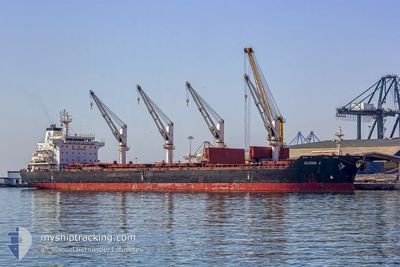
APHRODITE M
Bulk Carrier
Current Trip
| Trip Time | 1 day |
|---|---|
| Trip Distance | 241.38 nm |
| AVG Speed | 8.9 Knots |
| MAX Speed | 13 Knots |
| Dybgang | 7.4 m |
| AVG Wind | 11.1 knots |
| MAX Wind | 13.8 knots |
| MIN Temp | 23.2°C / 73.76°F |
| MAX Temp | 27.9°C / 82.22°F |
| Position Modtaget | 22 h, 32 m siden |
Current Position
| Longitude | -81.19731° |
|---|---|
| Latitude | 30.97190° |
| Status | Moored |
| Fart | |
| Kurs | 93° |
| Område | North Atlantic Ocean |
| Station | T-AIS |
| Position Modtaget | 22 h, 32 m siden |
Info
Information
The current position of APHRODITE M is in North Atlantic Ocean with coordinates 30.97190° / -81.19731° as reported on 2024-05-31 04:55 by AIS to our vessel tracker app. The vessel's current speed is 0 Knots and is currently inside the port of BRUNSWICK.
The vessel APHRODITE M (IMO: 9450832, MMSI: 538003690) is a Bulk Carrier that was built in 2011 ( 13 år gamle ). It's sailing under the flag of [MH] Marshall Is.
In this page you can find informations about the vessels current position, last detected port calls, and current voyage information. If the vessels is not in coverage by AIS you will find the latest position.
The current position of APHRODITE M is detected by our AIS receivers and we are not responsible for the reliability of the data. The last position was recorded while the vessel was in Coverage by the Ais receivers of our vessel tracking app.
The current draught of APHRODITE M as reported by AIS is 7.4 meters
Weather
| Temperature | 20.1°C / 68.18°F |
|---|---|
| Wind Speed | 5 knots |
| Direction | 93° E |
| Pressure | 1021.8 hPa |
| Humidity | 59.7 % |
| Cloud Coverage | 56 % |
Featured Company
Last Port Calls
| Port | Arrival | Departure | Time In Port |
|---|---|---|---|
| 2024-05-31 15:11 | |||
| 2024-05-26 21:40 | 2024-05-30 02:27 | 3 d | |
| 2024-05-20 17:54 | 2024-05-23 18:34 | 3 d | |
| 2024-04-28 23:15 | 2024-04-30 12:53 | 1 d | |
| 2024-04-20 18:35 | 2024-04-24 01:57 | 3 d | |
| 2024-04-09 19:44 | 2024-04-13 14:38 | 3 d |
Last Trips
| Origin | Departure | Destination | Arrival | Distance | |
|---|---|---|---|---|---|
| 2024-05-29 22:27 | 2024-05-31 11:11 | 241.38 nm | |||
| 2024-05-23 14:34 | 2024-05-26 17:40 | 665.65 nm | |||
| 2024-04-30 15:53 | 2024-05-20 13:54 | 4797.84 nm | |||
| 2024-04-24 03:57 | 2024-04-29 02:15 | 1345.57 nm | |||
| 2024-04-13 16:38 | 2024-04-20 20:35 | 184.95 nm | |||
| 2024-03-30 09:09 | 2024-04-09 21:44 | 2881.47 nm |
Events
| Tid | Hændelsen | Detaljer | Position / Dest | Info |
|---|---|---|---|---|
| 2024-05-31 15:29 | STOP Sejllads |
31.12833 / -81.49333
[US] BRUNSWICK
|
Fart: Kurs: -1° |
|
| 2024-05-31 15:11 | Skibe i havn |
|
31.11500 / -81.48167
[US] BRUNSWICK
|
Fart: 8 kn Kurs: 292° |
| 2024-05-31 13:17 | START Sejllads | 16.47 nm, South East of BRUNSWICK |
30.99833 / -81.22334
US SSI
|
Fart: 7 kn Kurs: 344° |
| 2024-05-31 10:23 | STOP Sejllads | 16.9 nm, South East of BRUNSWICK |
30.99167 / -81.21833
US SSI
|
Fart: Kurs: -1° |
| 2024-05-31 09:23 | START Sejllads | 18.49 nm, South East of BRUNSWICK |
30.97833 / -81.19167
US SSI
|
Fart: 5 kn Kurs: 3° |
| 2024-05-31 05:11 | Status er ændret | Default Moored |
30.97167 / -81.19666
US SSI
|
Fart: Kurs: 93° |
| 2024-05-31 04:55 | Status er ændret | Moored Default |
30.97190 / -81.19731
US SSI
|
Fart: Kurs: -1° |
| 2024-05-31 04:55 | Udenfor Dækning |
30.97190 / -81.19731
North Atlantic Ocean
|
Fart: Kurs: 343.4° |
|
| 2024-05-31 04:47 | Status er ændret | Default Moored |
30.97167 / -81.19666
US SSI
|
Fart: Kurs: 92° |
| 2024-05-31 04:37 | Status er ændret | Moored Default |
30.97183 / -81.19735
US SSI
|
Fart: Kurs: -1° |