
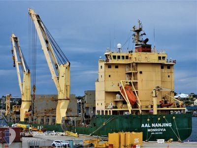
AAL NANJING
General Cargo
Current Trip
| Time Travelled | 4 days |
|---|---|
| Remaining Time | 3 h, 44 mins |
| Distance Travelled | 316.78 nm |
| Remaining Distance | 23.84 nm |
| AVG Speed | 7 Knots |
| MAX Speed | 14.3 Knots |
| AVG Wind | 26.8 knots |
| MAX Wind | 38.9 knots |
| MIN Temp | 13.6°C / 56.48°F |
| MAX Temp | 21.1°C / 69.98°F |
| Dybgang | 6.2 m |
| Position Modtaget | 1 m siden |
Current Position
| Longitude | 115.52372° |
|---|---|
| Latitude | -32.89558° |
| Status | Under way using engine |
| Fart | 6.6 Knots |
| Kurs | 349.3° |
| Område | Indian Ocean |
| Station | T-AIS |
| Position Modtaget | 1 m siden |
Info
Information
The current position of AAL NANJING is in Indian Ocean with coordinates -32.89558° / 115.52372° as reported on 2024-06-01 18:50 by AIS to our vessel tracker app. The vessel's current speed is 6.6 Knots and is heading at the port of BUNBURY. The estimated time of arrival as calculated by MyShipTracking vessel tracking app is 2024-06-02 06:35 LT
The vessel AAL NANJING (IMO: 9521552, MMSI: 210461000) is a General Cargo that was built in 2012 ( 12 år gamle ). It's sailing under the flag of [CY] Cyprus.
In this page you can find informations about the vessels current position, last detected port calls, and current voyage information. If the vessels is not in coverage by AIS you will find the latest position.
The current position of AAL NANJING is detected by our AIS receivers and we are not responsible for the reliability of the data. The last position was recorded while the vessel was in Coverage by the Ais receivers of our vessel tracking app.
The current draught of AAL NANJING as reported by AIS is 6.2 meters
Weather
| Temperature | 17.9°C / 64.22°F |
|---|---|
| Wind Speed | 21 knots |
| Direction | 298° WNW |
| Pressure | 1003 hPa |
| Humidity | 82.6 % |
| Cloud Coverage | 100 % |
Featured Company
Last Port Calls
| Port | Arrival | Departure | Time In Port |
|---|---|---|---|
| 2024-05-23 01:12 | 2024-05-28 14:49 | 5 d | |
| 2024-05-14 19:35 | 2024-05-15 09:49 | 14 h | |
| 2024-05-10 19:44 | 2024-05-11 20:39 | 1 d | |
| 2024-04-23 08:51 | 2024-04-25 02:32 | 1 d | |
| 2024-04-10 10:37 | 2024-04-11 12:56 | 1 d | |
| 2024-04-09 18:04 | 2024-04-10 06:43 | 12 h | |
| 2024-04-09 12:37 | 2024-04-09 14:58 | 2 h |
Last Trips
| Origin | Departure | Destination | Arrival | Distance | |
|---|---|---|---|---|---|
| 2024-05-15 09:49 | 2024-05-23 01:12 | 834.49 nm | |||
| 2024-05-11 20:39 | 2024-05-14 19:35 | 158.59 nm | |||
| 2024-04-25 02:32 | 2024-05-10 19:44 | 2669.67 nm | |||
| 2024-04-11 12:56 | 2024-04-23 08:51 | 1449.39 nm | |||
| 2024-04-10 06:43 | 2024-04-10 10:37 | 4.47 nm | |||
| 2024-04-09 14:58 | 2024-04-09 18:04 | 0.16 nm | |||
| 2024-03-26 15:31 | 2024-04-09 12:37 | 4412.79 nm |
Events
| Tid | Hændelsen | Detaljer | Position / Dest | Info |
|---|---|---|---|---|
| 2024-06-01 15:17 | START Sejllads | 3.75 nm, North West of BUNBURY |
-33.28821 / 115.58191
BUNBURY
|
Fart: 3.5 kn Kurs: 24° |
| 2024-06-01 15:06 | Status er ændret | Under way using engine At anchor |
-33.28866 / 115.58279
BUNBURY
|
Fart: 0.5 kn Kurs: 331° |
| 2024-06-01 00:00 | ETA er ændret | 2025/05/29 10:00 2024/05/29 10:00 |
-33.28527 / 115.57905
BUNBURY
|
Fart: 0.3 kn Kurs: 345° |
| 2024-05-31 02:46 | Status er ændret | At anchor Default |
-33.28483 / 115.57946
BUNBURY
|
Fart: 0.7 kn Kurs: 358° |
| 2024-05-31 02:43 | Status er ændret | Default At anchor |
-33.28484 / 115.57905
BUNBURY
|
Fart: 0.2 kn Kurs: 352° |
| 2024-05-30 05:15 | STOP Sejllads | 3.97 nm, North West of BUNBURY |
-33.28151 / 115.58155
BUNBURY
|
Fart: 0.1 kn Kurs: 243° |
| 2024-05-30 05:06 | Status er ændret | At anchor Under way using engine |
-33.28241 / 115.57988
BUNBURY
|
Fart: 0.7 kn Kurs: 287° |
| 2024-05-30 02:38 | Status er ændret | Under way using engine Default |
-32.95203 / 115.24842
BUNBURY
|
Fart: 12.3 kn Kurs: 179° |
| 2024-05-30 02:37 | Status er ændret | Default Under way using engine |
-32.94863 / 115.24841
BUNBURY
|
Fart: 12.2 kn Kurs: 179.5° |
| 2024-05-30 02:37 | Status er ændret | Under way using engine Default |
-32.94811 / 115.24837
BUNBURY
|
Fart: 11.9 kn Kurs: 180° |