
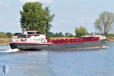
ZUIGZAND
Cargo
Current Trip
| Time Travelled | 1 day |
|---|---|
| Remaining Time | --- |
| Distance Travelled | 20.38 nm |
| Remaining Distance | --- |
| AVG Speed | 5.6 Knots |
| MAX Speed | 7.4 Knots |
| AVG Wind | 7.1 knots |
| MAX Wind | 16 knots |
| MIN Temp | 6.5°C / 43.7°F |
| MAX Temp | 10.8°C / 51.44°F |
| Draught | 1.2 m |
| Position Received | 5 m ago |
Current Position
| Longitude | 4.49600° |
|---|---|
| Latitude | 51.23873° |
| Status | Moored |
| Speed | |
| Course | --- |
| Area | North Sea |
| Station | T-AIS |
| Position Received | 5 m ago |
Info
Information
The current position of ZUIGZAND is in North Sea with coordinates 51.23873° / 4.49600° as reported on 2024-04-20 03:08 by AIS to our vessel tracker app. The vessel's current speed is 0 Knots
The vessel ZUIGZAND (MMSI: 205505290) is a Cargo It's sailing under the flag of [BE] Belgium.
In this page you can find informations about the vessels current position, last detected port calls, and current voyage information. If the vessels is not in coverage by AIS you will find the latest position.
The current position of ZUIGZAND is detected by our AIS receivers and we are not responsible for the reliability of the data. The last position was recorded while the vessel was in Coverage by the Ais receivers of our vessel tracking app.
The current draught of ZUIGZAND as reported by AIS is 1.2 meters
Weather
| Temperature | 5.3°C / 41.54°F |
|---|---|
| Wind Speed | 10 knots |
| Direction | 342° NNW |
| Pressure | 1019 hPa |
| Humidity | 74.7 % |
| Cloud Coverage | 75 % |
Featured Company
Last Port Calls
| Port | Arrival | Departure | Time In Port |
|---|---|---|---|
| 2024-04-18 06:39 | 2024-04-18 10:25 | 3 h | |
| 2024-04-17 08:51 | 2024-04-17 12:20 | 3 h | |
| 2024-04-15 14:17 | 2024-04-17 08:44 | 1 d | |
| 2024-04-15 12:07 | 2024-04-15 14:09 | 2 h | |
| 2024-04-14 12:18 | 2024-04-14 16:15 | 3 h | |
| 2024-04-09 11:45 | 2024-04-14 12:13 | 5 d | |
| 2024-04-08 10:39 | 2024-04-09 06:11 | 19 h | |
| 2024-04-07 12:30 | 2024-04-07 14:04 | 1 h | |
| 2024-04-02 17:33 | 2024-04-03 05:11 | 11 h | |
| 2024-04-02 13:08 | 2024-04-02 17:18 | 4 h |
Last Trips
| Origin | Departure | Destination | Arrival | Distance | |
|---|---|---|---|---|---|
| 2024-04-17 14:20 | 2024-04-18 08:39 | 48.29 nm | |||
| 2024-04-17 10:44 | 2024-04-17 10:51 | 0.61 nm | |||
| 2024-04-15 16:09 | 2024-04-15 16:17 | 0.52 nm | |||
| 2024-04-14 18:15 | 2024-04-15 14:07 | 64.89 nm | |||
| 2024-04-14 14:13 | 2024-04-14 14:18 | 0.82 nm | |||
| 2024-04-09 08:11 | 2024-04-09 13:45 | 1.57 nm | |||
| 2024-04-07 16:04 | 2024-04-08 12:39 | 48.50 nm | |||
| 2024-04-03 07:11 | 2024-04-07 14:30 | 23.28 nm | |||
| 2024-04-02 19:18 | 2024-04-02 19:33 | 1.02 nm | |||
| 2024-04-02 06:13 | 2024-04-02 15:08 | 60.64 nm |
Events
| Time | Event | Details | Position / Dest | Info |
|---|---|---|---|---|
| 2024-04-19 15:48 | Status Changed | Moored Under way using engine |
51.23876 / 4.49594
EVERINGEN
|
Speed: 0.1 kn Course: 511° |
| 2024-04-19 15:46 | Draught Changed | 1.2 3 |
51.23873 / 4.49591
EVERINGEN
|
Speed: 0.1 kn Course: 511° |
| 2024-04-19 15:46 | Destination Changed | EVERINGEN GROBBENDONK |
51.23873 / 4.49591
EVERINGEN
|
Speed: 0.1 kn Course: 511° |
| 2024-04-19 15:46 | ETA Changed | 2024/04/22 09:31 2024/04/18 13:38 |
51.23873 / 4.49591
EVERINGEN
|
Speed: 0.1 kn Course: 511° |
| 2024-04-19 15:42 | STOP Moving | 0.66 nm, West of WIJNEGEM |
51.23876 / 4.49593
GROBBENDONK
|
Speed: Course: 511° |
| 2024-04-19 15:20 | START Moving | 0.93 nm, South East of WIJNEGEM |
51.22762 / 4.53413
GROBBENDONK
|
Speed: 4.5 kn Course: 295.7° |
| 2024-04-19 14:45 | STOP Moving | 1.36 nm, South East of WIJNEGEM |
51.22502 / 4.54462
GROBBENDONK
|
Speed: 0.2 kn Course: 511° |
| 2024-04-19 14:12 | IN Coverage |
51.20095 / 4.61840
North Sea
|
Speed: 7.4 kn Course: 293.1° |
|
| 2024-04-19 02:22 | OUT of Coverage |
51.18065 / 4.74214
North Sea
|
Speed: Course: 511° |
|
| 2024-04-19 02:22 | IN Coverage |
51.18065 / 4.74214
North Sea
|
Speed: Course: 511° |