
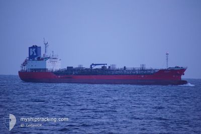
ZOEY
Oil/Chemical Tanker
Current Trip
JP KWS / E
| Time Travelled | 19 h, 40 mins |
|---|---|
| Remaining Time | --- |
| Distance Travelled | 166.21 nm |
| Remaining Distance | --- |
| AVG Speed | 10.7 Knots |
| MAX Speed | 12.8 Knots |
| AVG Wind | 2.9 knots |
| MAX Wind | 7.1 knots |
| MIN Temp | 14.8°C / 58.64°F |
| MAX Temp | 18.8°C / 65.84°F |
| Draught | 8.5 m |
| Position Received | 4 h, 8 m ago |
Current Position
| Longitude | 130.95500° |
|---|---|
| Latitude | 33.95643° |
| Status | Under way using engine |
| Speed | 10.1 Knots |
| Course | 34.1° |
| Area | Inland Sea |
| Station | T-AIS |
| Position Received | 4 h, 8 m ago |
Info
Information
The current position of ZOEY is in Inland Sea with coordinates 33.95643° / 130.95500° as reported on 2024-04-19 00:51 by AIS to our vessel tracker app. The vessel's current speed is 10.1 Knots
The vessel ZOEY (IMO: 9624548, MMSI: 356131000) is a Oil/Chemical Tanker that was built in 2011 ( 13 years old ). It's sailing under the flag of [PA] Panama.
In this page you can find informations about the vessels current position, last detected port calls, and current voyage information. If the vessels is not in coverage by AIS you will find the latest position.
The current position of ZOEY is detected by our AIS receivers and we are not responsible for the reliability of the data. The last position was recorded while the vessel was in Coverage by the Ais receivers of our vessel tracking app.
The current draught of ZOEY as reported by AIS is 8.5 meters
Weather
| Temperature | 17.6°C / 63.68°F |
|---|---|
| Wind Speed | 3 knots |
| Direction | 261° W |
| Pressure | 1014.5 hPa |
| Humidity | 53.6 % |
| Cloud Coverage | --- |
Featured Company
Last Port Calls
| Port | Arrival | Departure | Time In Port |
|---|---|---|---|
| 2024-04-17 08:51 | 2024-04-18 09:19 | 1 d | |
| 2024-04-13 20:32 | 2024-04-14 07:48 | 11 h | |
| 2024-04-12 05:59 | 2024-04-13 00:06 | 18 h | |
| 2024-04-08 11:54 | 2024-04-09 11:29 | 23 h | |
| 2024-04-04 07:54 | 2024-04-04 23:34 | 15 h | |
| 2024-04-02 19:15 | 2024-04-04 00:13 | 1 d | |
| 2024-03-29 00:20 | 2024-03-30 14:28 | 1 d | |
| 2024-03-14 02:58 | 2024-03-26 05:29 | 12 d | |
| 2024-03-10 22:20 | 2024-03-11 22:06 | 23 h | |
| 2024-03-03 06:49 | 2024-03-04 03:40 | 20 h |
Last Trips
| Origin | Departure | Destination | Arrival | Distance | |
|---|---|---|---|---|---|
| 2024-04-14 16:48 | 2024-04-17 17:51 | 673.68 nm | |||
| 2024-04-13 09:06 | 2024-04-14 05:32 | 207.28 nm | |||
| 2024-04-09 20:29 | 2024-04-12 14:59 | 749.79 nm | |||
| 2024-04-05 07:34 | 2024-04-08 20:54 | 908.31 nm | |||
| 2024-04-04 08:13 | 2024-04-04 15:54 | 91.49 nm | |||
| 2024-03-30 23:28 | 2024-04-03 03:15 | 889.51 nm | |||
| 2024-03-26 14:29 | 2024-03-29 09:20 | 387.97 nm | |||
| 2024-03-12 07:06 | 2024-03-14 11:58 | 460.22 nm | |||
| 2024-03-04 11:40 | 2024-03-11 07:20 | 1591.76 nm | |||
| 2024-03-03 06:47 | 2024-03-03 14:49 | 88.82 nm |
Events
| Time | Event | Details | Position / Dest | Info |
|---|---|---|---|---|
| 2024-04-19 00:51 | OUT of Coverage |
33.95643 / 130.95500
Inland Sea
JP KWS / E
|
Speed: 10.1 kn Course: 34.1° |
|
| 2024-04-19 00:23 | Change Sea Area | Japanese part of the Inland Sea Japanese part of the Japan Sea |
33.90154 / 130.90631
Inland Sea
JP KWS / E
|
Speed: 9.8 kn Course: 113.5° |
| 2024-04-18 21:22 | Draught Changed | 8.5 5.5 |
34.03798 / 130.32194
JP KWS / E
|
Speed: 12.1 kn Course: 91.7° |
| 2024-04-18 21:22 | Destination Changed | JP KWS / E KR YOS |
34.03798 / 130.32194
JP KWS / E
|
Speed: 12.1 kn Course: 91.7° |
| 2024-04-18 21:22 | ETA Changed | 2024/04/21 22:00 2024/04/16 14:00 |
34.03798 / 130.32194
JP KWS / E
|
Speed: 12.1 kn Course: 91.7° |
| 2024-04-18 21:05 | IN Coverage |
34.04015 / 130.25773
Japan Sea
|
Speed: 12 kn Course: 92° |
|
| 2024-04-18 09:19 | PORT DEPARTURE |
|
34.58504 / 127.94263
KR YOS
|
Speed: Course: 250° |
| 2024-04-17 08:51 | STOP Moving |
34.86301 / 127.75594
[KR] GWANGYANG
|
Speed: Course: 251° |
|
| 2024-04-17 08:51 | PORT ARRIVAL |
|
34.86301 / 127.75594
[KR] GWANGYANG
|
Speed: 2.5 kn Course: 240° |
| 2024-04-17 07:44 | START Moving | 7.28 nm, East of YEOSU |
34.73296 / 127.81161
KR YOS
|
Speed: 4.2 kn Course: 54° |