
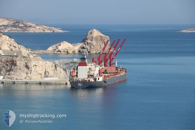
INVINCIBLE
Bulk Carrier
Current Trip
| Time Travelled | 10 days |
|---|---|
| Remaining Time | --- |
| Distance Travelled | 2595.34 nm |
| Remaining Distance | --- |
| AVG Speed | 10.6 Knots |
| MAX Speed | 12.9 Knots |
| AVG Wind | 14 knots |
| MAX Wind | 20.6 knots |
| MIN Temp | 18.5°C / 65.3°F |
| MAX Temp | 28.1°C / 82.58°F |
| Draught | 10.6 m |
| Position Received | 2 d ago |
Current Position
| Longitude | -61.07679° |
|---|---|
| Latitude | 13.53763° |
| Status | Under way using engine |
| Speed | 9 Knots |
| Course | 125° |
| Area | Caribbean Sea |
| Station | T-AIS |
| Position Received | 2 d ago |
Info
Information
The current position of INVINCIBLE is in Caribbean Sea with coordinates 13.53763° / -61.07679° as reported on 2024-04-22 20:57 by AIS to our vessel tracker app. The vessel's current speed is 9 Knots and is heading at the port of SINGAPORE. The estimated time of arrival as calculated by MyShipTracking vessel tracking app is 2024-06-04 07:00 LT
The vessel INVINCIBLE (IMO: 9442574, MMSI: 636015357) is a Bulk Carrier that was built in 2011 ( 13 years old ). It's sailing under the flag of [LR] Liberia.
In this page you can find informations about the vessels current position, last detected port calls, and current voyage information. If the vessels is not in coverage by AIS you will find the latest position.
The current position of INVINCIBLE is detected by our AIS receivers and we are not responsible for the reliability of the data. The last position was recorded while the vessel was in Coverage by the Ais receivers of our vessel tracking app.
The current draught of INVINCIBLE as reported by AIS is 10.6 meters
Weather
| Temperature | 27.3°C / 81.14°F |
|---|---|
| Wind Speed | 13 knots |
| Direction | 66° ENE |
| Pressure | 1011 hPa |
| Humidity | 68.6 % |
| Cloud Coverage | 100 % |
Featured Company
Last Port Calls
| Port | Arrival | Departure | Time In Port |
|---|---|---|---|
| 2024-04-12 22:20 | 2024-04-15 03:32 | 2 d | |
| 2024-04-03 23:37 | 2024-04-06 05:20 | 2 d | |
| 2024-03-31 15:20 | 2024-04-02 05:19 | 1 d | |
| 2024-03-28 09:21 | 2024-03-29 22:23 | 1 d | |
| 2024-03-18 15:51 | 2024-03-22 02:31 | 3 d | |
| 2024-03-18 14:51 | 2024-03-18 15:13 | 21 m | |
| 2024-02-14 09:02 | 2024-02-28 16:03 | 14 d |
Most Visited Ports (Last year)
| Port | Arrivals | |
|---|---|---|
| 11 | ||
| 2 | ||
| 2 | ||
| 2 | ||
| 1 | ||
| 1 |
Last Trips
| Origin | Departure | Destination | Arrival | Distance | |
|---|---|---|---|---|---|
| 2024-04-06 00:20 | 2024-04-12 17:20 | 525.20 nm | |||
| 2024-04-02 00:19 | 2024-04-03 18:37 | 438.75 nm | |||
| 2024-03-29 18:23 | 2024-03-31 10:20 | 465.83 nm | |||
| 2024-03-21 22:31 | 2024-03-28 05:21 | 1421.99 nm | |||
| 2024-03-18 11:13 | 2024-03-18 11:51 | 3.47 nm | |||
| 2024-02-28 13:03 | 2024-03-18 10:51 | 4886.63 nm | |||
| 2024-01-26 05:34 | 2024-02-14 06:02 | 5549.10 nm |
Events
| Time | Event | Details | Position / Dest | Info |
|---|---|---|---|---|
| 2024-04-22 21:02 | Status Changed | Default Under way using engine |
13.53053 / -61.06623
SG SIN
|
Speed: 9 kn Course: 125° |
| 2024-04-22 20:57 | Status Changed | Under way using engine Default |
13.53763 / -61.07679
SG SIN
|
Speed: 8.9 kn Course: 125° |
| 2024-04-22 20:57 | OUT of Coverage |
13.53763 / -61.07679
Caribbean Sea
|
Speed: 9 kn Course: 125° |
|
| 2024-04-22 20:42 | Status Changed | Default Under way using engine |
13.55868 / -61.10731
SG SIN
|
Speed: 8.5 kn Course: 120° |
| 2024-04-22 20:36 | Change Sea Area | Saint Vincent and the Grenadines part of the Caribbean Sea Puerto Rican part of the Caribbean Sea |
13.56605 / -61.11957
Caribbean Sea
|
Speed: 8.5 kn Course: 120° |
| 2024-04-22 20:36 | Status Changed | Under way using engine Default |
13.56605 / -61.11957
SG SIN
|
Speed: 8.5 kn Course: 122° |
| 2024-04-22 20:21 | IN Coverage |
13.56605 / -61.11957
Caribbean Sea
|
Speed: 8.5 kn Course: 120° |
|
| 2024-04-20 23:34 | Status Changed | Default Under way using engine |
17.90472 / -67.67337
SG SIN
|
Speed: 10.6 kn Course: 158.7° |
| 2024-04-20 23:28 | OUT of Coverage |
17.92012 / -67.67889
Caribbean Sea
|
Speed: 10.6 kn Course: 158.7° |
|
| 2024-04-20 23:20 | Change Sea Area | Puerto Rican part of the Caribbean Sea Cuban part of the Gulf of Mexico |
17.94208 / -67.68776
Caribbean Sea
|
Speed: 10.6 kn Course: 156.6° |