
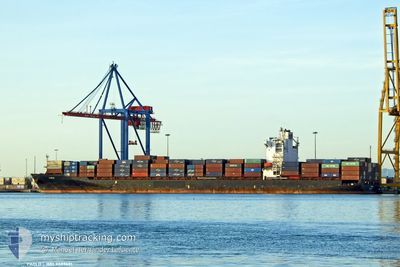
MERVE A
Container Ship
Current Trip
| Time Travelled | 4 days |
|---|---|
| Remaining Time | 4 days |
| Distance Travelled | 1396.68 nm |
| Remaining Distance | 1601.61 nm |
| AVG Speed | 13.8 Knots |
| MAX Speed | 18.9 Knots |
| AVG Wind | 13.1 knots |
| MAX Wind | 20.8 knots |
| MIN Temp | 12.7°C / 54.86°F |
| MAX Temp | 22.4°C / 72.32°F |
| Draught | 9.6 m |
| Position Received | 1 d ago |
Current Position
| Longitude | -17.21217° |
|---|---|
| Latitude | 22.54377° |
| Status | Under way using engine |
| Speed | 14.4 Knots |
| Course | 211.2° |
| Area | North Atlantic Ocean |
| Station | T-AIS |
| Position Received | 1 d ago |
Info
Information
The current position of MERVE A is in North Atlantic Ocean with coordinates 22.54377° / -17.21217° as reported on 2024-04-24 17:22 by AIS to our vessel tracker app. The vessel's current speed is 14.4 Knots and is heading at the port of TEMA. The estimated time of arrival as calculated by MyShipTracking vessel tracking app is 2024-04-30 12:38 LT
The vessel MERVE A (IMO: 9389681, MMSI: 249414000) is a Container Ship that was built in 2008 ( 16 years old ). It's sailing under the flag of [MT] Malta.
In this page you can find informations about the vessels current position, last detected port calls, and current voyage information. If the vessels is not in coverage by AIS you will find the latest position.
The current position of MERVE A is detected by our AIS receivers and we are not responsible for the reliability of the data. The last position was recorded while the vessel was in Coverage by the Ais receivers of our vessel tracking app.
The current draught of MERVE A as reported by AIS is 9.6 meters
Weather
| Temperature | 22.3°C / 72.14°F |
|---|---|
| Wind Speed | 11 knots |
| Direction | 340° NNW |
| Pressure | 1010 hPa |
| Humidity | 81.6 % |
| Cloud Coverage | 8 % |
Featured Company
Last Port Calls
| Port | Arrival | Departure | Time In Port |
|---|---|---|---|
| 2024-04-20 03:54 | 2024-04-20 20:44 | 16 h | |
| 2024-04-08 18:21 | 2024-04-10 13:48 | 1 d | |
| 2024-04-07 12:29 | 2024-04-08 08:33 | 20 h | |
| 2024-04-02 17:41 | 2024-04-06 06:43 | 3 d | |
| 2024-03-18 07:45 | 2024-03-19 00:25 | 16 h | |
| 2024-03-16 12:41 | 2024-03-16 16:41 | 3 h | |
| 2024-02-26 18:43 | 2024-03-02 15:08 | 4 d | |
| 2024-02-24 01:19 | 2024-02-24 19:31 | 18 h | |
| 2024-02-10 07:54 | 2024-02-11 09:44 | 1 d |
Most Visited Ports (Last year)
| Port | Arrivals | |
|---|---|---|
| 8 | ||
| 8 | ||
| 7 | ||
| 6 | ||
| 5 | ||
| 5 |
Last Trips
| Origin | Departure | Destination | Arrival | Distance | |
|---|---|---|---|---|---|
| 2024-04-10 13:48 | 2024-04-20 04:54 | 3051.17 nm | |||
| 2024-04-08 09:33 | 2024-04-08 18:21 | 167.87 nm | |||
| 2024-04-06 07:43 | 2024-04-07 13:29 | 90.69 nm | |||
| 2024-03-19 00:25 | 2024-04-02 18:41 | 3573.23 nm | |||
| 2024-03-16 17:41 | 2024-03-18 07:45 | 153.39 nm | |||
| 2024-03-02 16:08 | 2024-03-16 13:41 | 3279.51 nm | |||
| 2024-02-24 20:31 | 2024-02-26 19:43 | 71.87 nm | |||
| 2024-02-11 10:44 | 2024-02-24 02:19 | 3316.39 nm | |||
| 2024-01-18 02:54 | 2024-02-10 08:54 | 3947.73 nm |
Events
| Time | Event | Details | Position / Dest | Info |
|---|---|---|---|---|
| 2024-04-24 17:30 | Status Changed | Default Under way using engine |
22.51569 / -17.23066
TEMA
|
Speed: 14.4 kn Course: 211.2° |
| 2024-04-24 17:22 | OUT of Coverage |
22.54377 / -17.21217
North Atlantic Ocean
TEMA
|
Speed: 14.4 kn Course: 211.2° |
|
| 2024-04-24 17:20 | Status Changed | Under way using engine Default |
22.54889 / -17.20883
TEMA
|
Speed: 14.4 kn Course: 211° |
| 2024-04-24 17:10 | Status Changed | Default Under way using engine |
22.58516 / -17.18562
TEMA
|
Speed: 14.4 kn Course: 209.2° |
| 2024-04-24 16:56 | Status Changed | Under way using engine Default |
22.63385 / -17.15547
TEMA
|
Speed: 14.3 kn Course: 210° |
| 2024-04-24 16:54 | Status Changed | Default Under way using engine |
22.63942 / -17.15198
TEMA
|
Speed: 14.3 kn Course: 210.3° |
| 2024-04-24 16:36 | Status Changed | Under way using engine Default |
22.70399 / -17.11121
TEMA
|
Speed: 14.2 kn Course: 211° |
| 2024-04-24 15:58 | Status Changed | Default Under way using engine |
22.83641 / -17.02537
TEMA
|
Speed: 14.5 kn Course: 210.7° |
| 2024-04-24 15:46 | Status Changed | Under way using engine Default |
22.87457 / -17.00045
TEMA
|
Speed: 14.5 kn Course: 211° |
| 2024-04-24 15:42 | Status Changed | Default Under way using engine |
22.89054 / -16.99015
TEMA
|
Speed: 14.5 kn Course: 210.8° |