
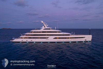
ZEN
Pleasure Craft
Current Trip
| Time Travelled | 27 days |
|---|---|
| Remaining Time | --- |
| Distance Travelled | 1553.66 nm |
| Remaining Distance | --- |
| AVG Speed | 11.3 Knots |
| MAX Speed | 16.4 Knots |
| AVG Wind | 8.3 knots |
| MAX Wind | 20 knots |
| MIN Temp | 23.7°C / 74.66°F |
| MAX Temp | 33.6°C / 92.48°F |
| Draught | 4 m |
| Position Received | 1 d ago |
Current Position
| Longitude | -79.59315° |
|---|---|
| Latitude | 9.80254° |
| Status | Under way using engine |
| Speed | 12.7 Knots |
| Course | 46.2° |
| Area | Caribbean Sea |
| Station | T-AIS |
| Position Received | 1 d ago |
Info
Information
The current position of ZEN is in Caribbean Sea with coordinates 9.80254° / -79.59315° as reported on 2024-04-17 22:14 by AIS to our vessel tracker app. The vessel's current speed is 12.7 Knots and is heading at the port of FALMOUTH. The estimated time of arrival as calculated by MyShipTracking vessel tracking app is 2024-04-21 18:00 LT
The vessel ZEN (IMO: 9828053, MMSI: 319200300) is a Pleasure Craft It's sailing under the flag of [KY] Cayman Is.
In this page you can find informations about the vessels current position, last detected port calls, and current voyage information. If the vessels is not in coverage by AIS you will find the latest position.
The current position of ZEN is detected by our AIS receivers and we are not responsible for the reliability of the data. The last position was recorded while the vessel was in Coverage by the Ais receivers of our vessel tracking app.
The current draught of ZEN as reported by AIS is 4 meters
Weather
| Temperature | 28.1°C / 82.58°F |
|---|---|
| Wind Speed | 9 knots |
| Direction | 8° N |
| Pressure | 1008.7 hPa |
| Humidity | 75.6 % |
| Cloud Coverage | 76 % |
Featured Company
Last Trips
| Origin | Departure | Destination | Arrival | Distance | |
|---|---|---|---|---|---|
| 2024-03-06 18:27 | 2024-03-08 09:12 | 311.24 nm | |||
| 2023-12-18 18:24 | 2024-03-06 17:08 | 659.45 nm |
Events
| Time | Event | Details | Position / Dest | Info |
|---|---|---|---|---|
| 2024-04-17 22:14 | OUT of Coverage |
9.80254 / -79.59315
Caribbean Sea
AG FAM
|
Speed: 12.7 kn Course: 46.2° |
|
| 2024-04-17 19:35 | START Moving | 1.85 nm, North West of CRISTOBAL |
9.36818 / -79.93184
AG FAM
|
Speed: 7.5 kn Course: 70° |
| 2024-04-17 19:32 | Destination Changed | AG FAM PA ONX |
9.36689 / -79.93529
AG FAM
|
Speed: 3.3 kn Course: 62° |
| 2024-04-17 19:32 | ETA Changed | 2024/04/21 18:00 2024/04/17 06:00 |
9.36689 / -79.93529
AG FAM
|
Speed: 3.3 kn Course: 62° |
| 2024-04-17 19:25 | Status Changed | Under way using engine At anchor |
9.36720 / -79.93606
PA ONX
|
Speed: Course: 5° |
| 2024-04-17 05:34 | Status Changed | At anchor Under way using engine |
9.36671 / -79.93608
PA ONX
|
Speed: 0.2 kn Course: 34° |
| 2024-04-17 05:29 | STOP Moving | 1.99 nm, North West of CRISTOBAL |
9.36672 / -79.93632
PA ONX
|
Speed: 0.3 kn Course: 30° |
| 2024-04-17 05:13 | Change Sea Area | Panamanian part of the Caribbean Sea Panamanian part of the North Pacific Ocean |
9.36654 / -79.92481
Caribbean Sea
PA ONX
|
Speed: 5.1 kn Course: 296.8° |
| 2024-04-17 04:31 | START Moving | 3.98 nm, South of CRISTOBAL |
9.28079 / -79.92164
PA ONX
|
Speed: 4.2 kn Course: 7° |
| 2024-04-17 03:24 | STOP Moving | 4.63 nm, South of CRISTOBAL |
9.27007 / -79.92317
PA ONX
|
Speed: Course: 7° |