
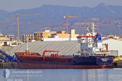
ZELIHA K
General Cargo
Current Trip
| Time Travelled | 3 h, 12 mins |
|---|---|
| Remaining Time | --- |
| Distance Travelled | 6.11 nm |
| Remaining Distance | --- |
| AVG Speed | 10.4 Knots |
| MAX Speed | 11 Knots |
| AVG Wind | 4.9 knots |
| MAX Wind | 5 knots |
| MIN Temp | 15.3°C / 59.54°F |
| MAX Temp | 16.2°C / 61.16°F |
| Draught | 6 m |
| Position Received | 13 d ago |
Current Position
| Longitude | 29.22468° |
|---|---|
| Latitude | 41.38711° |
| Status | Under way using engine |
| Speed | 8 Knots |
| Course | 1.8° |
| Area | Black Sea |
| Station | T-AIS |
| Position Received | 13 d ago |
Info
Information
The current position of ZELIHA K is in Black Sea with coordinates 41.38711° / 29.22468° as reported on 2024-04-11 15:46 by AIS to our vessel tracker app. The vessel's current speed is 8 Knots and is heading at the port of SULINA.
The vessel ZELIHA K (IMO: 9395185, MMSI: 353427000) is a General Cargo that was built in 2007 ( 17 years old ). It's sailing under the flag of [PA] Panama.
In this page you can find informations about the vessels current position, last detected port calls, and current voyage information. If the vessels is not in coverage by AIS you will find the latest position.
The current position of ZELIHA K is detected by our AIS receivers and we are not responsible for the reliability of the data. The last position was recorded while the vessel was in Coverage by the Ais receivers of our vessel tracking app.
The current draught of ZELIHA K as reported by AIS is 6 meters
Weather
| Temperature | 15.8°C / 60.44°F |
|---|---|
| Wind Speed | 5 knots |
| Direction | 7° N |
| Pressure | 1005.5 hPa |
| Humidity | 59.9 % |
| Cloud Coverage | 71 % |
Featured Company
Last Port Calls
| Port | Arrival | Departure | Time In Port |
|---|---|---|---|
| 2024-04-25 04:59 | |||
| 2024-04-17 13:50 | |||
| 2024-04-13 09:37 | 2024-04-13 10:02 | 24 m | |
| 2024-04-03 10:19 | 2024-04-06 08:22 | 2 d | |
| 2024-03-28 06:31 | 2024-04-01 13:45 | 4 d | |
| 2024-03-19 08:52 | |||
| 2024-03-14 17:28 | |||
| 2024-03-02 11:13 | 2024-03-04 00:29 | 1 d | |
| 2024-03-01 03:44 | |||
| 2024-02-12 16:58 | 2024-02-15 17:34 | 3 d |
Last Trips
| Origin | Departure | Destination | Arrival | Distance | |
|---|---|---|---|---|---|
| 2024-04-06 10:22 | 2024-04-13 12:37 | 1021.61 nm | |||
| 2024-04-01 15:45 | 2024-04-03 12:19 | 106.04 nm | |||
| 2024-03-19 09:52 | 2024-03-28 08:31 | 1289.50 nm | |||
| 2024-03-01 05:44 | 2024-03-02 13:13 | 135.99 nm | |||
| 2024-02-10 13:54 | 2024-02-12 17:58 | 456.39 nm | |||
| 2024-02-02 13:13 | 2024-02-08 07:34 | 1199.83 nm |
Events
| Time | Event | Details | Position / Dest | Info |
|---|---|---|---|---|
| 2024-04-25 04:59 | PORT DEPARTURE |
|
45.44637 / 28.18818
ROSUL
|
Speed: Course: 179° |
| 2024-04-17 14:46 | STOP Moving | 3.36 nm, South West of GIURGIULESTI |
45.43052 / 28.14651
ROSUL
|
Speed: 0.3 kn Course: 303° |
| 2024-04-17 13:50 | PORT DEPARTURE |
|
45.43325 / 28.14471
ROSUL
|
Speed: 7.9 kn Course: 71° |
| 2024-04-17 12:45 | START Moving |
45.43722 / 28.07623
[RO] GALATI
|
Speed: 5 kn Course: 234° |