
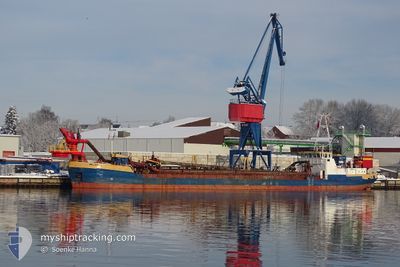
WILLEM SR
Trailing Suction Hopper Dredger
Current Trip
STRALSUND DREDGE
| Time Travelled | 3 days |
|---|---|
| Remaining Time | --- |
| Distance Travelled | 395.80 nm |
| Remaining Distance | --- |
| AVG Speed | 7.2 Knots |
| MAX Speed | 9.1 Knots |
| AVG Wind | 10.3 knots |
| MAX Wind | 18 knots |
| MIN Temp | -0.3°C / 31.46°F |
| MAX Temp | 8.7°C / 47.66°F |
| Draught | 3.8 m |
| Position Received | 1 m ago |
Current Position
| Longitude | 13.73375° |
|---|---|
| Latitude | 54.46769° |
| Status | Restricted manoeuverability |
| Speed | 7.8 Knots |
| Course | 346.4° |
| Area | Baltic Sea |
| Station | T-AIS |
| Position Received | 1 m ago |
Info
Information
The current position of WILLEM SR is in Baltic Sea with coordinates 54.46769° / 13.73375° as reported on 2024-04-25 18:48 by AIS to our vessel tracker app. The vessel's current speed is 7.8 Knots
The vessel WILLEM SR (IMO: 8302739, MMSI: 246384000) is a Trailing Suction Hopper Dredger that was built in 1982 ( 42 years old ). It's sailing under the flag of [NL] Netherlands.
In this page you can find informations about the vessels current position, last detected port calls, and current voyage information. If the vessels is not in coverage by AIS you will find the latest position.
The current position of WILLEM SR is detected by our AIS receivers and we are not responsible for the reliability of the data. The last position was recorded while the vessel was in Coverage by the Ais receivers of our vessel tracking app.
The current draught of WILLEM SR as reported by AIS is 3.8 meters
Weather
| Temperature | 5.4°C / 41.72°F |
|---|---|
| Wind Speed | 17 knots |
| Direction | 113° ESE |
| Pressure | 1004.6 hPa |
| Humidity | 84.9 % |
| Cloud Coverage | 83 % |
Featured Company
Last Port Calls
| Port | Arrival | Departure | Time In Port |
|---|---|---|---|
| 2024-04-20 02:24 | 2024-04-22 09:52 | 2 d | |
| 2024-04-19 15:15 | 2024-04-19 15:18 | 2 m | |
| 2024-04-17 17:13 | 2024-04-17 17:49 | 35 m | |
| 2024-04-15 10:56 | 2024-04-17 13:21 | 2 d | |
| 2024-04-13 08:18 | 2024-04-15 06:43 | 1 d | |
| 2024-04-12 13:00 | 2024-04-12 13:26 | 25 m | |
| 2024-04-12 09:33 | 2024-04-12 09:50 | 17 m | |
| 2024-04-11 13:29 | 2024-04-11 13:43 | 14 m | |
| 2024-04-11 10:08 | 2024-04-11 10:26 | 17 m | |
| 2024-04-11 04:24 | 2024-04-11 04:45 | 20 m |
Most Visited Ports (Last year)
| Port | Arrivals | |
|---|---|---|
| 51 | ||
| 48 | ||
| 18 | ||
| 7 | ||
| 3 | ||
| 2 |
Last Trips
| Origin | Departure | Destination | Arrival | Distance | |
|---|---|---|---|---|---|
| 2024-04-19 17:18 | 2024-04-20 04:24 | 75.04 nm | |||
| 2024-04-17 19:49 | 2024-04-19 17:15 | 325.91 nm | |||
| 2024-04-17 15:21 | 2024-04-17 19:13 | 31.04 nm | |||
| 2024-04-15 08:43 | 2024-04-15 12:56 | 28.55 nm | |||
| 2024-04-12 15:26 | 2024-04-13 10:18 | 59.42 nm | |||
| 2024-04-12 11:50 | 2024-04-12 15:00 | 17.31 nm | |||
| 2024-04-11 15:43 | 2024-04-12 11:33 | 60.57 nm | |||
| 2024-04-11 12:26 | 2024-04-11 15:29 | 17.34 nm | |||
| 2024-04-11 06:45 | 2024-04-11 12:08 | 25.79 nm | |||
| 2024-04-11 02:54 | 2024-04-11 06:24 | 17.45 nm |
Events
| Time | Event | Details | Position / Dest | Info |
|---|---|---|---|---|
| 2024-04-25 18:25 | Status Changed | Restricted manoeuverability Default |
54.41980 / 13.75533
STRALSUND DREDGE
|
Speed: 8.2 kn Course: 348° |
| 2024-04-25 17:58 | Status Changed | Default Restricted manoeuverability |
54.36048 / 13.77618
STRALSUND DREDGE
|
Speed: 8.1 kn Course: 349.1° |
| 2024-04-25 17:36 | Status Changed | Restricted manoeuverability Default |
54.31195 / 13.76960
STRALSUND DREDGE
|
Speed: 8.3 kn Course: 20° |
| 2024-04-25 17:20 | IN Coverage |
54.31262 / 13.76993
Baltic Sea
|
Speed: 8.2 kn Course: 16.5° |
|
| 2024-04-25 14:37 | Status Changed | Default Restricted manoeuverability |
54.25922 / 13.21982
STRALSUND DREDGE
|
Speed: 8 kn Course: 136.2° |
| 2024-04-25 14:32 | OUT of Coverage |
54.26446 / 13.20288
Baltic Sea
|
Speed: 8 kn Course: 136.2° |
|
| 2024-04-25 13:50 | START Moving | 0.91 nm, East of STRALSUND |
54.30470 / 13.11541
STRALSUND DREDGE
|
Speed: 3.9 kn Course: 150° |
| 2024-04-25 08:26 | STOP Moving | 0.85 nm, East of STRALSUND |
54.30677 / 13.11430
STRALSUND DREDGE
|
Speed: 0.3 kn Course: 151° |
| 2024-04-25 07:13 | Status Changed | Restricted manoeuverability Default |
54.24805 / 13.26468
STRALSUND DREDGE
|
Speed: 7.1 kn Course: 292° |
| 2024-04-25 07:13 | IN Coverage |
54.24817 / 13.26421
Baltic Sea
|
Speed: 7.4 kn Course: 293.1° |