
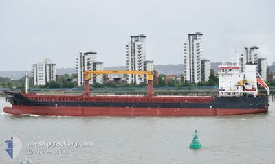
BULKER BEE 11
General Cargo
Current Trip
| Trip Time | 6 days |
|---|---|
| Trip Distance | 16.85 nm |
| AVG Speed | 5.1 Knots |
| MAX Speed | 8.7 Knots |
| Draught | 8.2 m |
| AVG Wind | 7 knots |
| MAX Wind | 15.8 knots |
| MIN Temp | 28.5°C / 83.3°F |
| MAX Temp | 32.6°C / 90.68°F |
| Position Received | 19 d ago |
Current Position
| Longitude | -79.46534° |
|---|---|
| Latitude | 8.41708° |
| Status | Under way using engine |
| Speed | 11.2 Knots |
| Course | 180° |
| Area | North Pacific Ocean |
| Station | T-AIS |
| Position Received | 19 d ago |
Info
Information
The current position of BULKER BEE 11 is in North Pacific Ocean with coordinates 8.41708° / -79.46534° as reported on 2024-03-31 07:01 by AIS to our vessel tracker app. The vessel's current speed is 11.2 Knots and is currently inside the port of ACAJUTLA.
The vessel BULKER BEE 11 (IMO: 9507075, MMSI: 245935000) is a General Cargo that was built in 2011 ( 13 years old ). It's sailing under the flag of [NL] Netherlands.
In this page you can find informations about the vessels current position, last detected port calls, and current voyage information. If the vessels is not in coverage by AIS you will find the latest position.
The current position of BULKER BEE 11 is detected by our AIS receivers and we are not responsible for the reliability of the data. The last position was recorded while the vessel was in Coverage by the Ais receivers of our vessel tracking app.
The current draught of BULKER BEE 11 as reported by AIS is 8.2 meters
Weather
| Temperature | 29.2°C / 84.56°F |
|---|---|
| Wind Speed | 8 knots |
| Direction | 201° SSW |
| Pressure | 1009.5 hPa |
| Humidity | 69.4 % |
| Cloud Coverage | 16 % |
Featured Company
Last Trips
| Origin | Departure | Destination | Arrival | Distance | |
|---|---|---|---|---|---|
| 2024-04-11 16:42 | 2024-04-18 08:50 | 16.85 nm | |||
| 2024-03-01 22:45 | 2024-04-08 14:16 | 7051.53 nm | |||
| 2024-02-27 02:27 | 2024-02-28 16:15 | 133.73 nm | |||
| 2024-02-22 07:57 | 2024-02-24 01:47 | 409.94 nm | |||
| 2024-02-12 22:28 | 2024-02-22 07:55 | 2245.56 nm |
Events
| Time | Event | Details | Position / Dest | Info |
|---|---|---|---|---|
| 2024-04-18 15:08 | STOP Moving |
13.57514 / -89.83796
[SV] ACAJUTLA
|
Speed: Course: 125° |
|
| 2024-04-18 14:50 | PORT ARRIVAL |
|
13.57550 / -89.83822
[SV] ACAJUTLA
|
Speed: 2 kn Course: 128° |
| 2024-04-18 14:26 | START Moving | 0.56 nm, West of ACAJUTLA |
13.57788 / -89.84795
SVAQJ OWN
|
Speed: 3.4 kn Course: 74° |
| 2024-04-18 13:20 | STOP Moving | 1.69 nm, West of ACAJUTLA |
13.56811 / -89.86539
SVAQJ OWN
|
Speed: 0.3 kn Course: 305° |
| 2024-04-18 12:23 | START Moving | 3.23 nm, West of ACAJUTLA |
13.57717 / -89.89372
SVAQJ OWN
|
Speed: 8.7 kn Course: 114° |
| 2024-04-12 00:01 | STOP Moving | 4.48 nm, West of ACAJUTLA |
13.58821 / -89.91446
SVAQJ OWN
|
Speed: Course: 212° |
| 2024-04-11 22:43 | START Moving | 0.46 nm, West of ACAJUTLA |
13.57777 / -89.84618
SVAQJ OWN
|
Speed: 4.3 kn Course: 240° |
| 2024-04-11 22:42 | PORT DEPARTURE |
|
13.57777 / -89.84618
SVAQJ OWN
|
Speed: 1.8 kn Course: 130° |