
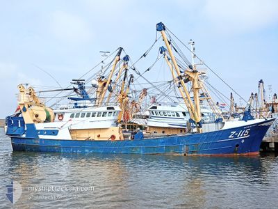
Z115 ANTJE DE VRIES
Fishing
Current Trip
FISHINGGROUND><>
| Time Travelled | 2 days |
|---|---|
| Remaining Time | --- |
| Distance Travelled | 394.96 nm |
| Remaining Distance | --- |
| AVG Speed | 4.7 Knots |
| MAX Speed | 4.7 Knots |
| AVG Wind | 16.3 knots |
| MAX Wind | 34.7 knots |
| MIN Temp | 8.3°C / 46.94°F |
| MAX Temp | 11°C / 51.8°F |
| Draught | 5 m |
| Position Received | Now |
Current Position
| Longitude | -5.22196° |
|---|---|
| Latitude | 50.84897° |
| Status | Engaged in Fishing |
| Speed | 4.4 Knots |
| Course | 83° |
| Area | Celtic Sea |
| Station | T-AIS |
| Position Received | Now |
Info
Information
The current position of Z115 ANTJE DE VRIES is in Celtic Sea with coordinates 50.84897° / -5.22196° as reported on 2024-04-18 03:57 by AIS to our vessel tracker app. The vessel's current speed is 4.4 Knots
The vessel Z115 ANTJE DE VRIES (IMO: 8812760, MMSI: 205752000) is a Fishing It's sailing under the flag of [BE] Belgium.
In this page you can find informations about the vessels current position, last detected port calls, and current voyage information. If the vessels is not in coverage by AIS you will find the latest position.
The current position of Z115 ANTJE DE VRIES is detected by our AIS receivers and we are not responsible for the reliability of the data. The last position was recorded while the vessel was in Coverage by the Ais receivers of our vessel tracking app.
The current draught of Z115 ANTJE DE VRIES as reported by AIS is 5 meters
Weather
| Temperature | 9.3°C / 48.74°F |
|---|---|
| Wind Speed | 13 knots |
| Direction | 40° NE |
| Pressure | 1023 hPa |
| Humidity | 71.8 % |
| Cloud Coverage | 14 % |
Featured Company
Last Port Calls
| Port | Arrival | Departure | Time In Port |
|---|---|---|---|
| 2024-04-11 15:29 | 2024-04-15 06:27 | 3 d | |
| 2024-03-28 15:02 | 2024-04-01 23:12 | 4 d | |
| 2024-03-15 11:36 | 2024-03-18 07:30 | 2 d | |
| 2024-03-08 18:53 | 2024-03-11 08:57 | 2 d | |
| 2024-03-01 13:21 | 2024-03-04 07:34 | 2 d | |
| 2024-02-23 11:22 | 2024-02-26 07:35 | 2 d | |
| 2024-02-13 09:47 | 2024-02-19 04:05 | 5 d | |
| 2024-02-02 00:00 | 2024-02-05 03:02 | 3 d |
Last Trips
| Origin | Departure | Destination | Arrival | Distance | |
|---|---|---|---|---|---|
| 2024-04-02 01:12 | 2024-04-11 17:29 | 1192.38 nm | |||
| 2024-03-18 08:30 | 2024-03-28 16:02 | 964.26 nm | |||
| 2024-03-11 09:57 | 2024-03-15 12:36 | 370.81 nm | |||
| 2024-03-04 08:34 | 2024-03-08 19:53 | 497.73 nm | |||
| 2024-02-26 08:35 | 2024-03-01 14:21 | 160.64 nm | |||
| 2024-02-19 05:05 | 2024-02-23 12:22 | 471.49 nm | |||
| 2024-02-05 04:02 | 2024-02-13 10:47 | 1121.35 nm | |||
| 2024-01-22 20:44 | 2024-02-02 01:00 | 1072.49 nm |
Events
| Time | Event | Details | Position / Dest | Info |
|---|---|---|---|---|
| 2024-04-18 00:38 | Status Changed | Engaged in Fishing Under way using engine |
50.86151 / -5.15124
FISHINGGROUND><>
|
Speed: 49.1 kn Course: 249.8° |
| 2024-04-18 00:38 | Status Changed | Under way using engine Engaged in Fishing |
50.86155 / -5.15094
FISHINGGROUND><>
|
Speed: 4.1 kn Course: 257° |
| 2024-04-17 23:29 | START Moving | 20.61 nm, North West of PORT ISAAC |
50.89003 / -5.10828
FISHINGGROUND><>
|
Speed: 5 kn Course: 41.4° |
| 2024-04-17 23:23 | STOP Moving | 20.63 nm, North West of PORT ISAAC |
50.88930 / -5.11120
FISHINGGROUND><>
|
Speed: 0.3 kn Course: 50° |
| 2024-04-16 15:11 | Detected in Sea | United Kingdom part of the Celtic Sea |
50.43777 / -5.67521
Celtic Sea
FISHINGGROUND><>
|
Speed: 1.2 kn Course: 173° |
| 2024-04-16 15:11 | IN Coverage |
50.43777 / -5.67521
Celtic Sea
FISHINGGROUND><>
|
Speed: 1.2 kn Course: 173° |
|
| 2024-04-16 05:35 | OUT of Coverage |
49.91915 / -4.45205
English Channel
FISHINGGROUND><>
|
Speed: 9.4 kn Course: 266.2° |
|
| 2024-04-16 02:28 | Detected in Sea | United Kingdom part of the English Channel |
49.93722 / -3.73695
English Channel
FISHINGGROUND><>
|
Speed: 8.5 kn Course: 263.6° |
| 2024-04-16 02:28 | IN Coverage |
49.93722 / -3.73695
English Channel
FISHINGGROUND><>
|
Speed: 8.5 kn Course: 263.6° |
|
| 2024-04-15 10:00 | OUT of Coverage |
49.67723 / -.67756
English Channel
FISHINGGROUND><>
|
Speed: 7.8 kn Course: 288.3° |