
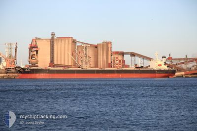
DONG XING HAI TAI
Bulk Carrier
Current Trip
JIN ZHOU
| Time Travelled | 5 days |
|---|---|
| Remaining Time | --- |
| Distance Travelled | 1432.01 nm |
| Remaining Distance | --- |
| AVG Speed | 10.5 Knots |
| MAX Speed | 12.6 Knots |
| AVG Wind | 11.3 knots |
| MAX Wind | 25.8 knots |
| MIN Temp | 8.2°C / 46.76°F |
| MAX Temp | 27°C / 80.6°F |
| Draught | 6.9 m |
| Position Received | 2 h, 38 m ago |
Current Position
| Longitude | 114.31708° |
|---|---|
| Latitude | 21.99813° |
| Status | Under way using engine |
| Speed | 10.6 Knots |
| Course | 249° |
| Area | South China Sea |
| Station | T-AIS |
| Position Received | 2 h, 38 m ago |
Info
Information
The current position of DONG XING HAI TAI is in South China Sea with coordinates 21.99813° / 114.31708° as reported on 2024-04-25 13:46 by AIS to our vessel tracker app. The vessel's current speed is 10.6 Knots
The vessel DONG XING HAI TAI (IMO: 9138501, MMSI: 412095000) is a Bulk Carrier that was built in 1997 ( 27 years old ). It's sailing under the flag of [CN] China.
In this page you can find informations about the vessels current position, last detected port calls, and current voyage information. If the vessels is not in coverage by AIS you will find the latest position.
The current position of DONG XING HAI TAI is detected by our AIS receivers and we are not responsible for the reliability of the data. The last position was recorded while the vessel was in Coverage by the Ais receivers of our vessel tracking app.
The current draught of DONG XING HAI TAI as reported by AIS is 6.9 meters
Weather
| Temperature | 25.6°C / 78.08°F |
|---|---|
| Wind Speed | 9 knots |
| Direction | 201° SSW |
| Pressure | 1005.7 hPa |
| Humidity | 96.7 % |
| Cloud Coverage | 9 % |
Featured Company
Last Trips
| Origin | Departure | Destination | Arrival | Distance | |
|---|---|---|---|---|---|
| 2024-03-29 23:53 | 2024-04-16 20:35 | 2882.38 nm | |||
| 2024-03-14 01:02 | 2024-03-28 05:41 | 2730.01 nm | |||
| 2024-02-25 23:51 | 2024-03-12 17:54 | 2690.44 nm | |||
| 2024-02-09 10:14 | 2024-02-24 10:27 | 2701.62 nm | |||
| 2024-01-24 10:05 | 2024-02-08 01:42 | 2719.63 nm |
Events
| Time | Event | Details | Position / Dest | Info |
|---|---|---|---|---|
| 2024-04-25 15:57 | STOP Moving | 7.54 nm, South of WAILINGDING ISLAND |
21.97638 / 114.00906
JIN ZHOU
|
Speed: 0.3 kn Course: 294° |
| 2024-04-25 13:52 | Status Changed | Default Under way using engine |
21.99167 / 114.29763
JIN ZHOU
|
Speed: 10.6 kn Course: 249° |
| 2024-04-25 13:46 | OUT of Coverage |
21.99813 / 114.31708
South China Sea
|
Speed: 10.6 kn Course: 249° |
|
| 2024-04-25 13:45 | Status Changed | Under way using engine Default |
21.99948 / 114.32103
JIN ZHOU
|
Speed: 10.6 kn Course: 250° |
| 2024-04-25 13:40 | Status Changed | Default Under way using engine |
22.00372 / 114.33344
JIN ZHOU
|
Speed: 10.6 kn Course: 246° |
| 2024-04-25 13:33 | Status Changed | Under way using engine Default |
22.01098 / 114.35488
JIN ZHOU
|
Speed: 10.5 kn Course: 249° |
| 2024-04-25 13:20 | Status Changed | Default Under way using engine |
22.02460 / 114.39289
JIN ZHOU
|
Speed: 10.2 kn Course: 249° |
| 2024-04-25 12:54 | Status Changed | Under way using engine Default |
22.05076 / 114.46945
JIN ZHOU
|
Speed: 10.5 kn Course: 252° |
| 2024-04-25 12:52 | Status Changed | Default Under way using engine |
22.05195 / 114.47393
JIN ZHOU
|
Speed: 10.5 kn Course: 254° |
| 2024-04-25 12:47 | Status Changed | Under way using engine Default |
22.05657 / 114.49168
JIN ZHOU
|
Speed: 10.3 kn Course: 256° |