
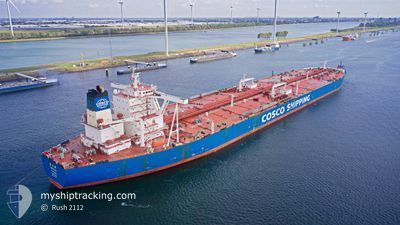
YUAN YUE HU
Tanker
Current Trip
CGDJE
| Time Travelled | 29 days |
|---|---|
| Remaining Time | --- |
| Distance Travelled | 8434.59 nm |
| Remaining Distance | --- |
| AVG Speed | 12.1 Knots |
| MAX Speed | 15.9 Knots |
| AVG Wind | 9.5 knots |
| MAX Wind | 25 knots |
| MIN Temp | 10.4°C / 50.72°F |
| MAX Temp | 30.6°C / 87.08°F |
| Draught | 11.2 m |
| Position Received | 1 d ago |
Current Position
| Longitude | 17.72060° |
|---|---|
| Latitude | -34.14491° |
| Status | Under way using engine |
| Speed | 10.2 Knots |
| Course | 302.4° |
| Area | South Atlantic Ocean |
| Station | T-AIS |
| Position Received | 1 d ago |
Info
Information
The current position of YUAN YUE HU is in South Atlantic Ocean with coordinates -34.14491° / 17.72060° as reported on 2024-04-22 16:11 by AIS to our vessel tracker app. The vessel's current speed is 10.2 Knots
The vessel YUAN YUE HU (IMO: 9681211, MMSI: 414215000) is a Tanker It's sailing under the flag of [CN] China.
In this page you can find informations about the vessels current position, last detected port calls, and current voyage information. If the vessels is not in coverage by AIS you will find the latest position.
The current position of YUAN YUE HU is detected by our AIS receivers and we are not responsible for the reliability of the data. The last position was recorded while the vessel was in Coverage by the Ais receivers of our vessel tracking app.
The current draught of YUAN YUE HU as reported by AIS is 11.2 meters
Weather
| Temperature | 19.1°C / 66.38°F |
|---|---|
| Wind Speed | 18 knots |
| Direction | 162° SSE |
| Pressure | 1015.9 hPa |
| Humidity | 83.3 % |
| Cloud Coverage | 6 % |
Featured Company
Most Visited Ports (Last year)
| Port | Arrivals | |
|---|---|---|
| 2 | ||
| 1 | ||
| 1 | ||
| 1 | ||
| 1 | ||
| 1 |
Last Trips
| Origin | Departure | Destination | Arrival | Distance |
|---|
Events
| Time | Event | Details | Position / Dest | Info |
|---|---|---|---|---|
| 2024-04-22 16:19 | Status Changed | Default Under way using engine |
-34.13310 / 17.69736
CGDJE
|
Speed: 10.2 kn Course: 302.4° |
| 2024-04-22 16:11 | OUT of Coverage |
-34.14491 / 17.72060
South Atlantic Ocean
CGDJE
|
Speed: 10.2 kn Course: 302.4° |
|
| 2024-04-22 16:10 | Status Changed | Under way using engine Default |
-34.14642 / 17.72342
CGDJE
|
Speed: 10.3 kn Course: 306° |
| 2024-04-22 16:06 | Status Changed | Default Under way using engine |
-34.15249 / 17.73358
CGDJE
|
Speed: 10 kn Course: 306.3° |
| 2024-04-22 14:16 | Status Changed | Under way using engine Default |
-34.37758 / 17.99942
CGDJE
|
Speed: 10.9 kn Course: 310° |
| 2024-04-22 14:14 | Status Changed | Default Under way using engine |
-34.38107 / 18.00452
CGDJE
|
Speed: 10.7 kn Course: 311.2° |
| 2024-04-22 14:10 | Status Changed | Under way using engine Default |
-34.39037 / 18.01749
CGDJE
|
Speed: 10.6 kn Course: 312° |
| 2024-04-22 14:07 | Status Changed | Default Under way using engine |
-34.39560 / 18.02450
CGDJE
|
Speed: 10.8 kn Course: 310° |
| 2024-04-22 10:59 | Destination Changed | CGDJE KIZOMBA |
-34.74317 / 18.53977
CGDJE
|
Speed: 9.8 kn Course: 310.2° |
| 2024-04-22 10:59 | ETA Changed | 2024/04/29 14:00 2024/04/29 04:00 |
-34.74317 / 18.53977
CGDJE
|
Speed: 9.8 kn Course: 310.2° |