
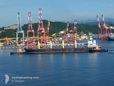
YUAN SHUN
Bulk Carrier
Current Trip
JP NGO
| Time Travelled | 29 mins |
|---|---|
| Remaining Time | --- |
| Distance Travelled | 0.59 nm |
| Remaining Distance | --- |
| AVG Speed | 8.8 Knots |
| MAX Speed | 8.9 Knots |
| AVG Wind | 5.5 knots |
| MAX Wind | 5.5 knots |
| MIN Temp | 16.1°C / 60.98°F |
| MAX Temp | 16.1°C / 60.98°F |
| Draught | 6 m |
| Position Received | 4 d ago |
Current Position
| Longitude | 136.84965° |
|---|---|
| Latitude | 35.02388° |
| Status | Under way using engine |
| Speed | 4.6 Knots |
| Course | 40° |
| Area | Philippine Sea |
| Station | T-AIS |
| Position Received | 4 d ago |
Info
Information
The current position of YUAN SHUN is in Philippine Sea with coordinates 35.02388° / 136.84965° as reported on 2024-04-19 14:51 by AIS to our vessel tracker app. The vessel's current speed is 4.6 Knots
The vessel YUAN SHUN (IMO: 9252058, MMSI: 477300400) is a Bulk Carrier that was built in 2001 ( 23 years old ). It's sailing under the flag of [HK] Hong Kong.
In this page you can find informations about the vessels current position, last detected port calls, and current voyage information. If the vessels is not in coverage by AIS you will find the latest position.
The current position of YUAN SHUN is detected by our AIS receivers and we are not responsible for the reliability of the data. The last position was recorded while the vessel was in Coverage by the Ais receivers of our vessel tracking app.
The current draught of YUAN SHUN as reported by AIS is 6 meters
Weather
| Temperature | 16.1°C / 60.98°F |
|---|---|
| Wind Speed | 7 knots |
| Direction | 231° SW |
| Pressure | 1007.5 hPa |
| Humidity | 89.8 % |
| Cloud Coverage | 100 % |
Featured Company
Last Port Calls
| Port | Arrival | Departure | Time In Port |
|---|---|---|---|
| 2024-04-19 14:36 | 2024-04-24 09:32 | 4 d | |
| 2024-04-11 14:57 | 2024-04-13 06:54 | 1 d | |
| 2024-04-10 09:51 | 2024-04-11 02:09 | 16 h | |
| 2024-04-08 11:58 | 2024-04-09 17:53 | 1 d | |
| 2024-04-07 06:01 | 2024-04-08 00:33 | 18 h | |
| 2024-04-03 19:49 | 2024-04-06 17:25 | 2 d | |
| 2024-04-02 06:33 | 2024-04-03 08:37 | 1 d | |
| 2024-03-31 17:31 | 2024-04-01 20:55 | 1 d | |
| 2024-03-30 07:01 | 2024-03-31 04:33 | 21 h | |
| 2024-03-28 00:00 | 2024-03-29 19:52 | 1 d |
Last Trips
| Origin | Departure | Destination | Arrival | Distance | |
|---|---|---|---|---|---|
| 2024-04-13 14:54 | 2024-04-19 23:36 | 1047.23 nm | |||
| 2024-04-11 10:09 | 2024-04-11 22:57 | 122.92 nm | |||
| 2024-04-10 01:53 | 2024-04-10 17:51 | 130.41 nm | |||
| 2024-04-08 08:33 | 2024-04-08 19:58 | 122.65 nm | |||
| 2024-04-07 01:25 | 2024-04-07 14:01 | 121.75 nm | |||
| 2024-04-03 16:37 | 2024-04-04 03:49 | 123.56 nm | |||
| 2024-04-02 04:55 | 2024-04-02 14:33 | 120.12 nm | |||
| 2024-03-31 12:33 | 2024-04-01 01:31 | 122.93 nm | |||
| 2024-03-30 03:52 | 2024-03-30 15:01 | 122.07 nm | |||
| 2024-03-28 02:44 | 2024-03-28 08:00 | 43.35 nm |
Events
| Time | Event | Details | Position / Dest | Info |
|---|---|---|---|---|
| 2024-04-24 09:32 | PORT DEPARTURE |
|
35.00315 / 136.79244
JP NGO
|
Speed: 8.1 kn Course: 219° |
| 2024-04-24 09:00 | START Moving |
35.03220 / 136.85886
[JP] NAGOYA
|
Speed: 3.3 kn Course: 235° |
|
| 2024-04-19 14:51 | OUT of Coverage |
35.02388 / 136.84965
Philippine Sea
[JP] NAGOYA
|
Speed: 4.6 kn Course: 45.7° |
|
| 2024-04-19 14:36 | PORT ARRIVAL |
|
34.99876 / 136.82633
[JP] NAGOYA
|
Speed: 10.8 kn Course: 34.3° |
| 2024-04-19 14:21 | IN Coverage |
34.96135 / 136.79577
Philippine Sea
|
Speed: 10.3 kn Course: 40.7° |
|
| 2024-04-17 02:40 | STOP Moving | 3.37 nm, East of YOKKAICHI |
34.96027 / 136.74103
JP NGO
|
Speed: 0.2 kn Course: 342° |
| 2024-04-17 02:12 | Status Changed | Default Under way using engine |
34.92878 / 136.74625
JP NGO
|
Speed: 10.2 kn Course: 357.4° |
| 2024-04-17 02:08 | OUT of Coverage |
34.91900 / 136.74736
Philippine Sea
JP NGO
|
Speed: 10.2 kn Course: 357.4° |
|
| 2024-04-17 02:05 | Status Changed | Under way using engine Default |
34.90980 / 136.74754
JP NGO
|
Speed: 10.7 kn Course: 357° |
| 2024-04-17 02:00 | Status Changed | Default Under way using engine |
34.89406 / 136.74795
JP NGO
|
Speed: 11.9 kn Course: 357.7° |