
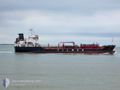
YM NEPTUNE
Oil/Chemical Tanker
Current Trip
| Time Travelled | 26 days |
|---|---|
| Remaining Time | --- |
| Distance Travelled | 3623.35 nm |
| Remaining Distance | --- |
| AVG Speed | 9.1 Knots |
| MAX Speed | 11.8 Knots |
| AVG Wind | 9 knots |
| MAX Wind | 21 knots |
| MIN Temp | 12.4°C / 54.32°F |
| MAX Temp | 29.8°C / 85.64°F |
| Draught | 6.9 m |
| Position Received | 26 d ago |
Current Position
| Longitude | -15.34197° |
|---|---|
| Latitude | 27.41293° |
| Status | Under way using engine |
| Speed | 9.8 Knots |
| Course | 204.7° |
| Area | North Atlantic Ocean |
| Station | T-AIS |
| Position Received | 26 d ago |
Info
Information
The current position of YM NEPTUNE is in North Atlantic Ocean with coordinates 27.41293° / -15.34197° as reported on 2024-03-24 12:24 by AIS to our vessel tracker app. The vessel's current speed is 9.8 Knots and is heading at the port of SOYO.
The vessel YM NEPTUNE (IMO: 9464106, MMSI: 249813000) is a Oil/Chemical Tanker that was built in 2009 ( 15 years old ). It's sailing under the flag of [MT] Malta.
In this page you can find informations about the vessels current position, last detected port calls, and current voyage information. If the vessels is not in coverage by AIS you will find the latest position.
The current position of YM NEPTUNE is detected by our AIS receivers and we are not responsible for the reliability of the data. The last position was recorded while the vessel was in Coverage by the Ais receivers of our vessel tracking app.
The current draught of YM NEPTUNE as reported by AIS is 6.9 meters
Weather
| Temperature | 28.1°C / 82.58°F |
|---|---|
| Wind Speed | 6 knots |
| Direction | 74° ENE |
| Pressure | 1008.8 hPa |
| Humidity | 76.9 % |
| Cloud Coverage | 100 % |
Featured Company
Last Port Calls
| Port | Arrival | Departure | Time In Port |
|---|---|---|---|
| 2024-03-23 21:12 | 2024-03-24 06:11 | 8 h | |
| 2024-03-23 11:10 | 2024-03-23 19:55 | 8 h | |
| 2024-03-13 00:57 | 2024-03-15 06:18 | 2 d | |
| 2024-03-12 08:03 | 2024-03-13 00:14 | 16 h | |
| 2024-03-07 23:28 | 2024-03-09 04:37 | 1 d | |
| 2024-03-02 13:34 | 2024-03-03 02:45 | 13 h | |
| 2024-02-17 14:15 | 2024-02-20 13:31 | 2 d | |
| 2024-02-14 22:26 | 2024-02-15 23:33 | 1 d | |
| 2024-02-11 16:02 | 2024-02-13 08:03 | 1 d | |
| 2024-02-08 17:52 | 2024-02-10 10:08 | 1 d |
Last Trips
| Origin | Departure | Destination | Arrival | Distance | |
|---|---|---|---|---|---|
| 2024-03-23 19:55 | 2024-03-23 21:12 | 4.19 nm | |||
| 2024-03-15 07:18 | 2024-03-23 11:10 | 1791.77 nm | |||
| 2024-03-13 01:14 | 2024-03-13 01:57 | 5.52 nm | |||
| 2024-03-09 05:37 | 2024-03-12 09:03 | 320.78 nm | |||
| 2024-03-03 02:45 | 2024-03-08 00:28 | 729.74 nm | |||
| 2024-02-20 14:31 | 2024-03-02 13:34 | 2370.32 nm | |||
| 2024-02-16 00:33 | 2024-02-17 15:15 | 381.86 nm | |||
| 2024-02-13 09:03 | 2024-02-14 23:26 | 382.07 nm | |||
| 2024-02-10 11:08 | 2024-02-11 17:02 | 285.71 nm | |||
| 2024-02-08 18:38 | 2024-02-08 18:52 | 1.38 nm |
Events
| Time | Event | Details | Position / Dest | Info |
|---|---|---|---|---|
| 2024-04-18 22:41 | STOP Moving |
-6.47679 / 11.09999
ESLPA>AOSZA
|
Speed: 0.1 kn Course: 356° |
|
| 2024-04-18 21:26 | START Moving |
-6.50559 / 11.07916
ESLPA>AOSZA
|
Speed: 4.7 kn Course: 36° |
|
| 2024-04-18 16:27 | STOP Moving |
-6.45700 / 11.08767
ESLPA>AOSZA
|
Speed: 0.3 kn Course: 193° |
|
| 2024-04-18 15:19 | START Moving |
-6.45172 / 11.13880
ESLPA>AOSZA
|
Speed: 3.5 kn Course: 265° |
|
| 2024-04-17 22:15 | STOP Moving |
-6.47487 / 11.09666
ESLPA>AOSZA
|
Speed: 0.3 kn Course: 82° |
|
| 2024-04-17 20:23 | START Moving |
-6.53906 / 11.07250
ESLPA>AOSZA
|
Speed: 3.3 kn Course: 16° |
|
| 2024-04-17 15:15 | STOP Moving |
-6.45950 / 11.08680
ESLPA>AOSZA
|
Speed: 0.3 kn Course: 189° |
|
| 2024-04-17 13:13 | START Moving |
-6.60454 / 11.10059
ESLPA>AOSZA
|
Speed: 5.1 kn Course: 357° |
|
| 2024-04-17 05:53 | STOP Moving |
-6.58867 / 11.10117
ESLPA>AOSZA
|
Speed: 0.3 kn Course: 68° |
|
| 2024-04-17 04:36 | START Moving |
-6.52810 / 11.04392
ESLPA>AOSZA
|
Speed: 4.2 kn Course: 161° |